geo.wikisort.org - Island
White Head Island is an island located in the Bay of Fundy. It is off the east coast of Grand Manan Island, New Brunswick. In 2011 the island had a population of 162. White Head Island is governed as a local service district.[1]
 White Head Island Location in the Bay of Fundy | |
| Geography | |
|---|---|
| Location | Bay of Fundy |
| Coordinates | 44°37′52.6″N 66°42′28.63″W |
| Archipelago | Grand Manan Archipelago |
| Area | 6.17 km2 (2.38 sq mi) |
| Administration | |
Canada | |
| Province | New Brunswick |
| County | Charlotte |
| Parish | Grand Manan Parish |
| Demographics | |
| Population | 162 (2011)[1] |
| Pop. density | 26.3/km2 (68.1/sq mi) |
| Long Point Lighthouse | |
 Long Point Lighthouse at the southern tip of White Head Island | |
| Constructed | 1966 |
| Foundation | concrete base |
| Construction | concrete tower |
| Height | 11 m (36 ft) |
| Shape | quadrangular tower with balcony and lantern rising from the fog signal building[2] |
| Markings | white tower, red lantern |
| Power source | solar power |
| Operator | Canadian Coast Guard[3][4] |
| Fog signal | 2s. blast every 20s. |
| Focal height | 15.5 m (51 ft) |
| Range | 12 nmi (22 km; 14 mi) |
| Characteristic | Iso W 12s |
Its economy is based largely around aquaculture and fishing.[5]
The island has an elementary school which has kindergarten to grade 2 and grades 3 to 6 in two separate classrooms. Recently there have been efforts to move children to the larger Grand Manan Community School however the younger grades remain on White Head due to the ferry crossing. It's the smallest school within the Anglophone South School District of Southern New Brunswick.
Coastal Transport Limited provides car ferry service between White Head and Grand Manan. The ferry William Frankland operates year-round and is free of charge.[6]
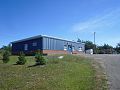
The community has a small general store located at the dock where the ferry arrives at the island.
There is a Baptist church on the island that was completed in 1981. However, there are records of a religious house in use until 1928, when the second of three churches was dedicated.[7]
Gallery
 White Head elementary school August, 2016
 White Head Post Office
 The car ferry William Frankland at Ingalls Head


See also
- List of lighthouses in New Brunswick
- List of communities in New Brunswick
- List of islands of New Brunswick
References
- "White Head, New Brunswick. Census Profile". 2011 Census. Statistics Canada. 2012.
- List of Lights, Pub. 110: Greenland, The East Coasts of North and South America (Excluding Continental U.S.A. Except the East Coast of Florida) and the West Indies (PDF). List of Lights. United States National Geospatial-Intelligence Agency. 2015.
- Rowlett, Russ. "Lighthouses of Canada: Southern New Brunswick". The Lighthouse Directory. University of North Carolina at Chapel Hill. Retrieved 2017-03-23.
- Long Point, NB Lighthouse Friends. Retrieved 23 March 2017
- "...things to do while on Grand Manan". ambleinncottages.com/. September 2018.
- "White Head Schedule". Coastal Transport. Retrieved 3 July 2017.
- "White Head Baptist Church". Ancestry.com. Ancestry.com. Retrieved 2017-05-01.
Lighthouses of Canada | |
|---|---|
| British Columbia |
|
| Manitoba |
|
| New Brunswick |
|
| Newfoundland and Labrador |
|
| Nova Scotia |
|
| Ontario |
|
| Prince Edward Island |
|
| Quebec |
|
This New Brunswick location article is a stub. You can help Wikipedia by expanding it. |
На других языках
- [en] White Head Island
[fr] Île White Head
L'Île White Head est située à l'extrême sud-ouest de la province canadienne du Nouveau-Brunswick.[ru] Уайтхед (остров)
Уайтхед (англ. White Head Island) — остров в заливе Фанди (в северо-восточной части залива Мэн Атлантического океана[1]). Относится к приходу Гран-Манан[en] графства Шарлотт провинции Нью-Брансуик Канады[2].Другой контент может иметь иную лицензию. Перед использованием материалов сайта WikiSort.org внимательно изучите правила лицензирования конкретных элементов наполнения сайта.
WikiSort.org - проект по пересортировке и дополнению контента Википедии