geo.wikisort.org - Island
The Tokara Islands (吐噶喇列島, Tokara-rettō) is an archipelago in the Nansei Islands, and are part of the Satsunan Islands, which is in turn part of the Ryukyu Archipelago. The 150 kilometres (81 nmi) chain consists of twelve small islands located between Yakushima and Amami-Oshima. The islands have a total area of 101.35 square kilometres (39.13 sq mi). Administratively, the whole group belongs to Toshima Village, Kagoshima Prefecture, Japan. Only seven of the islands are permanently inhabited. The islands, especially Takarajima, are home to the Tokara Pony.
Native name: 吐噶喇列島 (トカラ列島), Tokara rettō | |
|---|---|
 Akusekijima | |
Map of Kagoshima Prefecture | |
| Geography | |
| Coordinates | 29.9667°N 129.917°E |
| Adjacent bodies of water | Pacific Ocean |
| Total islands | 12 |
| Area | 101.35 km2 (39.13 sq mi) |
| Administration | |
Japan | |
| Prefectures | Kagoshima |
| District | Kagoshima District |
| Village | Toshima |
| Demographics | |
| Population | 648 (2010) |
| Pop. density | 6.39/km2 (16.55/sq mi) |
| Ethnic groups | Japanese |
Etymology
One theory holds that the name “Tokara” was derived from “tohara”, or “distant sea area” (沖の海原), as viewed from Okinawa. Another theory states that the name come from the Ainu word tokap, which means “breast”. The southernmost inhabited island in the archipelago, Takarajima, has a mountain Megamiyama (女神山, Goddess Mountain) with such a shape.
History
Mention is made in the Shoku Nihongi under an entry for the year 699 of an island called “Tokan” ( 度感 ), which is usually identified with Tokara, together with the islands of Tane, Yaku and Amami, although “Tokan” is also sometimes identified with Tokunoshima, an island approximately 150 kilometres (93 miles) away. (While an entry in the earlier Nihon Shoki for the year 654 mentions a "Tokara Country" 吐火罗国, Tokara no kuni, it is a reference to the Tokhara region of Central Asia, rather than the Tokara Islands.) During the 15th and 16th centuries, the islands came under the control of the Shimazu clan of Satsuma Domain and the Ryukyu Kingdom. Ryukyu ceded its territory in the Tokara Islands to Satsuma in 1611, which was confirmed by the Tokugawa Shogunate in 1624.
In 1908, the islands were administratively organized into Jitto Village (十島村, Jitto-mura, literally “Ten islands”), of which seven were inhabited. After World War II, from 2 February 1946 all of the Satsunan islands south of 30th Latitude, including the Tokara Islands, were placed under United States military administration as part of the Provisional Government of Northern Ryukyu Islands. However, the three northern inhabited islands in the archipelago, Iōjima, Kuroshima and Takeshima, remained under the control of Japan, and were placed under the administration of the village of Mishima. The remaining Tokara Islands reverted to Japan on 10 February 1952 and are now administered as the village of Toshima.
Important Bird Area
The islands have been recognised as an Important Bird Area (IBA) by BirdLife International because they support populations of Japanese wood pigeons, Ryukyu green pigeons, Ijima's leaf-warblers, Izu thrushes and Ryukyu robins.[1]
Islands


| Photo | Name | Kanji | Area [km²] | Population 2004[2] | highest point [m] | Peak | Coordinates |
|---|---|---|---|---|---|---|---|
| Hirase[3] | - | 30°2′32.26″N 130°3′0.29″E(Toudai-Se) | |||||
| Kuchinoshima | 口之島 | 13.33 | 140 | 628.5 | Maedake | 29°58′15″N 129°55′20″E | |
| Nakanoshima | 中之島 | 34.47 | 167 | 979.0 | Otake | 29°50′30″N 129°52′30″E | |
| Gajajima | 臥蛇島 | 4.07 | – | 497.2 | 29°54′11″N 129°32′30″E | ||
| Kogajajima | 小臥蛇島 | 0.5 | – | 301 | 29°52′48″N 129°37′15″E | ||
 |
Tairajima | 平島 | 2.08 | 88 | 245 | Ontake | 29°41′15″N 129°31′57″E |
| Suwanosejima | 諏訪之瀬島 | 27.66 | 48 | 796 | Ontake | 29°38′19″N 129°42′50″E | |
| Akusekijima | 悪石島 | 7.49 | 72 | 584 | Mitake | 29°27′36″N 129°36′06″E | |
| Kojima | 小島 | 0.36 | – | 56 | 29°13′40″N 129°20′45″E | ||
| Kodakarajima | 小宝島 | 1.00 | 43 | 102.7 | 29°13′26″N 129°19′34″E | ||
| Takarajima | 宝島 | 7.14 | 114 | 291.9 | Imakira-dake | 29°08′40″N 129°12′29″E | |
| Kaminonejima | 上ノ根島 | 0.54 | – | 280 | 28°49′56″N 129°0′03″E | ||
| Yokoate-jima | 横当島 | 2.76 | – | 494.8 | Higashimine | 28°47′57″N 128°59′20″E | |
References
- National Geospatial Intelligence Agency (NGIA). Prostar Sailing Directions 2005 Japan Enroute. Prostar Publications (2005). ISBN 1577856511
- "Tokara Islands". BirdLife Data Zone. BirdLife International. 2021. Retrieved 1 February 2021.
- "Toshima" (PDF). 2004. Archived from the original (PDF; 19 kB) on 4 July 2011. Retrieved 6 July 2013.
- (JPN)。
External links
 Tokara Islands travel guide from Wikivoyage
- Official website in Japanese
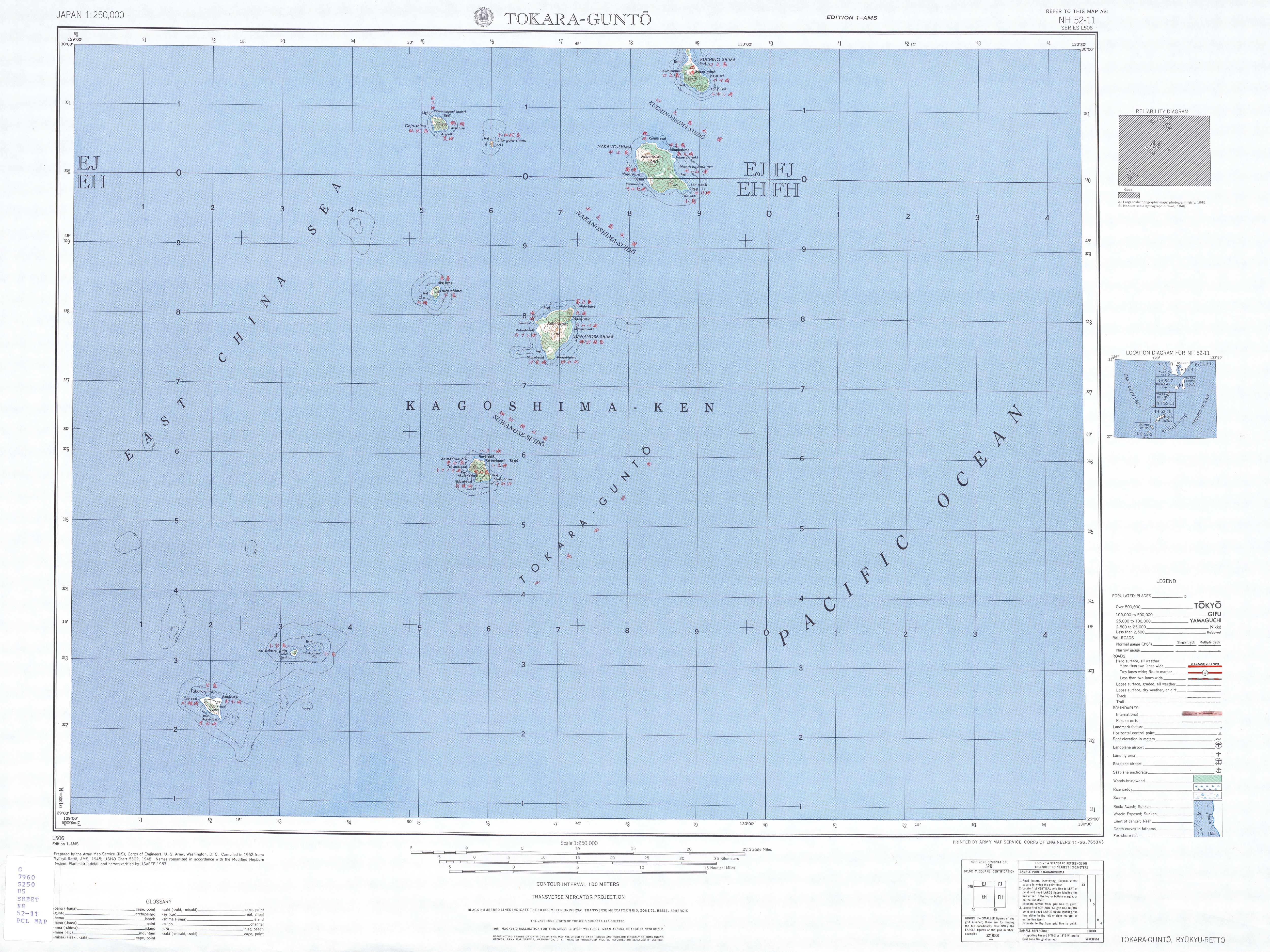
- Topographic Map 1:250.000
Authority control | |
|---|---|
| General | |
| National libraries | |
На других языках
[de] Tokara-Inseln
Die Tokara-Inseln (japanisch 吐噶喇列島 oder vereinfacht トカラ列島, Tokara-rettō) sind eine Inselkette im Südwesten Japans, die zu den Ryūkyū-Inseln beziehungsweise Nansei-Inseln gehört, die seit 1970 als politische Region existieren.[1]- [en] Tokara Islands
[fr] Îles Tokara
Les îles Tokara (吐噶喇列島/トカラ列島, Tokara rettō?, littéralement « chaine d'îles Tokara ») sont un groupe d’îles volcaniques de la mer de Chine orientale situé au sud-ouest du Japon. Les îles font partie de l'archipel Satsunan, avec les îles Amami au sud et l'archipel Ōsumi au nord, et sont aussi incluses dans l'archipel Nansei. Cet archipel est situé entre Kyūshū et Okinawa Hontō, la grande île de l'archipel d'Okinawa.[it] Isole Tokara
Le Isole Tokara (吐噶喇列島 o トカラ列島 Tokara Rettō?) sono un gruppo di isole del Giappone meridionale, situate nella parte nord dell'arcipelago delle Ryūkyū.[ru] Токара
Тока́ра[1][2] (яп. 吐噶喇列島) — группа островов в Тихом океане, принадлежащие Японии. Являются частью островов Рюкю (Нансей)[1]. Расположены между островами Осуми и Амами. Отделены от островов Осуми проливом Токара[1], который соединяет Восточно-Китайское море с Тихим океаном[2]. На островах находится село Тосима. Административно острова относятся к префектуре Кагосима.Другой контент может иметь иную лицензию. Перед использованием материалов сайта WikiSort.org внимательно изучите правила лицензирования конкретных элементов наполнения сайта.
WikiSort.org - проект по пересортировке и дополнению контента Википедии