geo.wikisort.org - Island
Sitra (Arabic: سترة or سِتْرَة,[1] As-Sitra),[2] also known as Sitrah[3] (Arabic: Jazīrat Sitrah)[4] or Sitra Island (Arabic: Jazīrat as-Sitra),[5] is an island in Bahrain. It lies 5 km (3.1 mi) south of the capital, Manama, on Bahrain Island.
Native name: سترة | |
|---|---|
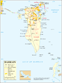
 Sitra Location of Sitra in Bahrain | |
| Geography | |
| Location | Persian Gulf |
| Coordinates | 26.12°N 50.65°E |
| Archipelago | Bahrain |
| Adjacent to | Persian Gulf |
| Total islands | 1 |
| Major islands |
|
| Area | 22.45 km2 (8.67 sq mi) |
| Length | 8.3 km (5.16 mi) |
| Width | 5 km (3.1 mi) |
| Coastline | 36 km (22.4 mi) |
| Highest elevation | 6 m (20 ft) |
| Administration | |
Bahrain | |
| Governorate | split between Capital Governorate and Southern Governorate |
| Largest settlement | Marquban (pop. 20,000) |
| Demographics | |
| Demonym | Bahraini |
| Population | 81,000 (2016) |
| Pop. density | 3,608/km2 (9345/sq mi) |
| Ethnic groups | Bahraini, non-Bahraini |
| Additional information | |
| Time zone |
|
| ISO code | BH-14 |
| Official website | www |
History
- Conflict with Al Khalifa in 1782
In 1782, a conflict occurred between locals and a number of Al Khalifa who came from Zubara to buy supplies. The clashes resulted in deaths from both sides.[6]
- Arab Spring
During the Arab Spring, there was a big protest here. Many protesters were injured or killed. (See Day of Rage (Bahrain)).
Geography
The Island is located just east of Bahrain Island in Persian Gulf. It lies south of Manama and Nabih Saleh. The island's western coast forms the boundary of Tubli Bay. The island used to be covered in date palm groves and farms, watered by several freshwater springs. Mangroves used to line the western coast, however they have almost disappeared due to development.
Demography
Most of the inhabitants of the island live in nine historic villages:
- Wadyan
- Al Kharijiya
- Marquban
- Al Garrya
- Mahazza
- Sufala
- Abul Aish
- Halat Um al-Baidh (the location of the yacht club and Al Bandar resort)
- Al Hamriya
There is a massive land reclamation project called East Sitra which increased the island size by 50% and has a new city built on it.[7][8]
Economy
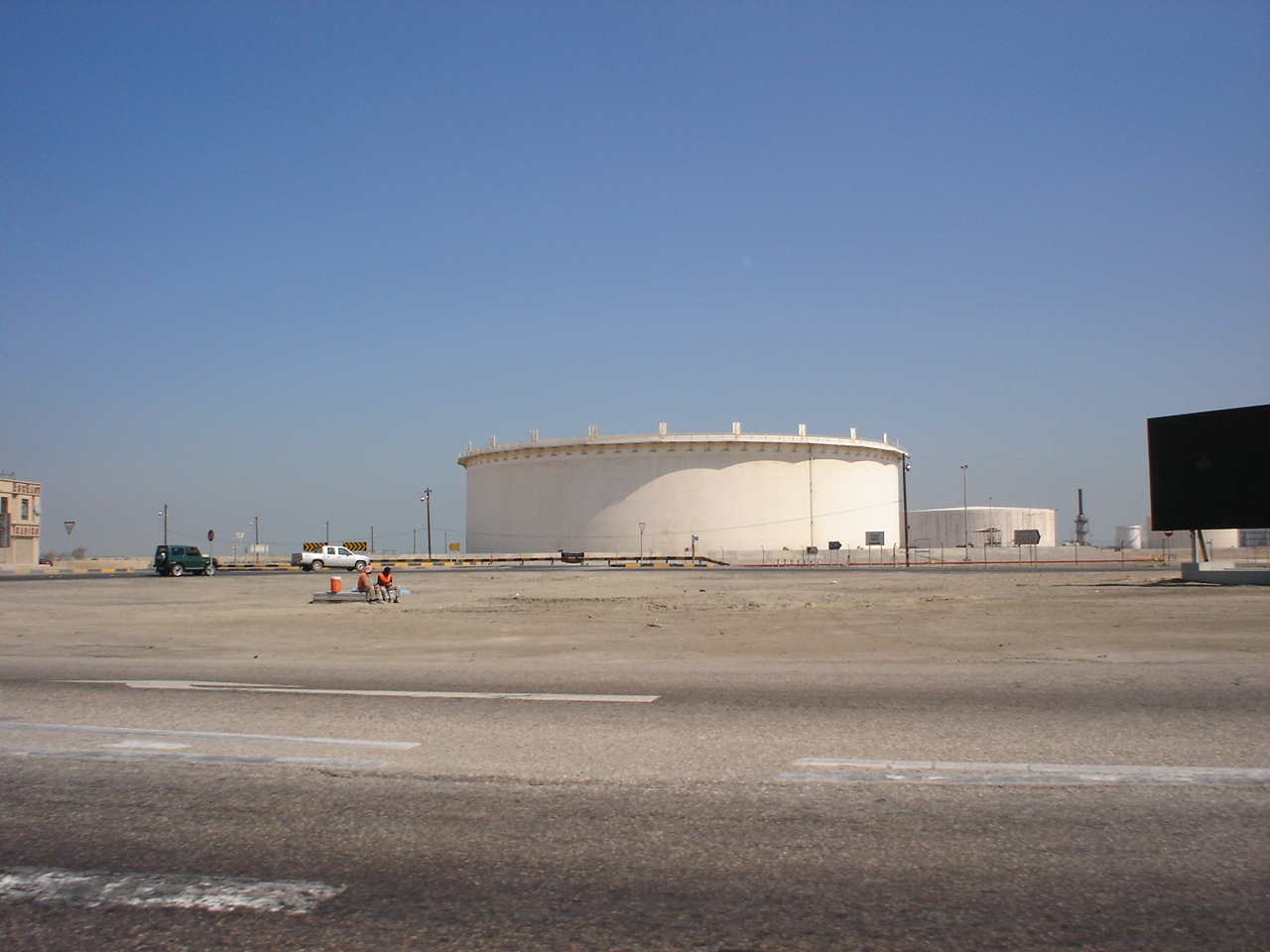
The island's economy used to be based on agriculture and fishing. The northern section of the island has been turned into an industrial area. Bapco oil storage reservoirs are located in the south. Sitra is also the terminus of the 42-km Dhahran-Sitra natural gas pipeline, which connects it to Dahran in Saudi Arabia.[9]
Several car and furniture showrooms also make up the new development on the island. The Sitra Club is a cultural and sports club for the island.
Today Sitra handles Bahrain's entire petroleum production. It is the location of Port of Sitra. It is also the export center for the oil fields in northeastern Saudi Arabia. [10]
Education
Sitra is the site of many school campuses such as Al Noor International School and Indian School, Bahrain. The Applied Science University is located here.
Transportation
The Sitra Causeway connects the north of the island to Nabih Saleh and to Umm al Hussam (Manama) on Bahrain Island. Two small bridges on the south west of Sitra also joins Bahrain Island, near the villages of Ma'ameer and Eker.
Administration
The southern part of the island belongs to Southern Governorate and the northern part to Capital Governorate. Between 1990 and 2013 it was part of Central Governorate of Bahrain, but that is now dissolved. Between 1920 and 1990 it was part of Sitra Municipality.
Sitra Municipality
This was a municipality in Bahrain before they were re-organized as Governorates. The Sitra Municipality consisted of the island of Sitra and three villages close to it on the main island of Bahrain: Ma'ameer, Eker and Nuwaidrat.[11]
Image gallery
 Map 1
Map 1 Map Districts
 District Map
 District Map
 Bapco Bahrain oil reservoirs in Sitra
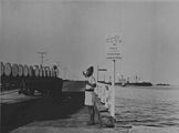 Berth number 4 in Sitra Wharf in 1940
 Map of Bahrain showing Sitrah municipality
 Cemetery
 Women taking part in a pro-democracy sit-in in Sitra
 Sitra (Sitrah), east of Manama, in Bahrain


References
- "سِتْرَة: Bahrain, name, administrative division, geographic coordinates and map". Geographical Names. Retrieved 2011-03-06.
- "As Sitra: Bahrain, name, administrative division, geographic coordinates and map". Geographical Names. Retrieved 2011-03-06.
- Holdich, Thomas Hungerford (1911), , in Chisholm, Hugh (ed.), Encyclopædia Britannica, vol. 3 (11th ed.), Cambridge University Press, p. 212
- "Jazīrat Sitrah: Bahrain, name, administrative division, geographic coordinates and map". Geographical Names. Retrieved 2011-03-06.
- "Jazīrat as Sitra: Bahrain, name, administrative division, geographic coordinates and map". Geographical Names. Retrieved 2011-03-06.
- (in Arabic) "Summary of Baharain and Baharna's history", Al Jareesh, Retrieved 4 April 2012
- News
- East Sitra Official site
- "Middle East Pipelines map - Crude Oil (petroleum) pipelines - Natural Gas pipelines - Products pipelines". Theodora.com/pipelines. Retrieved 2011-03-06.
- "Sitrah". Encyclopædia Britannica. Retrieved 2007-07-16.
- "Directory of Cities and Towns in Sitrah, Bahrain". Falling Rain. Archived from the original on 2007-05-26. Retrieved 2007-07-16.
External links
 Media related to Sitra at Wikimedia Commons
На других языках
[de] Sitra
Sitra (arabisch سترة, DMG Sitra) ist eine Insel in Bahrain mit ca. 42.000 Einwohnern. Sie liegt südlich von Manama und Nabih Saleh.- [en] Sitra
[es] Sitrah
Sitra (en árabe سترة) es una isla de Baréin, justo al este de la isla de Baréin, con la que está comunicada por la Calzada de Sitra. Se encuentra al sur de Manama y de la isla Nabih Saleh. La mayoría de su población es chiita. Según cálculos tiene cerca de 42.000 habitantes.[1][fr] Sitra
Sitra (en arabe سترة ou سِتْرَة[1], également: As Sitra[2], Jazīrat Sitrah[3] et Jazīrat as Sitra[4]) est une île de Bahreïn située dans le golfe de Bahreïn, dans le golfe Persique.[ru] Ситра
Ситра (араб. سترة) — город в королевстве Бахрейн. Входит в состав Центральной мухафазы.Другой контент может иметь иную лицензию. Перед использованием материалов сайта WikiSort.org внимательно изучите правила лицензирования конкретных элементов наполнения сайта.
WikiSort.org - проект по пересортировке и дополнению контента Википедии