geo.wikisort.org - Island
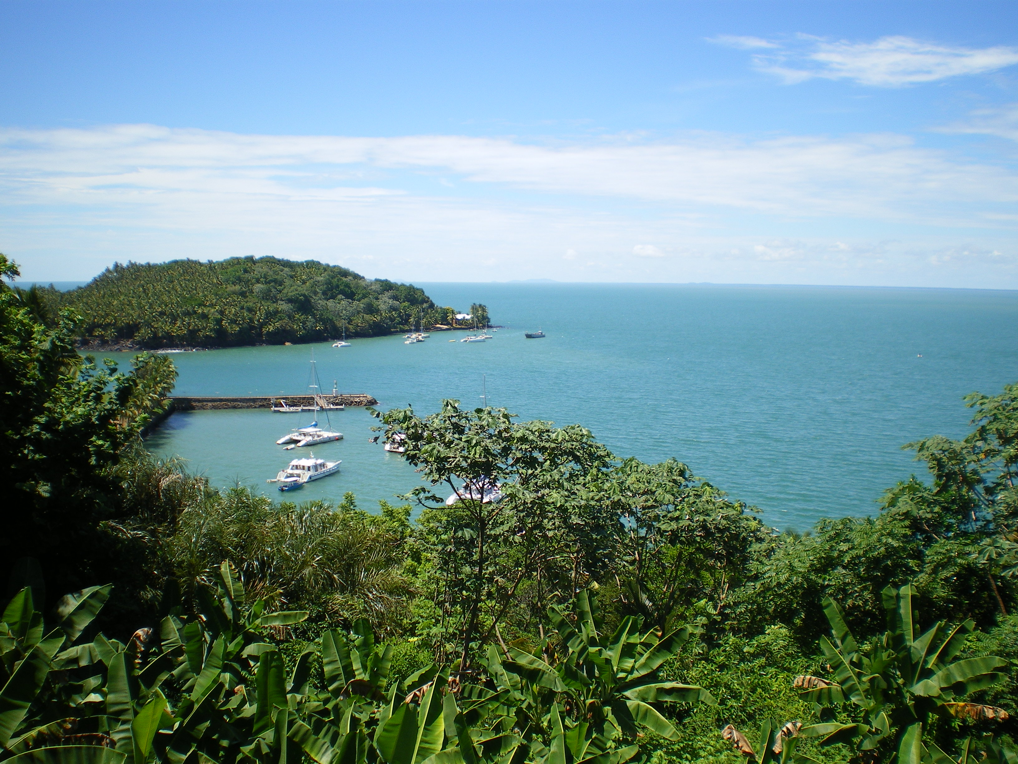
The Salvation Islands (French: Îles du Salut, so called because the missionaries went there to escape plague on the mainland; sometimes mistakenly[citation needed] called Safety Islands) are a group of small islands of volcanic[citation needed] origin about 11 kilometres (6.8 miles) off the coast of French Guiana, 14 kilometres (8.7 miles) north of Kourou, in the Atlantic Ocean. Although closer to Kourou, the islands are part of Cayenne commune (municipality), specifically Cayenne 1er Canton Nord-Ouest.


Geography
Islands
There are three islands, from north to south:
| Island | Area (ha) | Height (m) |
|---|---|---|
| Devil's Island | 14 | 40 |
| Royale Island | 28 | 66 |
| Saint-Joseph Island | 20 | 30 |
| Total | 62 | 136 |
Devil's Island, the most famous due to the political imprisonment there of Captain Alfred Dreyfus, is better known to French speakers as Île du Diable. The total area is 0.62 square kilometres (0.24 square miles). Devil's Island and Île Royale are separated by Passe des Grenadines, Île Royale and Saint-Joseph Island by Passe de Désirade.
Climate
The climate of Salvation Islands focuses on the characteristics of Royale Island. Royale Island (French: Île-Royale) has a tropical savanna climate (Köppen climate classification Aw). The average annual temperature in Royale Island is 27.6 °C (81.7 °F). The average annual rainfall is 2,496.7 mm (98.30 in) with May as the wettest month. The temperatures are highest on average in October, at around 28.7 °C (83.7 °F), and lowest in January, at around 26.9 °C (80.4 °F). The highest temperature ever recorded in Royale Island was 34.8 °C (94.6 °F) on 10 November 2008; the coldest temperature ever recorded was 18.4 °C (65.1 °F) on 10 July 1979.
| Climate data for Salvation Islands (Île-Royale, altitude 48m, 1991–2020 averages, extremes 1974−present) | |||||||||||||
|---|---|---|---|---|---|---|---|---|---|---|---|---|---|
| Month | Jan | Feb | Mar | Apr | May | Jun | Jul | Aug | Sep | Oct | Nov | Dec | Year |
| Record high °C (°F) | 31.9 (89.4) |
33.2 (91.8) |
33.5 (92.3) |
34.4 (93.9) |
33.9 (93.0) |
32.7 (90.9) |
32.7 (90.9) |
34.6 (94.3) |
34.6 (94.3) |
34.7 (94.5) |
34.8 (94.6) |
33.4 (92.1) |
34.8 (94.6) |
| Average high °C (°F) | 29.4 (84.9) |
29.6 (85.3) |
30.1 (86.2) |
30.0 (86.0) |
29.7 (85.5) |
29.7 (85.5) |
30.1 (86.2) |
30.8 (87.4) |
31.4 (88.5) |
31.9 (89.4) |
31.2 (88.2) |
30.1 (86.2) |
30.3 (86.5) |
| Daily mean °C (°F) | 26.9 (80.4) |
27.0 (80.6) |
27.4 (81.3) |
27.4 (81.3) |
27.2 (81.0) |
27.0 (80.6) |
27.3 (81.1) |
27.9 (82.2) |
28.5 (83.3) |
28.7 (83.7) |
28.3 (82.9) |
27.4 (81.3) |
27.6 (81.7) |
| Average low °C (°F) | 24.4 (75.9) |
24.4 (75.9) |
24.8 (76.6) |
24.9 (76.8) |
24.7 (76.5) |
24.3 (75.7) |
24.5 (76.1) |
25.1 (77.2) |
25.5 (77.9) |
25.6 (78.1) |
25.4 (77.7) |
24.8 (76.6) |
24.9 (76.8) |
| Record low °C (°F) | 20.0 (68.0) |
20.8 (69.4) |
21.2 (70.2) |
21.4 (70.5) |
20.3 (68.5) |
20.1 (68.2) |
18.4 (65.1) |
20.9 (69.6) |
21.1 (70.0) |
20.5 (68.9) |
19.8 (67.6) |
20.6 (69.1) |
18.4 (65.1) |
| Average precipitation mm (inches) | 261.6 (10.30) |
186.2 (7.33) |
186.6 (7.35) |
348.2 (13.71) |
461.0 (18.15) |
404.2 (15.91) |
188.2 (7.41) |
74.8 (2.94) |
27.7 (1.09) |
38.3 (1.51) |
104.3 (4.11) |
215.6 (8.49) |
2,496.7 (98.30) |
| Average precipitation days (≥ 1.0 mm) | 17.1 | 14.3 | 14.0 | 17.6 | 23.4 | 23.3 | 16.5 | 8.0 | 3.6 | 5.8 | 10.9 | 18.2 | 172.7 |
| Mean monthly sunshine hours | — | 125.9 | 151.4 | 143.7 | 136.2 | — | 203.1 | — | 246.9 | 248.6 | 202.8 | — | — |
| Source 1: Météo-France[1] | |||||||||||||
| Source 2: Meteociel (sunshine 1981-2010)[2] | |||||||||||||
History
Between 1852 and 1953, the islands were part of a notorious penal colony for the worst criminals of France. The penal colony stretched along the border with Suriname. Île Royale was the reception centre for the general population of the penal colony; they were housed in moderate freedom due to the difficulty of escape from the island. Saint-Joseph Island was the Reclusion, where inmates were sent to be punished by solitary confinement in silence and darkness for escapes or offences committed in the penal colony. Devil's Island was for political prisoners. In the 19th century, the most famous such prisoner was Captain Alfred Dreyfus, held there from 1895 to 1899 after his conviction in mainland France for treason.
This penal colony was controversial given its reputation for harshness and brutality. Prisoner upon prisoner violence was common, tropical diseases killed many, and a small core of broken survivors returned to France to tell how horrible it was and scare other potential criminals. This system was gradually phased out and ended completely in 1953. Nowadays the islands are a popular tourist destination. The islands were featured in the autobiography Papillon, by Henri Charrière, who was imprisoned there for 9 years. Joseph Conrad's short story An Anarchist (1906) is largely set in Salvation Islands.
As of 1979, the Salvation Islands are protected areas managed by Conservatoire du littoral.[3]
Gallery
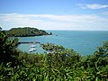 Royal Island.
 The arrival on the Royal Island.
 The Salvation Islands’s Lighthouse.
 Saint Joseph Island’s beach.
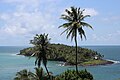 Devil Island.
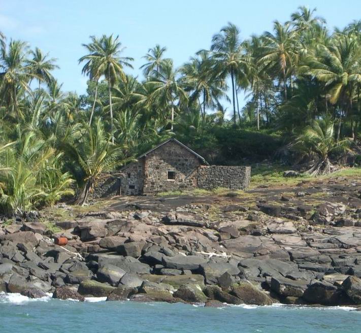
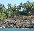 Alfred Dreyfus’s House.


References
- "Fiche Climatologique Statistiques 1991-2020 et records" (PDF) (in French). Météo-France. Retrieved August 29, 2022.
- "Normales et records pour Ile Royale (973)". Meteociel. Retrieved 4 June 2022.
- "Sites & Espaces Protégée" (PDF). Government of French Guiana (in French). p. 54. Retrieved 24 March 2021.
External links
Authority control | |
|---|---|
| General | |
| National libraries | |
На других языках
[de] Îles du Salut
Die Îles du Salut (deutsch Inseln des Heils[1]) sind eine kleine Inselgruppe 13 km vor der Küste von Kourou in Französisch-Guayana. Obwohl näher zu Kourou gelegen, gehören die Inseln zur 45 km südöstlich gelegenen Hauptstadtgemeinde Cayenne, und zwar zum Kanton Cayenne-1 Nord-Ouest.- [en] Salvation Islands
[es] Islas de la Salvación
Las islas de la Salvación (en francés: Îles du Salut) son un grupo de pequeñas islas de origen volcánico a sólo 11 kilómetros de la costa de la Guayana Francesa (14 km al norte de Kourou) en el océano Atlántico. Aunque están más cerca de Kourou, las islas son parte de la comuna de Cayena (municipio), específicamente Cayena en el primer Cantón Nord-Ouest.[fr] Îles du Salut
Les îles du Salut forment un archipel constitué de trois îlots d'origine volcanique rattachés à la Guyane, et situés à quatorze kilomètres au large de Kourou[1]. Les Îles du Salut sont rattachées au territoire de la commune de Cayenne et de Cayenne 1er Canton Nord-Ouest. Cependant, le Centre national d'études spatiales (CNES) est propriétaire de l'ensemble des trois îles (elles sont situées sous la trajectoire des lanceurs et représentent donc un site stratégique)[2], à l'exception de trois enclaves restées propriétés de l'État pour des besoins liés au fonctionnement du phare (entretien et gestion de ces enclaves assurés par la Direction départementale de l'Équipement). Seules les îles Royale et Saint-Joseph sont accessibles, l'île du Diable, la plus au nord, étant strictement interdite d'accès, notamment à cause des forts courants.[3][it] Île du Salut
Le Isole du Salut (in francese: Îles du Salut), cioè "Isole della Salvezza", sono un piccolo arcipelago di origine vulcanica che si trova nell'Oceano Atlantico, circa 11 chilometri al largo della costa della Guyana francese, cui appartengono politicamente. Benché esse siano solo a 14 chilometri da Kourou, fanno parte della municipalità di Caienna.Другой контент может иметь иную лицензию. Перед использованием материалов сайта WikiSort.org внимательно изучите правила лицензирования конкретных элементов наполнения сайта.
WikiSort.org - проект по пересортировке и дополнению контента Википедии