geo.wikisort.org - Island
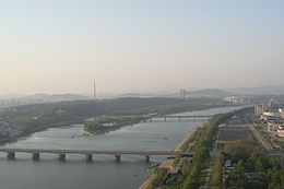
Rungra Island is an island in Pyongyang, North Korea, located in the middle of the Taedong River. Its total area is 1.3 square kilometres (0.50 sq mi). The Chongryu Bridge on the north side and the Rungra Bridge on the south side connect the island to the rest of Pyongyang.[1] The island is a good place to see some of the Eight Views of Pyongyang.[2]
| Rŭngrado | |
| Chosŏn'gŭl | |
|---|---|
| Hancha | |
| Revised Romanization | Reungrado Neungnado |
| McCune–Reischauer | Rŭngrado Nŭngnado |
 | |
 | |
| Geography | |
|---|---|
| Coordinates | 39°02′40″N 125°46′10″E |
| Area | 1.3 km2 (0.50 sq mi) |
| Administration | |
North Korea | |
Recreational facilities on the island include the Rungrado 1st of May Stadium. The Rungra People's Pleasure Ground, which opened in 2012; it includes a dolphin exhibit, volleyball and basketball courts, and a wading pool.[3]
References
- "Picturesque Islet", Korean Central News Agency, 9 May 2002, archived from the original on 9 June 2011, retrieved 2 June 2010
- "Rŭngrado". Doopedia (in Korean). Retrieved 5 May 2018.
- "Kim Jong Un Visits Rungna People's Pleasure Ground", Korean Central News Agency, 24 July 2012, retrieved 26 July 2012
На других языках
[de] Rungna
Rungna, auch Rungra genannt, ist eine Insel im Taedong-gang in Nordkorea. Sie gehört, wie auch die weiter südlich gelegene Insel Yanggak, zum Stadtteil Chung-guyŏk der nordkoreanischen Hauptstadt Pjöngjang.- [en] Rŭngrado
Текст в блоке "Читать" взят с сайта "Википедия" и доступен по лицензии Creative Commons Attribution-ShareAlike; в отдельных случаях могут действовать дополнительные условия.
Другой контент может иметь иную лицензию. Перед использованием материалов сайта WikiSort.org внимательно изучите правила лицензирования конкретных элементов наполнения сайта.
Другой контент может иметь иную лицензию. Перед использованием материалов сайта WikiSort.org внимательно изучите правила лицензирования конкретных элементов наполнения сайта.
2019-2025
WikiSort.org - проект по пересортировке и дополнению контента Википедии
WikiSort.org - проект по пересортировке и дополнению контента Википедии