geo.wikisort.org - Island
Mont-Saint-Michel[2] (French pronunciation: [lə mɔ̃ sɛ̃ miʃɛl]; Norman: Mont Saint Miché; Breton: Menez Mikael ar Mor; English: Saint Michael's Mount) is a tidal island and mainland commune in Normandy, France.
Le Mont-Saint-Michel | |
|---|---|
Commune | |
 View from the southeast during sunrise, 2018 | |
 Coat of arms | |
Location of Le Mont-Saint-Michel  | |
 Le Mont-Saint-Michel  Le Mont-Saint-Michel | |
| Coordinates: 48°38′10″N 1°30′40″W | |
| Country | France |
| Region | Normandy |
| Department | Manche |
| Arrondissement | Avranches |
| Canton | Pontorson |
| Intercommunality | CA Mont-Saint-Michel-Normandie |
| Government | |
| • Mayor (2020–2026) | Jacques Bono |
| Area 1 | 4.00 km2 (1.54 sq mi) |
| Population | 29 |
| • Density | 7.3/km2 (19/sq mi) |
| Time zone | UTC+01:00 (CET) |
| • Summer (DST) | UTC+02:00 (CEST) |
| INSEE/Postal code | 50353 /50116 |
| Elevation | 5–80 m (16–262 ft) |
UNESCO World Heritage Site | |
| Part of | Mont-Saint-Michel and its Bay |
| Criteria | Cultural: i, iii, vi |
| Reference | 80 |
| Inscription | 1979 (3rd Session) |
| Area | 6,560 hectares (16,200 acres) |
| Buffer zone | 57,510 hectares (142,100 acres) |
| 1 French Land Register data, which excludes lakes, ponds, glaciers > 1 km2 (0.386 sq mi or 247 acres) and river estuaries. | |
The island[3] lies approximately one kilometre (one-half nautical mile) off the country's north-western coast, at the mouth of the Couesnon River near Avranches and is 7 hectares (17 acres) in area. The mainland part of the commune is 393 hectares (971 acres) in area so that the total surface of the commune is 400 hectares (990 acres).[4][5] As of 2019[update], the island had a population of 29.[6]
The commune's position—on an island just a few hundred metres from land—made it accessible at low tide to the many pilgrims to its abbey, but defensible as an incoming tide stranded, drove off, or drowned would-be assailants. The island remained unconquered during the Hundred Years' War; a small garrison fended off a full attack by the English in 1433.[7] Louis XI recognised the reverse benefits of its natural defence and turned it into a prison. The abbey was used regularly as a prison during the Ancien Régime.
Mont-Saint-Michel and its surrounding bay were inscribed on the UNESCO list of World Heritage Sites in 1979 for its unique aesthetic and importance as a medieval Christian site.[8] It is visited by more than 3 million people each year. Over 60 buildings within the commune are protected in France as monuments historiques.[9]
Geography
Formation
Now a rocky tidal island, the Mont occupied dry land in prehistoric times. As sea levels rose, erosion reshaped the coastal landscape, and several outcrops of granite emerged in the bay, having resisted the wear and tear of the ocean better than the surrounding rocks. These included Lillemer, the Mont Dol, Tombelaine (the island just to the north), and Mont Tombe, later called Mont Saint-Michel.
Mont-Saint-Michel consists of leucogranite which solidified from an underground intrusion of molten magma about 525 million years ago, during the Cambrian period, as one of the younger parts of the Mancellian granitic batholith.[10] (Early studies of Mont Saint-Michel by French geologists sometimes describe the leucogranite of the Mont as "granulite", but this granitic meaning of granulite is now obsolete.)[11]
The Mont has a circumference of about 960 m (3,150 ft) and its highest point is 92 m (302 ft) above sea level.[12]
Tides
The tides vary greatly, at roughly 14 metres (46 ft) between highest and lowest water marks. Popularly nicknamed "St. Michael in peril of the sea" by medieval pilgrims making their way across the flats, the mount can still pose dangers for visitors who avoid the causeway and attempt the hazardous walk across the sands from the neighbouring coast.
Polderisation and occasional flooding have created salt marsh meadows that were found to be ideally suited to grazing sheep. The well-flavoured meat that results from the diet of the sheep in the pré salé (salt meadow) makes agneau de pré-salé (salt meadow lamb) a local specialty that may be found on the menus of restaurants that depend on income from the many visitors to the mount.
Tidal island
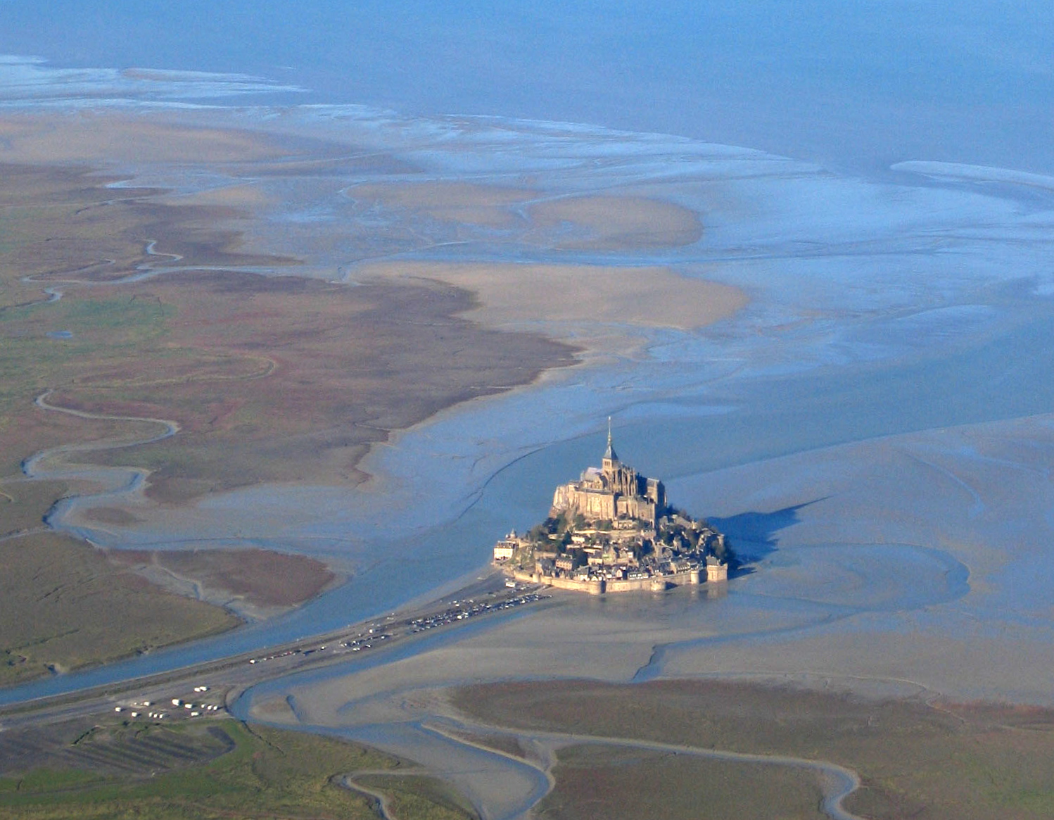
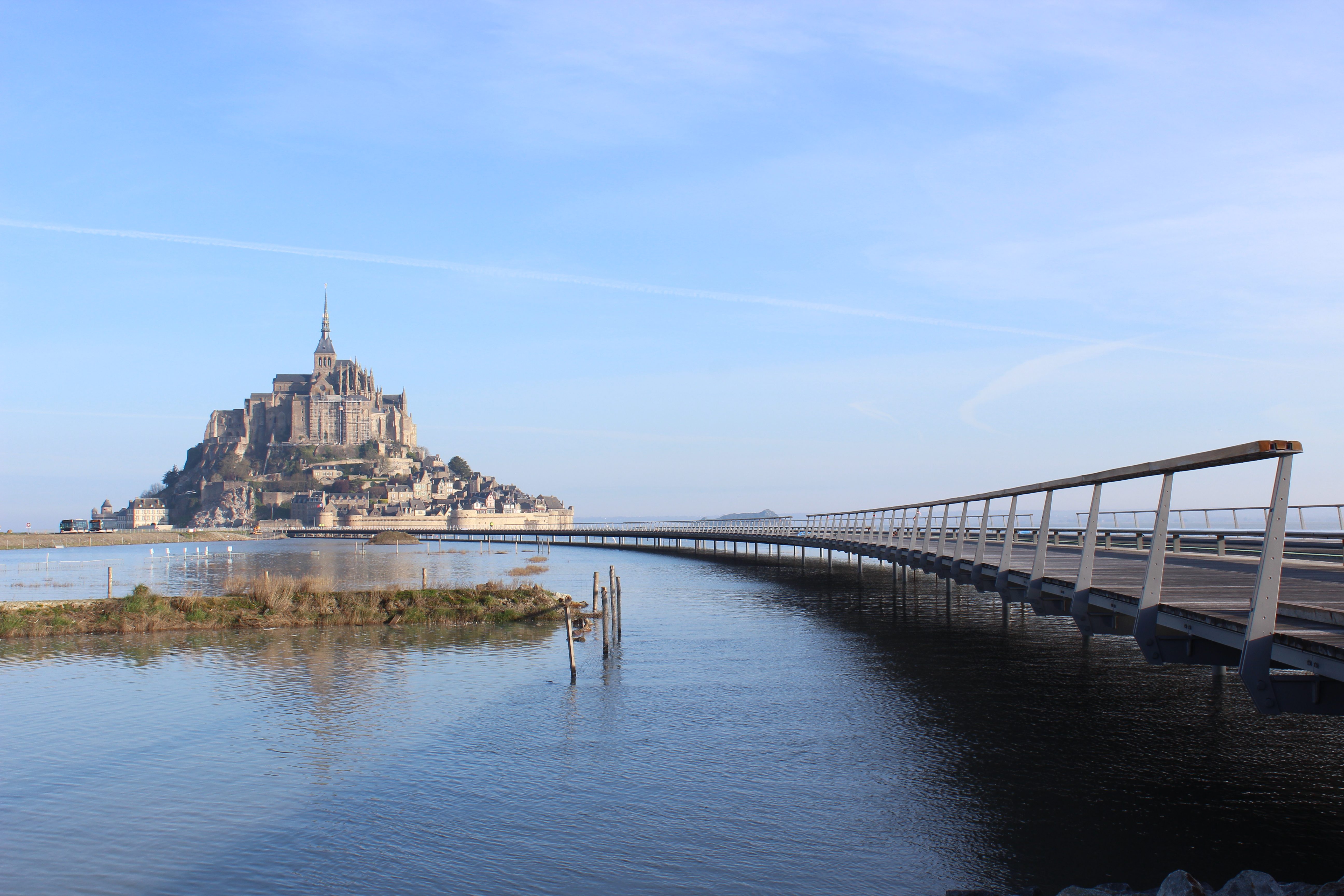
The connection between the Mont Saint-Michel and the mainland has changed over the centuries. Previously connected by a tidal causeway uncovered only at low tide, this was converted into a raised causeway in 1879, preventing the tide from scouring the silt around the mount. The coastal flats have also been polderised to create pastureland, decreasing the distance between the shore and the island, and the Couesnon River has been canalised, reducing the dispersion of the flow of water. These factors all encouraged silting-up of the bay.
On 16 June 2006, the French prime minister and regional authorities announced a €200 million project (Projet Mont-Saint-Michel)[13] to build a hydraulic dam using the waters of the Couesnon and the tides to help remove the accumulated silt, and to make Mont Saint-Michel an island again. The construction of the dam began in 2009. The project also includes the removal of the causeway and its visitor car park. Since 28 April 2012, the new car park on the mainland has been located 2.5 kilometres (1+1⁄2 mi) from the island. Visitors can walk or use shuttles to cross the causeway.
On 22 July 2014, the new bridge by architect Dietmar Feichtinger was opened to the public. The light bridge allows the waters to flow freely around the island and improves the efficiency of the now operational dam. The project, which cost €209 million, was officially opened by President François Hollande.[14]
On rare occasions, tidal circumstances produce an extremely high "supertide". The new bridge was completely submerged on 21 March 2015 by the highest sea level, for a once-in-18-years-occurrence, as crowds gathered to snap photos.[15]
History
Mont-Saint-Michel was used in the sixth and seventh centuries as an Armorican stronghold of Gallo-Roman culture and power until it was ransacked by the Franks, thus ending the trans-channel culture that had stood since the departure of the Romans in 460.[citation needed] From roughly the fifth to the eighth century, Mont Saint-Michel belonged to the territory of Neustria and, in the early ninth century, was an important place in the marches of Neustria.[citation needed]

Before the construction of the first monastic establishment in the 8th century, the island was called Mont Tombe (Latin: tumba). According to a legend, the archangel Michael appeared in 708 to Aubert of Avranches, the bishop of Avranches, and instructed him to build a church on the rocky islet.[16]
Unable to defend his kingdom against the assaults of the Vikings, the king of the Franks agreed to grant the Cotentin peninsula and the Avranchin, including Mont Saint-Michel traditionally linked to the city of Avranches, to the Bretons in the Treaty of Compiègne (867). This marked the beginning of a brief period of Breton possession of the Mont. In fact, these lands and Mont Saint-Michel were never really included in the duchy of Brittany and remained independent bishoprics from the newly created Breton archbishopric of Dol. When Rollo confirmed Franco as archbishop of Rouen, these traditional dependences of the Rouen archbishopric were retained in it.[citation needed]
The mount gained strategic significance again in 933 when William I Longsword annexed the Cotentin Peninsula from the weakened Duchy of Brittany. This made the mount definitively part of Normandy, and is depicted in the Bayeux Tapestry, which commemorates the 1066 Norman conquest of England. Harold Godwinson is pictured on the tapestry rescuing two Norman knights from the quicksand in the tidal flats during a battle with Conan II, Duke of Brittany. Norman ducal patronage financed the spectacular Norman architecture of the abbey in subsequent centuries.[citation needed]

In 1067 the monastery of Mont Saint-Michel gave its support to William the Conqueror in his claim to the throne of England. This he rewarded with properties and grounds on the English side of the Channel, including a small island off the southwestern coast of Cornwall which was modelled after the Mount and became a Norman priory named St Michael's Mount of Penzance.[citation needed]

During the Hundred Years' War, the Kingdom of England made repeated assaults on the island but was unable to seize it due to the abbey's improved fortifications. The English initially besieged the Mont in 1423–24, and then again in 1433–34 with English forces under the command of Thomas de Scales, 7th Baron Scales. Two wrought-iron bombards that Scales abandoned when he gave up his siege are still on site. They are known as les Michelettes.[17] Mont Saint-Michel's resolute resistance inspired the French, especially Joan of Arc.
When Louis XI of France founded the Order of Saint Michael in 1469, he intended that the abbey church of Mont Saint-Michel become the chapel for the Order, but because of its great distance from Paris, his intention could never be realized.[citation needed]
The wealth and influence of the abbey extended to many daughter foundations, including St. Michael's Mount in Cornwall. However, its popularity and prestige as a centre of pilgrimage waned with the Reformation, and by the time of the French Revolution there were scarcely any monks in residence. The abbey was closed and converted into a prison, initially to hold clerical opponents of the republican regime. High-profile political prisoners followed, but by 1836, influential figures—including Victor Hugo—had launched a campaign to restore what was seen as a national architectural treasure. The prison was finally closed in 1863.
In 1872, the highly decorated French architect of historic monuments, Édouard Corroyer, was responsible for assessing the condition of the Mont. It took him about two years to convince his minister to classify Mont Saint-Michel a historic monument, and it was officially declared as such in 1874. From then on, this highly qualified and educated architect and member of the Academy of Fine Arts devoted himself entirely to the restoration of "la Merveille". Under his direction, gigantic works were undertaken, starting with the most urgent and devoted fifteen years of his life to this work. He wrote four works on the building and his name remains forever attached to the "resurrection" of Mont Saint-Michel.[citation needed]
During the occupation of France in WWII, German soldiers occupied Mont Saint-Michel, where they used St. Auburn church as a lookout post. The island was a major attraction for German tourists and soldiers with around 325,000 German tourists from July 18, 1940, to the end of the occupation of France. After the initial D-Day invasion by the allies, many exhausted German soldiers retreated to strongholds like Mont Saint-Michel. On August 1, 1944, Allied troops entered the Mont Saint-Michel. They were accompanied by two British reporters, Gault MacGowan of the New York Sun and Paul Holt with the London Daily Express, and crowds of jubilant French locals.[18]
Mont Saint-Michel and its bay were added to the UNESCO list of World Heritage Sites in 1979, and it was listed with criteria such as cultural, historical, and architectural significance, as well as human-created and natural beauty.[8]
Abbey design

In the 11th century, William of Volpiano, the Italian architect who had built Fécamp Abbey in Normandy, was chosen by Richard II, Duke of Normandy, to be the building contractor. He designed the Romanesque church of the abbey, daringly placing the transept crossing at the top of the mount. Many underground crypts and chapels had to be built to compensate for this weight; these formed the basis for the supportive upward structure that can be seen today. Today Mont Saint-Michel is seen as a building of Romanesque architecture.
Robert de Thorigny, a great supporter of Henry II of England (who was also Duke of Normandy), reinforced the structure of the buildings and built the main façade of the church in the 12th century. In 1204, Guy of Thouars, regent for the Duchess of Brittany, as vassal of the King of France, undertook a siege of the Mount. After having set fire to the village and having massacred the population, he was obliged to beat a retreat under the powerful walls of the abbey. Unfortunately, the fire which he himself lit extended to the buildings, and the roofs fell prey to the flames. Horrified by the cruelty and the exactions of his Breton ally, Philip Augustus offered Abbot Jordan a grant for the reconstruction of the abbey in the new Gothic architectural style.[19]
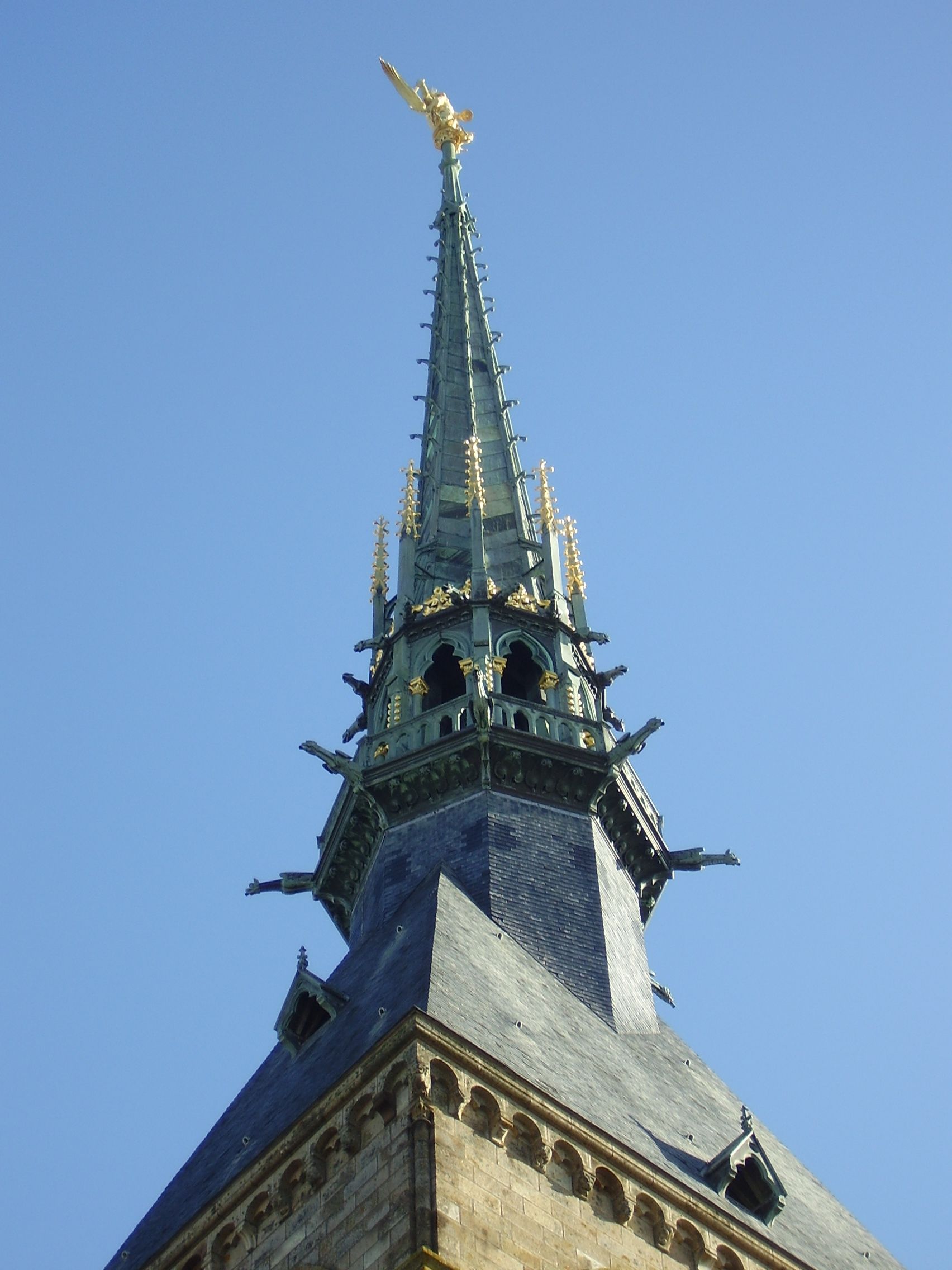
Charles VI is credited with adding major fortifications to the abbey-mount, building towers, successive courtyards, and strengthening the ramparts.
Development
 10th century
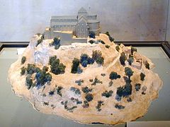 11th to 12th century
 17th to 18th century
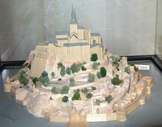 19th to 21st century


Administration

The islet belongs to the French commune of Le Mont-Saint-Michel, in the département of Manche, in Normandy.[20] The nearest significant town, with an SNCF train station, is Pontorson, with a population of slightly over 4000. Le Mont-Saint-Michel belongs to the Organization of World Heritage Cities.
Population
|
|
| |||||||||||||||||||||||||||||||||||||||||||||||||||||||||||||||||||||||||||||||||||||||||||||||||||||||||||||||||||||
| From the year 1962 on: No double counting—residents of multiple communes (e.g. students and military personnel) are counted only once. Source: EHESS[21] and Insee[22] | |||||||||||||||||||||||||||||||||||||||||||||||||||||||||||||||||||||||||||||||||||||||||||||||||||||||||||||||||||||||
| 1956–1962 | 1962–1968 | 1968–1975 | 1975–1982 | 1982–1990 | 1990–1999 |
|---|---|---|---|---|---|
| xx | 13 | 16 | 8 | 6 | 4 |
| 1956–1962 | 1962–1968 | 1968–1975 | 1975–1982 | 1982–1990 | 1990–1999 |
|---|---|---|---|---|---|
| xx | 6 | 6 | 4 | 5 | 3 |
Up to 20,000 people [citation needed] visit the city during the summer months. Among the 43 inhabitants as of 2006[update], 5 were monks and 7 nuns.
The Monastic Fraternities of Jerusalem
Since 24 June 2001, following the appeal addressed to them in 2000 by Bishop Jacques Fihey, Bishop of Coutances and Avranches,[23] a community of monks and nuns of the Monastic Fraternities of Jerusalem, sent from the mother-house of St-Gervais-et-St-Protais in Paris, have been living as a community on Mont Saint-Michel. They replaced the Benedictine monks who returned to the Mount in 1966. They are tenants of the centre for national monuments and are not involved in the management of the abbey.
The community has seven sisters and four brothers. They live the mission that the Church has entrusted to them in their own charism of being "in the heart of the world" to be "in the heart of God". Their life revolves around prayer, work and fraternal life.[23] The community meets four times a day to recite the liturgical office in the abbey itself (or in the crypt of Notre-Dame des Trente Cierges in winter). In this way, the building keeps its original purpose as a place of prayer and singing the glory of God. The presence of the community attracts many visitors and pilgrims who come to join in the various liturgical celebrations.
In 2012, the community undertook the renovation of a house on the Mount, the Logis Saint-Abraham, which is used as a guest house for pilgrims on retreat.
People and places of note
- Robert of Torigni, famous abbot of the Mount;
- The Duke of Chartres (later Louis-Philippe I) came to demolish the "iron cage";
- Louis Auguste Blanqui, political prisoner in the Mount;
- Armand Barbès, political prisoner in the Mount;
- La Mère Poulard, famous omelet restaurant;
- Anne Boutiaut Poulard, creator of the Omelette de la mère Poulard.
Economy
The Mont-Saint-Michel has long "belonged" to some families who shared the businesses in the town and succeeded to the village administration. Tourism is almost the sole source of income of the commune. Tourism brings about $63 million to the small island.[24] There are about 50 shops for 3 million tourists. Only about 25 people sleep every night on the Mount (monks included), except for those in hotels. The main institutions are shared by:
- Eric Vannier, owner of the group the Mère Poulard (holding half of restaurants, shops, hotels and three museums);
- Jean-Yves Vételé, CEO of Sodetour (five hotels, a supermarket and shops—all extramural—including Mercury Barracks);
- Patrick Gaul, former elected official, hotelier and intramural restaurateur;
- Independent merchants.
Twin towns and sister cities
- Hatsukaichi, Hiroshima, Japan, where Itsukushima Shrine, another UNESCO World Heritage Site, is located.[25][26][27]
Historically, Mont Saint-Michel was the Norman counterpart of St Michael's Mount in Cornwall, UK, which was given to the Benedictines, religious order of Mont-Saint-Michel, by Edward the Confessor in the 11th century. The two mounts share the same tidal island characteristics and a similar conical shape, though Mont-Saint-Michel is much taller.[28]
Modern pilgrimage
During the medieval period, pilgrims walked from Italy, Germany, and England as well as other parts of France. Such devotees were known as Miquelots. Modern pilgrims can follow the same routes. Ten hiking trails have been created that enable pilgrims from various European countries to retrace the path their ancestors may have taken during a medieval pilgrimage.[29]
In popular culture
Mont-Saint-Michel served as an artistic inspiration for a number of works. Part of the action in Helen MacInnes's thriller Assignment in Brittany takes place at the Mont, including a dramatic nighttime chase across the sands. In Peter Jackson's 2003 film The Lord of the Rings: The Return of the King, Gondor's capital city, Minas Tirith, was modelled on Mont Saint-Michel.[30] The site appeared in the 2004 film Mickey, Donald, Goofy: The Three Musketeers. Likewise, the town and castle in the Disney hit Tangled were based on Mont-Saint-Michel,[31] as was the design of Dark Souls location New Londo Ruins.[32]
See also
- Aragonese Castle
- Carolingian architecture
- Carolingian art
- French Romanesque architecture
- Key Monastery
- La Mère Poulard
- Le Mont Saint Michel (clothing), clothing brand named after the abbey
- List of Carolingian monasteries
- Manoir de Brion
- Monemvasia
- Mont Saint Michel Abbey
- Saint-Malo
- Saint Michael in the Catholic Church
- St Michael's Mount, Cornwall
References
- "Populations légales 2019". The National Institute of Statistics and Economic Studies. 29 December 2021.
- With two hyphens and the French article "Le" ahead, because it is the name of a commune, not a hill.
- By far, the most famous part of the commune, known as the "Mont Saint-Michel" or the "Mount Saint-Michel", with only one hyphen and the name "Mont" untied because it precisely means the hill, a geologic element, in this case, an island.
- Institut géographique national (IGN) (ed.). "Commune of Le Mont-Saint-Michel's territory (scale 1:34110), the two mainland zones (enclaves) are visible, surrounded by a yellow line : one on the west of the Couesnon River is a relatively big one (387 ha), the other one on the east of the Couesnon River is a tiny one (6 ha)". geoportail.gouv.fr. Retrieved 9 August 2018.
- "Communal limits : the three areas (two of them are on the mainland and the third one is the island itself) are each surrounded by an orange line". openstreetmap.org. Retrieved 9 August 2018.
- Téléchargement du fichier d'ensemble des populations légales en 2019, INSEE
- "Mont Saint-Michel". xenophongroup.com. Archived from the original on 19 May 2015. Retrieved 7 October 2015.
- "Mont-Saint-Michel and its Bay". UNESCO World Heritage List. United Nations Educational, Scientific, and Cultural Organization. 13 December 2006. Archived from the original on 24 May 2011. Retrieved 31 May 2011.
- Base Mérimée: Search for heritage in the commune, Ministère français de la Culture. (in French)
- L'Homer, A.; et al. (1999). Notice explicative, Carte géologique de la France (1/50 000), feuille Baie du mont-Saint-Michel (208) (PDF) (in French). Orléans: BRGM. ISBN 2-7159-1208-0. Archived (PDF) from the original on 6 October 2015.
- "Carnets géologique de Philippe Glangeaud - Glossaire" (in French). Archived from the original on 14 November 2015. Retrieved 7 October 2015.
- Chantal Bonnot-Courtois, La Baie du Mont-Saint-Michel et l'estuaire de la Rance: environnements sédimentaires, aménagements et évolution récente. Editor Technip. 2002. pages 15–20
- "Official website of the restoring operation of the Mont Saint-Michel's maritime character". www.projetmontsaintmichel.com. Archived from the original on 17 October 2015. Retrieved 7 October 2015.
- "Mont Saint-Michel reclaims its island status". rfi.
- Galimberti, Katy (31 March 2015). "PHOTOS: Supertide Turns Mont Saint-Michel into Island in a Once in 18-Year Spectacle". AccuWeather. Archived from the original on 17 October 2015.
- "Catholic Encyclopedia: Mont-St-Michel". Newadvent.org. 1 October 1911. Archived from the original on 16 January 2013. Retrieved 10 July 2013.
- James, David (6 October 2017). "10 Fascinating Facts About Mont Saint-Michel — the Medieval City on a Rock". 5-Minute History. Retrieved 24 January 2022.
- Hymel, Kevin. "Freeing Mont Saint Michel". Warfare History Network.
{{cite web}}: CS1 maint: url-status (link) - Adams, Henry (1913). Mont-Saint-Michel and Chartres: A Study of Thirteenth-Century Unity. Boston: Houghton Mifflin. pp. 37–38.
- Commune du Mont-Saint-Michel (50353), INSEE
- Des villages de Cassini aux communes d'aujourd'hui: Commune data sheet 23871, EHESS. (in French)
- Population en historique depuis 1968, INSEE
- "Mont Saint Michel facts". Retrieved 5 September 2018.
- Stille, Alexander (June 2014). "The Massive and Controversial Attempt to Preserve One of the World's Most Iconic Islands". Smithsonian Magazine.
- "Le Mont-Saint-Michel – Jumelage" (in French). Wikimanche.fr. Archived from the original on 21 July 2011. Retrieved 31 May 2011.
- "Nishihiroshima Times". L-co.co.jp. Archived from the original on 13 January 2010. Retrieved 31 May 2011.
- "Miyajima Grand Hotel Info". Miyajima-arimoto.co.jp. 16 May 2009. Archived from the original on 6 March 2012. Retrieved 31 May 2011.
- Henderson, Charles (1925). Cornish Church Guide. Truro: Oscar Blackford. pp. 160–61.
- "The ways of holy Michel mount". www.lescheminsdumontsaintmichel.com. Retrieved 27 June 2020.
- Morrison, Geoffrey (27 June 2014). "The real-life Minas Tirith from 'Lord of the Rings': A tour of Mont Saint-Michel". CNET.
- "10 Real Life Locations That Inspired Disney Films". Buzzfeed. buzzfeed.com. 20 October 2013. Archived from the original on 29 April 2017.
- "Translation of the Design Works Interview with Hidetaka Miyazaki". Giant Bomb. giantbomb.com. Archived from the original on 30 June 2015. Retrieved 31 July 2015.
External links
- Mont Saint-Michel:A World Heritage Site
- Freeing Mont Saint-Michel
- Mont-Saint-Michel Celebrates 1,300 yrs of History
- Mont Saint-Michel between history and legends
- Official Mont-Saint-Michel Tourist site (English version) Archived 16 June 2019 at the Wayback Machine
- Virtual recreation of Mont St. Michel in Second Life
- Pano at 360° of Mont St Michel
- High-resolution 360° Panoramas and Images of Mont Saint-Michel | Art Atlas
- The Sledge Tramway
World Heritage Sites in France | ||
|---|---|---|
| Île-de-France |
| |
| Parisian basin |
| |
| Nord-Pas-de-Calais |
| |
| East |
| |
| West |
| |
| South West |
| |
| Centre East |
| |
| Mediterranean |
| |
| Multiple regions |
| |
| Overseas departments and territories |
| |
| ||
Routes of Santiago de Compostela in France | ||
|---|---|---|
UNESCO World Heritage Site | ||
| ||
Authority control | |
|---|---|
| General |
|
| National libraries | |
| Other | |
На других языках
[de] Le Mont-Saint-Michel
Le Mont-Saint-Michel ist eine französische Gemeinde mit 29 Einwohnern (Stand 1. Januar 2019) im Département Manche in der Region Normandie. Die Gemeinde besteht aus der felsigen Insel Mont Saint-Michel in der Bucht des Mont-Saint-Michel im Wattenmeer der Normandie und Anteilen am Festland. Die Insel, die nach dem Erzengel Michael benannt ist, ist etwa einen Kilometer von der Küste entfernt. Bei einem Umfang von rund 830 m ist sie nur etwa 55.000 m² groß; die Gemeindefläche beläuft sich auf insgesamt 4 km².[1] In der Nähe befinden sich die Mündung des Couesnon, die Stadt Avranches und die Grenze zur Bretagne. Die Landschaft heißt Avranchin.- [en] Mont-Saint-Michel
[fr] Le Mont-Saint-Michel
Le Mont-Saint-Michel[Note 1] est une commune française située dans le département de la Manche en Normandie. Elle tire son nom de l'îlot rocheux consacré à saint Michel où s’élève aujourd’hui l’abbaye du Mont-Saint-Michel.Другой контент может иметь иную лицензию. Перед использованием материалов сайта WikiSort.org внимательно изучите правила лицензирования конкретных элементов наполнения сайта.
WikiSort.org - проект по пересортировке и дополнению контента Википедии