geo.wikisort.org - Island
Mahé is the largest island of Seychelles, with an area of 157.3 square kilometres (60.7 sq mi), lying in the northeast of the Seychellean nation in the Somali Sea part of the Indian Ocean. The population of Mahé was 77,000, as of the 2010 census.[1] It contains the capital city of Victoria and accommodates 86% of the country's total population. The island was named after Bertrand-François Mahé de La Bourdonnais, a French governor of Isle de France (modern-day Mauritius).
 Beach on Mahé | |
 Mahé | |
| Geography | |
|---|---|
| Location | Seychelles, Indian Ocean |
| Coordinates | 4°40′S 55°28′E |
| Archipelago | Inner Islands, Seychelles |
| Adjacent bodies of water | Indian Ocean |
| Total islands | 1 |
| Major islands |
|
| Area | 157.3 km2 (60.7 sq mi) |
| Length | 26 km (16.2 mi) |
| Width | 17 km (10.6 mi) |
| Coastline | 111.3 km (69.16 mi) |
| Highest elevation | 905 m (2969 ft) |
| Highest point | Morne Seychellois |
| Administration | |
Seychelles | |
| Group | Inner Islands |
| Sub-Group | Mahe Islands |
| Districts | Multiple |
| Largest settlement | Victoria (pop. 35,000) |
| Demographics | |
| Population | 95,000 (2018) |
| Pop. density | 490/km2 (1270/sq mi) |
| Ethnic groups | Chinese, Creole, East Africans, French, and Indians |
| Additional information | |
| Time zone |
|
| Official website | www |
History
Mahé was first visited by the British in 1609 and not visited by Europeans again until Lazare Picault's expedition of 1742. The French navy frégate Le Cerf (English: The Deer) arrived at Port Victoria on 1 November 1756. On board was Corneille Nicholas Morphey, leader of the French expedition, which claimed the island for the King of France by laying a Stone of Possession on Mahé, Seychelles’ oldest monument, now on display in the National Museum, Victoria.
In August 1801 a Royal Navy frigate HMS Sibylle captured the French frigate Chiffonne on the island. Mahé remained a French possession until 1812 when it became a British colony. It remained a colony until 1976 when Seychelles became an independent nation.
Mahé had a huge land reclamation project due to a housing shortage in the areas of Bel Ombre and the Port of Victoria.[2]
Mahé was largely a plantation owned by the Frichot family.[3] In 1977 France-Albert René staged a coup d’état and forced all the Frichots out of Seychelles or into prison. Some, such as Robert Frichot, were held in René’s jails for several months in 1978 and told to leave Seychelles for their own safety upon release.[4]
Geography
Mahé's tallest peak is Morne Seychellois at 905 m (2,969 ft), which lies in the Morne Seychellois National Park. The northern and eastern parts of the island are home to much of the population and the Seychelles International Airport which opened in 1971. The southern and western parts have Baie Ternay Marine National Park, Port Launay Marine National Park, and University of Seychelles. The Sainte Anne Marine National Park lies offshore, as do Conception Island, Thérèse Island, Anonyme Island, and several smaller islands.
Mahé's forests have rare endemic plants found only in Seychelles, such as the critically endangered Medusagyne oppositifolia (the jellyfish tree), the carnivorous Nepenthes pervillei (Seychelles pitcher plant), and many unique species of orchid.
Administration
The island has multiple districts.[5]
Economy
Mahé's economy is mainly dependent on tourism.
Air Seychelles has its head office on the property of Seychelles International Airport on the island.[6] The Port of Victoria is home to a tuna fishing and canning industry. From 1963 to 1996, the United States Air Force maintained a satellite control network at the Indian Ocean Station, where it had a significant impact on the local economy.[7]
Gallery
 View point Anse Major, Mahe
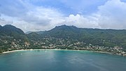 Aerial of Beau Vallon Mahe, Seychelles
 Beach resort Mahe Island, Seychelles
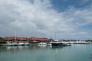 Eden island Mahe
 View point at Anse Intendance beach, Mahe
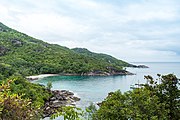
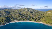 Aerial of beach Anse Intendance
 Aerial of Anse Takamaka beach, Mahe
 Map 1
Map 1 Mahé's capital Victoria
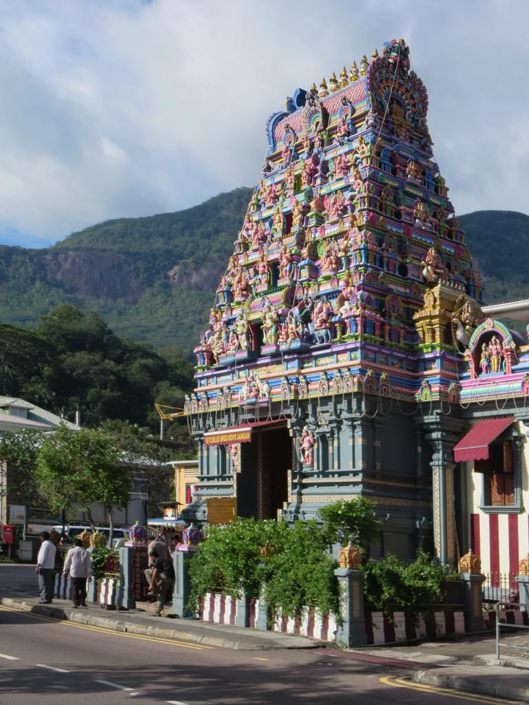
 Arulmigu Navasakti Vinayagar Temple
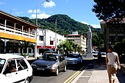 Mahé's capital Victoria
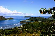 Mahé
Mahé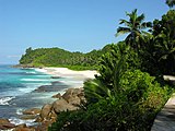 Beach
Beach Mahé's Harbour
 Port Launay Beach, Mahé


References
- "Population and Housing Census 2010 Report" (PDF). National Bureau of Statistics. p. 8. Archived from the original (PDF) on 14 May 2014. Retrieved 12 November 2013.
- "New plan" (PDF). Archived from the original (PDF) on 15 April 2016. Retrieved 3 April 2016.
- "Plantation ecologies on the Seychelles archipelago". 18 February 2022.
- "With the passing of Robert Frichot, I have lost a good friend, and Seychelles has lost a great leader".
- District map
- "Offices & GSAs head Office Archived 7 July 2011 at the Wayback Machine." Air Seychelles. Retrieved on 29 January 2011 "Head Office Air Seychelles Ltd Head Office International Airport P.O.Box 386 Victoria, Mahé, Seychelles."
- Seychelles Station Tracks U.S. Satellites : Air Force Facility Marks 25th Anniversary of Indian Ocean Duty
External links
Authority control | |
|---|---|
| General |
|
| National libraries | |
| Other | |
На других языках
[de] Mahé (Seychellen)
Mahé ist die Hauptinsel und größte Insel der Seychellen. Auf ihr wohnen mit 72.000 Menschen fast 90 % der Bevölkerung der Seychellen. Urbanes Zentrum der Insel ist die Hauptstadt Victoria mit knapp 25.000 Einwohnern.- [en] Mahé, Seychelles
[fr] Mahé (Seychelles)
Mahé est la principale île de l'archipel des Seychelles, dans l'océan Indien. Elle abrite la capitale, Victoria.[it] Mahé
Mahé è l'isola più grande (155 km²) dell'arcipelago delle Seychelles, situata nel nord-est della nazione. La popolazione al 2002 era di 70 828 abitanti. Sull'isola è situata la capitale, Port Victoria, e ospita il 90% del popolazione totale del paese. L'isola è stata nominata così in onore di Mahe de Labourdonnais, un governatore di Mauritius.[ru] Маэ
Маэ́ (фр. Mahé) — один из островов Сейшельского архипелага.Другой контент может иметь иную лицензию. Перед использованием материалов сайта WikiSort.org внимательно изучите правила лицензирования конкретных элементов наполнения сайта.
WikiSort.org - проект по пересортировке и дополнению контента Википедии