geo.wikisort.org - Island
Magerøya (Northern Sami: Máhkarávju) is a large island in Troms og Finnmark county, in the extreme northern part of Norway. The island lies along the Barents Sea in Nordkapp Municipality, just north of the Porsanger Peninsula. The mouth of Porsangerfjorden lies off the east coast of the island.
Native name: Máhkarávju | |
|---|---|
 | |
 | |
 Magerøya Location of the island  Magerøya Magerøya (Norway) | |
| Geography | |
| Location | Troms og Finnmark, Norway |
| Coordinates | 71.0335°N 25.8265°E |
| Area | 436.4 km2 (168.5 sq mi) |
| Length | 30 km (19 mi) |
| Width | 35 km (21.7 mi) |
| Highest elevation | 417 m (1368 ft) |
| Highest point | Gråkallfjellet |
| Administration | |
Norway | |
| County | Troms og Finnmark |
| Municipality | Nordkapp |
| Demographics | |
| Population | 3201 (2012) |
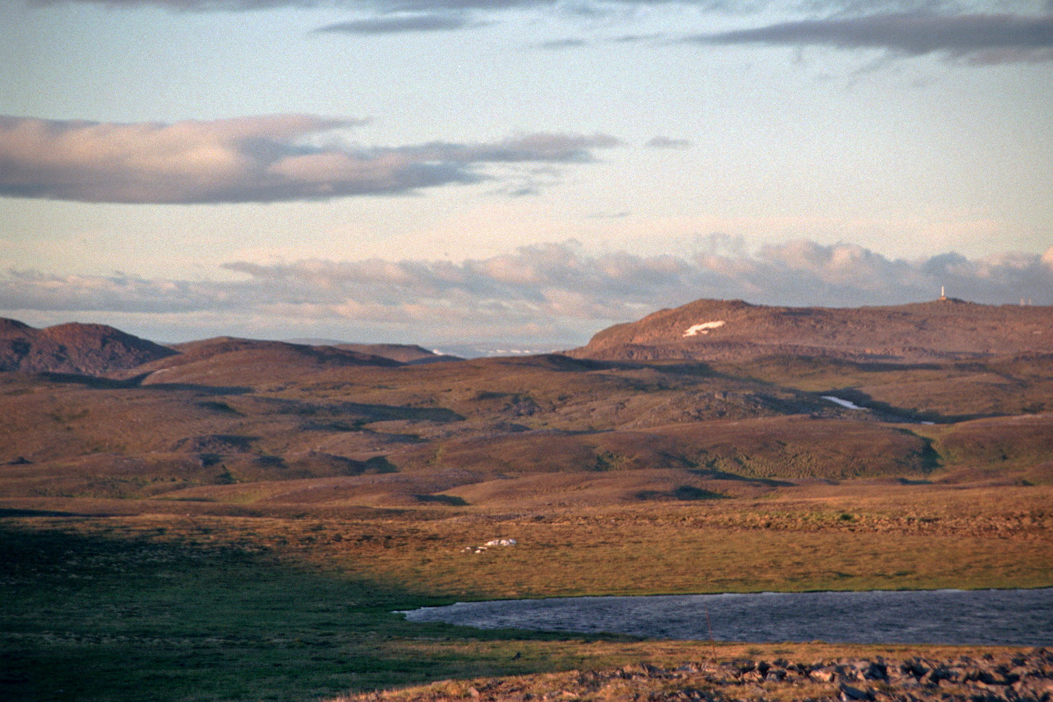
Magerøya has an area of 436.6 square kilometres (168.6 sq mi) and the highest elevation on the island is the 417-metre (1,368 ft) mountain Gråkallfjellet. The most northern point on the island is also the northernmost point in Norway outside Svalbard: Knivskjellodden. The island features a bleak, barren, tundra-covered landscape devoid of any trees (except for a few small pockets of mountain birch), with steep cliffs along the coast, and dramatic mountainscapes in the interior. On southern Magerøya, archaeologists have found evidence of settlements dating back 10,000 years.[1]
Places on Magerøya
The main population centre on the island is the town of Honningsvåg. Other smaller places include the fishing villages of Gjesvær, Skarsvåg, Nordvågen, and Kamøyvær. North Cape is a very popular tourist attraction on the northern shore of the island.
Transportation
Magerøya's main claim to fame is the North Cape, a steep cliff cape on the northern coast that is a major tourist attraction. To accommodate the large numbers of tourists that visit the island, a subsea tunnel was built from 1993 to 1999. The North Cape Tunnel is part of the European route E69 highway and it is 6.87 kilometres (4 mi 473 yd) long and reaches a depth of 212 metres (696 ft) below sea level. For a time, it was one of the longest and deepest subsea tunnels in the world. Fog or ice may occur inside the tunnel, even in summer.
Norway's Hurtigruten ferry service stops at the town of Honningsvåg on Magerøya since the waters around the island remain ice-free all year round due to the warm North Atlantic drift. Honningsvåg Airport is located on the eastern part of the island.
Media gallery
 View from
 E69
E69 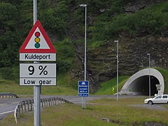 North Cape Tunnel entrance
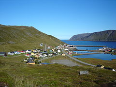 Skarsvåg village with some of the world's northernmost trees
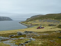 Tiny village of Tufjorden


See also
References
- Store norske leksikon. "Magerøya" (in Norwegian). Retrieved 2013-02-11.
| Authority control |
|
|---|
На других языках
[de] Magerøya
Die Insel Magerøya (norweg. für „karge Insel“) ist eine norwegische Insel im Nordatlantik, etwa sechs Kilometer vom Festland entfernt. Sie bildet den Hauptteil der Kommune Nordkapp in der Provinz Troms og Finnmark. Hauptort der Insel ist das an der Südküste gelegene Honningsvåg mit einer Bevölkerung von 2367 (2009). Die wichtigste Touristenattraktion ist das im Norden der Insel liegende Nordkap. Weitere Orte auf der Insel sind:- [en] Magerøya
[es] Magerøya
Magerøya (del noruego: "isla estéril") es una isla en la comuna de Nordkapp, en Troms og Finnmark, en el extremo norte de Noruega. El paisaje de la isla es de tundra, desolado y estéril, totalmente falto de árboles, debido a su elevada latitud. En la isla también se pueden encontrar altos acantilados que dan al mar, como el visitado de cabo Norte. La isla de Magerøya tiene una superficie de 436,6 km². El punto de mayor altitud, el Gråkollfjellet, se encuentra a 417 metros sobre el nivel del mar en el extremo oeste de Magerøya. El cabo Norte se considera la división, según la Organización Hidrográfica Internacional (IHO), entre el mar de Noruega y el mar de Barents.[1][fr] Magerøya
Magerøya (Same du Nord: Máhkarávju) est une île située à l'extrême nord de la Norvège, dans le comté de Finnmark. Elle est entièrement située dans la municipalité de Nordkapp. Elle doit sa renommée au cap Nord, une falaise de 307 mètres de hauteur qui marque symboliquement le point le plus au nord de l'Europe, même si cette particularité est en réalité détenue par le Knivskjellodden situé également sur l'île à environ 4 km à vol d'oiseau du cap Nord.[it] Magerøya
Magerøya è un'isola che fa parte della contea di Troms og Finnmark, nella parte più settentrionale della Norvegia; è compresa nel comune di Nordkapp.[ru] Магерёйа
Ма́герёйа[1][2], встречаются также варианты написания Магерёйя и Магерё (норв. Magerøya — бедный остров) — принадлежащий Норвегии остров в Баренцевом море у побережья Скандинавского полуострова.Другой контент может иметь иную лицензию. Перед использованием материалов сайта WikiSort.org внимательно изучите правила лицензирования конкретных элементов наполнения сайта.
WikiSort.org - проект по пересортировке и дополнению контента Википедии