geo.wikisort.org - Coast
The Porsanger Peninsula (Norwegian: Porsangerhalvøya) is a peninsula in Troms og Finnmark county, Norway. The large peninsula sits between the Altafjorden and the Porsangerfjorden and includes parts of the municipalities of Alta, Hammerfest, Måsøy, Nordkapp, and Porsanger. Stabbursdalen National Park lies on the southern end of the peninsula.[1]
Porsanger Peninsula
Porsangerhalvøya | |
|---|---|
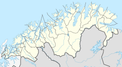 Porsanger Peninsula Location of the peninsula  Porsanger Peninsula Porsanger Peninsula (Norway) | |
| Coordinates: 70.7560°N 25.0671°E | |
| Location | Troms og Finnmark, Norway |
The landscape of the Porsanger peninsula consists mainly of a treeless plain, a continuation of the Finnmarksvidda plateau to the south. A number of fjords cut into the peninsula, of which the largest are the Repparfjorden, Revsbotn, and Snefjorden from the west and the Kobbefjorden from the north. The European route E06 highway runs north through the peninsula.
References
- Store norske leksikon. "Porsangerhalvøya" (in Norwegian). Retrieved 2013-02-10.
This article about a location in Troms og Finnmark is a stub. You can help Wikipedia by expanding it. |
На других языках
[de] Porsanger-Halbinsel
Die Porsanger-Halbinsel (norwegisch: Porsangerhalvøya) ist eine große Halbinsel in der norwegischen Provinz (Fylke) Troms og Finnmark. Sie liegt zwischen dem Altafjord im Westen und dem Porsangerfjord im Osten. Verwaltungsmäßig gehört die Halbinsel zu den Kommunen Alta, Kvalsund, Måsøy, Nordkapp und Porsanger.- [en] Porsanger Peninsula
Другой контент может иметь иную лицензию. Перед использованием материалов сайта WikiSort.org внимательно изучите правила лицензирования конкретных элементов наполнения сайта.
WikiSort.org - проект по пересортировке и дополнению контента Википедии