geo.wikisort.org - Island
Isabela Island (Spanish pronunciation: [isaˈβela]) is the largest island of the Galápagos with an area of 4,586 square kilometres (1,771 sq mi)[2] and length of 100 kilometres (62 mi), almost four times larger than Santa Cruz, the second largest of the archipelago. Isabela Island is larger than every other island in the Galápagos combined.[3] It was named after Queen Isabella I of Castile.[4] The island straddles the equator. This island was originally named Albemarle Island for the Duke of Albemarle by Ambrose Cowley, one of the first Europeans to set foot on the islands, in 1684.[5]
Native name: Isabela | |
|---|---|
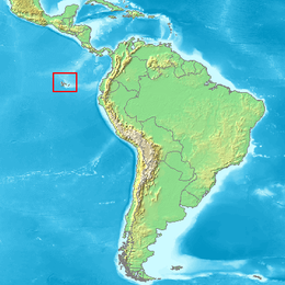
 Map of Galápagos Islands | |
 | |
| Geography | |
| Location | Pacific Ocean |
| Coordinates | 00°30′S 91°04′W |
| Archipelago | Galápagos Islands |
| Area | 4,586 km2 (1,771 sq mi) |
| Length | 100 km (60 mi) |
| Highest elevation | 1,707 m (5600 ft) |
| Highest point | Volcán Wolf |
| Administration | |
Ecuador | |
| Province | Galápagos Province |
| Demographics | |
| Population | 1,748[1] |
| Pop. density | 0.47/km2 (1.22/sq mi) |
| Ethnic groups | Ecuadorians |
Geology


One of the youngest islands, Isabela is located on the western edge of the archipelago near the Galápagos hotspot. At approximately 1 million years old, the seahorse-shaped island was formed by the merger of six shield volcanoes; Alcedo, Cerro Azul, Darwin,[6] Ecuador, Sierra Negra, and Wolf. All of these volcanoes except Ecuador are still active, making it one of the most volcanically active places on earth. Two of the volcanoes, Volcan Ecuador and Volcan Wolf (the island's highest point with an elevation of 1,707 m [5,600 ft]), lie directly on the equator. The island is primarily noted for its geology, providing excellent examples of a geologic occurrence that created the Galápagos Islands including uplifts at Urbina Bay[7] and the Bolivar Channel,[8] tuff cones at Tagus Cove, and Pulmace on Alcedo and Sierra Negra, one of the most active volcanoes in the world.
Wildlife

Isabela is also interesting for its flora and fauna. The young island does not follow the vegetation zones of the other islands. The relatively new lava fields and surrounding soils have not developed the sufficient nutrients required to support the varied life zones found on other islands. Another obvious difference occurs on Volcan Wolf and Cerro Azul; these volcanoes loft above the cloud cover and are arid on top.
Isabela's rich bird, animal and marine life is beyond compare. Isabela is home to more wild tortoises than all the other islands. Isabela's large size and notable topography created barriers for the slow-moving tortoises; apparently the creatures were unable to cross lava flows and other obstacles, causing several different sub-species of tortoise to develop. Today, tortoises roam free in the calderas of Alcedo, Wolf, Cerro Azul, Darwin,[6] and Sierra Negra.
Introduced goats multiplied to over 100,000, but were eradicated by the Galápagos National Park Service and the Charles Darwin Foundation in 2006-2007.[9] Since then, the vegetation has recovered greatly.
Other noted species include penguins, cormorants, marine iguanas, boobies, pelicans, Sally Lightfoot crabs, Galápagos land iguanas, Darwin's finches, Galápagos hawks, Galápagos doves, and very interesting lowland vegetation. The west coast of Isabela in the Bolivar Channel is the best place in Galápagos for viewing whales and dolphin.
History
Human occupation
The settlements of Puerto Villamil and Santo Tomás were founded in 1893. By 1905, the population of the island was 200. Exports at the time were sulfur mined from fumaroles and lime made from coral. Tortoises were used for meat and oil.[10][11] The third-largest human settlement of the archipelago, Puerto Villamil, is located at the south-eastern tip of the island.[12]
Other points of interest
Other popular attractions include El Muro de las Lágrimas, a wall built by prisoners when the island was a penal colony, and the[6] Flamingo Lagoon, named for the flamingos found there. Both are in the south of the island.[citation needed]
See also
- Ecuador
- List of volcanoes in Ecuador
- South America, the nearest continent
- Volcanoes of the Galápagos Islands
References
- "Isabela". Galapagos Conservancy.
- "Isabela Island". Quasar. 24 October 2019. Retrieved 13 July 2021.
- "Isabela Island". Voyagers Travel Specialists. 4 August 2017. Retrieved 13 July 2021.
- "Isabela Island". Galapagos Conservation Trust. 21 June 2016. Retrieved 1 June 2020.
- McEwen, Alec (July 1988). "The English Place-Names of the Galápagos". The Geographical Journal. 154: 234–242. doi:10.2307/633849. Retrieved 13 July 2021.
- "Darwin". www.volcanodiscovery.com. Retrieved 2020-02-06.
- "Galapagos Islands - Urbina Bay". www.visitgalapagos.travel. Retrieved 2020-02-06.
- Ruiz, Diego J.; Wolff, Matthias (2011-08-01). "The Bolivar Channel Ecosystem of the Galapagos Marine Reserve: Energy flow structure and role of keystone groups". Journal of Sea Research. 66 (2): 123–134. doi:10.1016/j.seares.2011.05.006. ISSN 1385-1101.
- "History and Achievements". Charles Darwin Foundation.
- "Human Discovery: Galapagos Colonists". Galapagos Conservancy. Retrieved 15 February 2014.
- White, W. M. "Colonization, Destruction, and Preservation". GALAPAGOS GEOLOGY ON THE WEB. Cornell University. Retrieved 15 February 2014.
- "The largest Island of Galapagos". Retrieved 1 February 2021.
External links
 Isabela Island (Galápagos) travel guide from Wikivoyage
- Galapagos Conservancy
На других языках
[de] Isabela (Galápagos)
Mit einer Größe von 4588 km² und einer Länge von 120 Kilometern ist Isabela (auch englisch Albemarle, spanisch Isla Isabela) die weitaus größte der Galapagosinseln, und fast fünfmal so groß wie die zweitgrößte Insel, Santa Cruz. Die Insel nimmt weit mehr als die Hälfte (58 Prozent) der Landfläche des gesamten Archipels ein. Sie wuchs aus bis zu sechs ursprünglich separaten Schildvulkaninseln durch ausströmende Lava zu einer Insel zusammen, ein weiteres Zusammenwachsen mit der westlich benachbarten und durch den 4,4 km breiten Canal Bolívar getrennten Insel Fernandina durch vulkanische Aktivität ist möglich.- [en] Isabela Island (Galápagos)
[es] Isla Isabela
La isla Isabela (nombre oficial en español) es la isla más grande del archipiélago ecuatoriano de las islas Galápagos, con 4588 km² de superficie. Representa el 60% de la superficie total terrestre de las islas Galápagos.[1][fr] Île Isabela (îles Galápagos)
L'île Isabela, en espagnol Isla Isabela, aussi appelée Albemarle par les Anglais, est une île d'Équateur située dans les îles Galápagos.[it] Isabela (Ecuador)
Isabela è l'isola più grande dell'arcipelago delle Galápagos. Con una lunghezza di 132 km e una larghezza di 84 si estende su una superficie di 4.588 km² e comprende una catena di 5 vulcani attivi, di cui Wolf che con 1.707 metri sul livello del mare rappresenta anche il punto più elevato dell'arcipelago.[ru] Исабела (остров, Галапагос)
Исабе́ла (А́лбемарл)[1][2] (исп. Isla Isabela, Albemarle) — самый крупный из островов архипелага Галапагос.Другой контент может иметь иную лицензию. Перед использованием материалов сайта WikiSort.org внимательно изучите правила лицензирования конкретных элементов наполнения сайта.
WikiSort.org - проект по пересортировке и дополнению контента Википедии