geo.wikisort.org - Island
Cồn Cỏ (![]() listen) (also known as Tiger Island) is a rural district of Quảng Trị province in the North Central Coast region of Vietnam. It is an island and is located 27 km to the east of Mũi Lay.
listen) (also known as Tiger Island) is a rural district of Quảng Trị province in the North Central Coast region of Vietnam. It is an island and is located 27 km to the east of Mũi Lay.
Cồn Cỏ district
Huyện đảo Cồn Cỏ | |
|---|---|
District (Island) | |
| Cồn Cỏ Island district | |
| Country | |
| Region | North Central Coast |
| Province | Quảng Trị |
| Capital | Đảo Cồn Cỏ |
| Area | |
| • Total | 0.8 sq mi (2 km2) |
| Population (2003) | |
| • Total | 400 |
| Time zone | UTC+07:00 (ICt) |
Con Co Island has an area of 2.3 km2 (0.89 sq mi), the isometric form of hills, the highest peak of 63m. This is a young volcanic island, composed of basalt and basalt tuff stones of Neogene – Quaternary age.[1]
Before it became its own district, the island was in the commune of Vĩnh Quang, in Vĩnh Linh district of Quảng Trị Province. The island became a district through Decree 174/2004 NĐ-CP of October 1, 2004. Province officials held a ceremony to create the district on April 18, 2005.
As of 2003 the district had a population of 400.[2] The district covers an area of 2 km², making one of the smallest districts in Vietnam. The district capital lies at Dảo Cồn Cỏ.[2]
History
According to recent archaeological work, in the Bến Nghè area of the island, there are rock artefacts believed to date to the Stone Age, tens of thousands of years ago. In the first few centuries CE, Cham people inhabited the island.
Excavations undertaken in 1994 show that during the 17th and 18th centuries, the island was a stopover point for Vietnamese sea merchants.
During the time of the Nguyễn Dynasty, the island was used to imprison convicts, and some objects such as chains and metal clasps have been found there.
Vietnam War
Due to its proximity to the Vietnamese Demilitarized Zone, during the Vietnam War, Tiger Island was used as a base for North Vietnamese military forces.[3]
On 14 March 1965 the island was attacked by Republic of Vietnam Air Force A-1 Skyraiders.[3]
On 27 June 1972, North Vietnamese coastal artillery on Tiger Island fired on US warships, including USS Blue Ridge, supporting a landing of South Vietnamese Marines near the Cửa Việt River.[4]
References
- Trần Đức Thạnh; Lê Đức An; Nguyễn Hữu Cử; Trần Đình Lân; Tạ Hoà Phương; Nguyễn Văn Quân (2012). "Biển đảo Việt Nam - Tài nguyên vị thế và những kỳ quan địa chất, sinh thái tiêu biểu (Vietnamese sea and islands – position resources, and typical geological and ecological wonders)". Khoa học Tự nhiên và Công nghệ. Hà Nội. doi:10.13140/RG.2.1.3586.8403.
{{cite journal}}: Cite journal requires|journal=(help) - "Districts of Vietnam". Statoids. Retrieved March 20, 2009.
- Kelley, Michael (2002). Where we were in Vietnam. Hellgate Press. p. 513. ISBN 978-1555716257.
- "Blue Ridge III (LCC-19)". Naval History and Heritage Command. Retrieved 27 September 2016.
Districts of Vietnam North Central Coast | ||
|---|---|---|
| Thanh Hóa province | 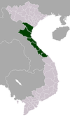 | |
| Nghệ An province | ||
| Hà Tĩnh province | ||
| Quảng Bình province |
| |
| Quảng Trị province |
| |
| Thừa Thiên Huế province |
| |
※ denotes provincial seat. | ||
This article about a location in Quảng Trị Province, Vietnam is a stub. You can help Wikipedia by expanding it. |
На других языках
- [en] Cồn Cỏ district
[ru] Конко (Вьетнам)
Конко (вьетн. Cồn Cỏ) — небольшой остров в Восточном море, относящийся к провинции Куангчи в центральном Вьетнаме. Площадь острова раньше составляла около 4 км², сейчас около 2,2 км². В административном отношении остров Конко одновременно является островным уездом Конко провинции Куангчи.Другой контент может иметь иную лицензию. Перед использованием материалов сайта WikiSort.org внимательно изучите правила лицензирования конкретных элементов наполнения сайта.
WikiSort.org - проект по пересортировке и дополнению контента Википедии