geo.wikisort.org - Island
Cuvier Island is a small uninhabited[1] island off the east coast of the North Island of New Zealand. It lies on the seaward end of the Colville Channel, 15 km (9.3 mi) north of the Mercury Islands and approximately 23 km (14 mi) south-east of Great Barrier Island. The 195 ha (480 acres)[2] island is a wildlife sanctuary, managed by the Department of Conservation and is the subject of an ongoing island restoration project to eliminate non-native mammals and restore the original ecosystem.[3] It is also the location of the Cuvier Island Lighthouse which was constructed in 1889 and the wreck of the old HMNZS Philomel which was scuttled near the island on 6 August 1949 after decommissioning and being stripped of useful equipment.
Repanga (Māori) | |
|---|---|
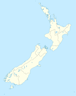 Cuvier Island Location of Cuvier Island. | |
| Geography | |
| Coordinates | 36°26′S 175°46′E |
| Area | 1.95 km2 (0.75 sq mi) |
| Highest elevation | 214 m (702 ft) |
| Administration | |
New Zealand | |
Geology
The island is the remains of an igneous intrusion of the Coromandel Volcanic Zone, which formed during the Miocene between 17 and 16 million years ago.[4]
Important Bird Area
The island has been identified as an Important Bird Area by BirdLife International because of its small breeding colony of vulnerable Pycroft's petrels.[5]
Name
The Māori name of the island is Repanga. The name Cuvier was given by D'Urville, naming it after Baron Cuvier.[6]
See also
- New Zealand outlying islands
- List of islands of New Zealand
- List of islands
- Desert island
References
- "Population by meshblock (2013 Census)". Stats NZ. 11 Dec 2015. Retrieved 2018-05-30.
- "Data Table - Protected Areas - LINZ Data Service (recorded area 194.0834 ha, excl. 60m radius around lighthouse)". Land Information New Zealand. Retrieved 2019-09-03.
- At one time in the 1920s the wife of the Lighthouse Keeper was the nominated Protector of Tuatara Lizards which were found in numbers at the rear of the house.Cuvier Island restoration Archived 2007-09-30 at the Wayback Machine (from the Department of Conservation website)
- Hayward, Bruce W. (2017). Out of the Ocean, Into the Fire. Geoscience Society of New Zealand. pp. 134–147. ISBN 978-0-473-39596-4.
- BirdLife International. (2012). Important Bird Areas factsheet: Cuvier Island (Repanga). Downloaded from "BirdLife International - conserving the world's birds". Archived from the original on 2007-07-10. Retrieved 2012-12-14. on 2012-02-02.
- New Zealand Lighthouses - Cuvier Archived 2002-03-17 at the Wayback Machine - named by D'Urville
External links
На других языках
[de] Cuvier Island
Cuvier Island (Māori: Repanga)[1] ist eine Insel vor der Ostküste der Nordinsel Neuseelands. Sie liegt am zum Meer führenden Ende des Colville Channel, 15 km nördlich der Mercury Islands und etwa 23 km südöstlich von Great Barrier Island. Die Insel ist ein Schutzgebiet, das vom Department of Conservation verwaltet wird und Teil eines Projekts zur Eliminierung nichtheimischer Säuger und der Wiederherstellung des ursprünglichen Ökosystems auf neuseeländischen Inseln ist.[2] Besonders der Tieke wurde hier erfolgreich wieder angesiedelt. Die Insel ist nach dem französischen Naturforscher Georges Cuvier benannt.[1]- [en] Cuvier Island
[fr] Île Cuvier
L'île Cuvier (en anglais : Cuvier Island) est une petite île de la côte est de l'Île du Nord de la Nouvelle-Zélande située à l'embouchure orientale du détroit de Colville à 15 km au nord des îles Mercure et à 23 km environ au sud-est de l'île de la Grande Barrière.Другой контент может иметь иную лицензию. Перед использованием материалов сайта WikiSort.org внимательно изучите правила лицензирования конкретных элементов наполнения сайта.
WikiSort.org - проект по пересортировке и дополнению контента Википедии