geo.wikisort.org - Island
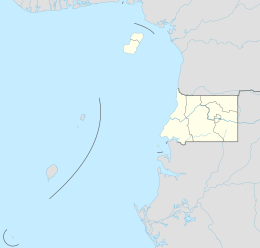
Corisco, Mandj, or Mandyi,[1] is a small island of Equatorial Guinea, located 29 km (18 mi) southwest of the Río Muni estuary that defines the border with Gabon. Corisco, whose name derives from the Portuguese word for lightning, has an area of 14 km2 (5 sq mi), and its highest point is 35 m (115 ft) above sea level. The most important settlement on the island is Gobe.
 | |
 Corisco Island and Elobey Islands | |
 Corisco | |
| Geography | |
|---|---|
| Coordinates | 0°54′54″N 9°19′12″E |
| Area | 14 km2 (5.4 sq mi) |
| Length | 6 km (3.7 mi) |
| Width | 5 km (3.1 mi) |
| Highest point | 35 m |
| Administration | |
Equatorial Guinea | |
| Litoral | |
| Insular Region | |
| Additional information | |
| Time zone |
|
History
During the Iron Age (50 BC - 1400 AD) and before the arrival of the Portuguese, the island was densely settled. The most important evidence of human occupation comes from the area of Nandá, near the eastern coast, where dozens of prehistoric burials have been excavated.[2] These burials belong to two different periods: Early Iron Age (50 BC - 450 AD) and Middle Iron Age (1000-1150 AD). During the first period, the islanders deposited bundles of human bones and iron implements (axes, bracelets, spears, spoons, iron currency) in shallow pits dug in the sand. During the second period, tombs have been documented where the corpses (not preserved) lay surrounded by pots, probably containing food and alcoholic beverages. The deceased were interred with their adornments (collars, bracelets and anklets) and a few personal possessions (knives and adzes).
When Portuguese sailors arrived in the Mino Estuary in 1471, they noted that the islands in the area were mainly unpopulated. They named Corisco after 'lightning', due to the gales they experienced around the island.[3] After more than three centuries of abandonment, when it was sporadically visited by European sailors, Corisco was settled by the Benga people.[3] They arrived during the second half of the 18th century attracted by the prospects of trade with the Europeans. The island was later acquired by Spain in 1843, as a result of an arrangement made by Juan José Lerena y Barry with Benga king Bonkoro I. Bonkoro I died in 1846 and was succeeded by his son Bonkoro II, but due to rivalries on the island, Bonkoro II moved to São Tomé, and Munga I ruled in Corisco 1848 to 1858, his son Munga II taking over, and meeting the explorer Manuel Iradier in the 1870s.
In general, the Spanish paid little attention to Corisco. In the early part of the 20th century it was part of the administration of Elobey, Annobon, and Corisco, and postage stamps were issued under that name. It became an integral part of Equatorial Guinea upon independence.
Corisco and the surrounding waters of Corisco Bay have become of interest in recent years for their oil prospects. A consortium of Elf Aquitaine and Petrogab began prospecting in 1981. The area is disputed with Gabon because of the perceived value of the oil. In February 2003, Gabonese Defence Minister Ali-Ben Bongo Ondimba visited the islands and re-stated Gabon's claim to them.[4]
See also
References
- "ISLA DE CORISCO | Marine World Database". web.archive.org. 2015-05-11. Archived from the original on 2015-05-11. Retrieved 2022-08-01.
{{cite web}}: CS1 maint: bot: original URL status unknown (link) - Digital.CSIC: Arqueología en el Estuario del Muni (Guinea Ecuatorial)
- Mark P. Leone; Jocelyn E. Knauf (27 May 2015). Historical Archaeologies of Capitalism. Springer. p. 430. ISBN 978-3-319-12760-6.
- "GABON-EQUATORIAL GUINEA: UN mediates dispute over Corisco Bay islands", IRIN, January 23, 2004.
Further reading
- X. Ayán Vila et al., Arqueología en el Estuario del Muni (Guinea Ecuatorial). Revista de Arqueología, 362: 24–33.
- Manuel Iradier Bulfi (1878). Fragmentos de un diario de viajes de exploración en la zona de Corisco. Fortanet. Retrieved 25 August 2012.
- Mary Henrietta Kingsley; Albert Carl Ludwig Gotthilf Günther; William Forsell Kirby (1897). Travels in West Africa: Congo Francais, Corisco and Cameroons. Macmillan. Retrieved 25 August 2012.
- Max Liniger-Goumaz, Small is not always beautiful: The Story of Equatorial Guinea (1989, ISBN 0-389-20861-2) p. 7.
- José Muñoz y Gaviria (1870). Crónica de las Islas de Fernando Póo, Corisco y Annobon. Rubio. Retrieved 25 August 2012.
- Francisco Salvadó y Cos (1891). Colección de apuntes preliminares sobre la lengua benga: ó sea, Intrucción a una gramática de este idióma que se habla en la isla de Corisco, pueblos de su bahía é islas adyacentes. Impr. de A. Pérez Cubrull. Retrieved 25 August 2012.
Authority control | |
|---|---|
| General |
|
| National libraries | |
На других языках
[de] Corisco
Corisco ist eine afrikanische Insel, Teil von Äquatorialguinea. Sie liegt 24 Kilometer vom Festland entfernt in der Bucht von Corisco. Sie hat eine Fläche von 14 Quadratkilometern, ihr höchster Punkt liegt 35 Meter über dem Meer. Der Name Corisco stammt von dem portugiesischen Wort für „Blitz“.- [en] Corisco
[es] Isla Corisco (Guinea Ecuatorial)
Corisco[1] o Mandyi[2] es una pequeña isla que hace parte de Guinea Ecuatorial[1][3] y está localizada a 29 km al sudoeste del estuario del río Muni que define su frontera con Gabón. Esta área insular es un municipio (que incluye las otras islas, Elobey Grande y Elobey Chico) perteneciente a la provincia del Litoral. El nombre Corisco deriva de una palabra portuguesa que significa «relámpago». Tiene un área de 15 km² y su punto más alto está a 35 metros sobre el nivel del mar. Sus coordenadas geográficas son: latitud 0°55'N, longitud 9°20'E. La población más importante de la isla es Gobe.[fr] Corisco
Corisco (également appelé Mandji Benga) est une île de la Guinée équatoriale, située à 29 km au sud-ouest de l'estuaire du Rio Muni qui marque la frontière avec le Gabon. Corisco, dont le nom dérive du mot portugais pour la foudre, a une superficie de 14 km², son point le plus élevé culminant à 35 mètres au-dessus de la mer.[it] Corisco (isola)
Corisco, o Mandj, è una piccola isola della Guinea Equatoriale, di appena 14 km², che si trova 29 km a sudovest dell'estuario del fiume Muni che segna il confine con il Gabon.[ru] Кориско
Кориско (бывш. Мандьи[1] исп. Corisco) — остров в Гвинейском заливе Атлантического океана, принадлежит Экваториальной Гвинее. Располагается в 29 км на юго-запад от Мбини (континентальной части страны). Площадь 14 км², высота до 35 м.Другой контент может иметь иную лицензию. Перед использованием материалов сайта WikiSort.org внимательно изучите правила лицензирования конкретных элементов наполнения сайта.
WikiSort.org - проект по пересортировке и дополнению контента Википедии