geo.wikisort.org - Island
Arrowsmith Island (Bulgarian: остров Ароусмит, romanized: otrov Arousmit, IPA: [ˈɔstrof ˈarousmit]) is a mostly ice-covered island in the Pitt group of Biscoe Islands, Antarctica. It is 2.53 km long in west-southwest to east-northeast direction and 900 m wide.
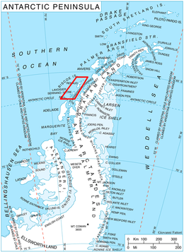 Location of Biscoe Islands in the Antarctic Peninsula region | |
 Arrowsmith Island Location in Antarctica  Arrowsmith Island Arrowsmith Island (Antarctic Peninsula) | |
| Geography | |
|---|---|
| Location | Antarctica |
| Coordinates | 65°30′28″S 65°32′09″W |
| Archipelago | Biscoe Islands |
| Administration | |
| Administered under the Antarctic Treaty System | |
| Demographics | |
| Population | Uninhabited |
The island is named after the British cartographer Aaron Arrowsmith (1750-1823) who published a map of the south polar region in 1794.
Location
Arrowsmith Island is located at 65°30′28″S 65°32′09″W, 1.43 km southeast of Pickwick Island, 500 m south of Tupman Island and 900 m northwest of Fizkin Island. British mapping in 1971.
Maps
- British Antarctic Territory: Graham Coast. Scale 1:200000 topographic map. DOS 610 Series, Sheet W 65 64. Directorate of Overseas Surveys, UK, 1971.
- Antarctic Digital Database (ADD). Scale 1:250000 topographic map of Antarctica. Scientific Committee on Antarctic Research (SCAR). Since 1993, regularly upgraded and updated.
References
- Bulgarian Antarctic Gazetteer. Antarctic Place-names Commission. (details in Bulgarian, basic data in English)
- Arrowsmith Island. SCAR Composite Antarctic Gazetteer.
External links
- Arrowsmith Island. Copernix satellite image
This article includes information from the Antarctic Place-names Commission of Bulgaria which is used with permission.
 | This Biscoe Islands location article is a stub. You can help Wikipedia by expanding it. |
На других языках
[de] Arrowsmith Island
Arrowsmith Island (englisch; bulgarisch остров Ароусмит .mw-parser-output .Latn{font-family:"Akzidenz Grotesk","Arial","Avant Garde Gothic","Calibri","Futura","Geneva","Gill Sans","Helvetica","Lucida Grande","Lucida Sans Unicode","Lucida Grande","Stone Sans","Tahoma","Trebuchet","Univers","Verdana"}ostrow Arousmit) ist eine in westsüdwest-ostnordöstlicher Ausrichtung 2,53 km lange und 0,9 km breite Insel vor der Westküste der Antarktischen Halbinsel. Als eine der Pitt-Inseln im Archipel der Biscoe-Inseln liegt sie 1,43 km südöstlich von Pickwick Island, 0,5 km südlich von Tupman Island und 0,9 km nordwestlich von Fizkin Island.- [en] Arrowsmith Island
Другой контент может иметь иную лицензию. Перед использованием материалов сайта WikiSort.org внимательно изучите правила лицензирования конкретных элементов наполнения сайта.
WikiSort.org - проект по пересортировке и дополнению контента Википедии