geo.wikisort.org - Island
Pickwick Island is the largest of the Pitt Islands, in the Biscoe Islands, Antarctica. It is 9.45 km long in southwest–northeast direction, separated from Renaud Island on the southwest by Mraka Sound, and has its northeast coast indented by Misionis Bay.
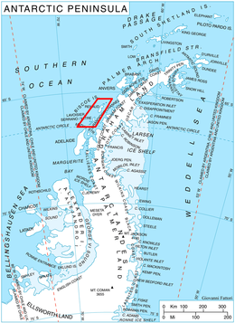 Location of Biscoe Islands in the Antarctic Peninsula region | |
 Pickwick Island Location in Antarctica | |
| Geography | |
|---|---|
| Location | Antarctica |
| Coordinates | 65°29′S 65°38′W |
| Administration | |
| Administered under the Antarctic Treaty System | |
| Demographics | |
| Population | Uninhabited |
The island was very roughly charted by the British Graham Land Expedition (BGLE) under Rymill, 1934–37. More accurately shown on an Argentine government chart of 1957. Named by the United Kingdom Antarctic Place-Names Committee (UK-APC) in 1959 after Samuel Pickwick, founder of the Pickwick Club in Charles Dickens' Pickwick Papers.[1]
See also
- List of Antarctic and sub-Antarctic islands
Maps
- British Antarctic Territory: Graham Coast. Scale 1:200000 topographic map. DOS 610 Series, Sheet W 65 64. Directorate of Overseas Surveys, UK, 1971.
- Antarctic Digital Database (ADD). Scale 1:250000 topographic map of Antarctica. Scientific Committee on Antarctic Research (SCAR). Since 1993, regularly upgraded and updated.
References
- Pickwick Island. SCAR Composite Antarctic Gazetteer.
![]() This article incorporates public domain material from the United States Geological Survey document: "Pickwick Island". (content from the Geographic Names Information System)
This article incorporates public domain material from the United States Geological Survey document: "Pickwick Island". (content from the Geographic Names Information System)
 | This Biscoe Islands location article is a stub. You can help Wikipedia by expanding it. |
На других языках
[de] Pickwick Island
Pickwick Island (in Argentinien Isla Maveroff) ist eine Insel vor der Westküste der Antarktischen Halbinsel. Sie ist die größte der Pitt-Inseln im Archipel der Biscoe-Inseln.- [en] Pickwick Island
[fr] Île Pickwick
L'île Pickwick est une île de l'Antarctique, une des îles Biscoe.Другой контент может иметь иную лицензию. Перед использованием материалов сайта WikiSort.org внимательно изучите правила лицензирования конкретных элементов наполнения сайта.
WikiSort.org - проект по пересортировке и дополнению контента Википедии