geo.wikisort.org - Island
The Archipelago of Lake Saint Pierre[1] counts 103 islands in the western part of Lake Saint Pierre, in Quebec, in Canada. There are two groups: Islands of Berthier to the north and the islands of Sorel to the south.
Native name: Archipel du Lac Saint-Pierre | |
|---|---|
 Satellite view of the Archipelago | |
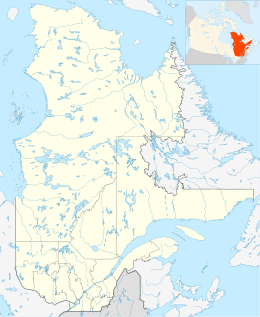 Archipelago of Lake Saint Pierre | |
| Geography | |
| Location | Saint Lawrence River, Lake Saint Pierre |
| Coordinates | 46°05′57″N 73°04′01″W |
| Administration | |
| Province | |
| Demographics | |
| Population | 2600 (2001) |
The shores of this archipelago has twenty-two coastal villages. Around 2600 people were living on those islands in 2011.[2] Islands Dupas and Saint-Ignace-de-Loyola are partially urbanized. The majority of the other islands are used for agriculture and grazing farm animals.
A network of small roads, often unpaved crosses the riparian environment of the islands. The islands of Saint-Ignace-de-Loyola, Dupas and Castors (Beavers) are connected to the north side of St. Lawrence River by a small network of bridges. The connection between the two sides of St. Lawrence River) is provided by a ferry service between Sorel and Saint-Ignace Island (the largest island of the archipelago). Most of the other islands are accessible only by boat. The south side of the river, the "Île des Embarras" (Embarrassment Island) is the smallest of the inhabited islands.
Geology
The Archipelago of Lake Saint Pierre is a delta from the last glaciation and modified by the alluvium of St. Lawrence River.[3] Following the withdrawal of the ice cap, the Sorel Islands region was invaded by the Champlain Sea which is then withdrawn gradually, about 12000 years ago. Clayey marine sediments were deposited at the bottom of the water.[4]
The visible part of the islands of the Archipelago is formed of recent alluvium. These deposits with a maximum height of 7 to 8 metres (23 to 26 feet) above the river level consist mainly of silt deposited by the Champlain Sea at the back that forced marine waters this time to integrate the current riverbed. Today, the same phenomenon is repeated annually during spring flooding[5] while the waters of the river cover a portion of the Sorel Islands and will leave a layer alluvium. Although they can cause problems and damage to the island for a few weeks to travel, the spring floods are beneficial to agriculture.[6]
Topography
The St. Lawrence River widens the entrance of Lake Saint Pierre which forms a delta archipelago of hundreds of islands and islets. Several channels crisscross between these islands. This region is characterized by a very few marked relief. The slope is 3 to 5 metres (9.8 to 16.4 feet) above sea level Most of the islands are widely flooded every spring.
Climate
This region plays a northern continental climate, slightly cooler[7] than area Montreal but much more sunny.[8] Frost-free period is long, which favors cereal crop production. In winter there is not too severe with rainfall[9] and bit excessive cold.[10]
Hydrography

The area of the Archipelago has 14 tributaries draining an area of 46,075 square kilometres (17,790 square miles), for a monthly average flow of 777 cubic metres (27,400 cubic feet) per second. The disproportion between the contribution of banks is impressive; the report is favourable to ten against one for the south shore to the Archipelago. The shore south of the Archipelago with only 4 rivers has a pool of 42,250 square kilometres (16,310 square miles) for a flow 712 cubic metres (25,100 cubic feet) per second while the bank on the north side of Archipelago with ten rivers covers only 3,825 square kilometres (1,477 square miles) and flows that 65.2 cubic metres (2,300 cubic feet) per second.[11]
Wildlife
Islands and Lake Saint Pierre is the most important migratory stopover in eastern Canada for waterfowl. The ecological value of these wetlands has been recognized by the UNESCO in 2000.
Human history on islands
These are the first Native Americans who inhabited and frequented the Archipelago are deriving their livelihood from the fauna of the islands. Jacques Cartier mentions in his travel in September 1535[12] · .[13] On 29 June 1603, it was the turn of Samuel de Champlain to observe Amerindian.[14] Then in August 1642, is the foundation of a wooden fort. This in order to repel the attacks of Iroquois on Trois-Rivières. The fort was burned by the Iroquois in 1647. It was not until 1665 that a new fort was rebuilt by the company of Captain Pierre de Saurel from Carignan.

A few years later, in 1672, demobilized soldiers are the first settlers in the Archipelago.[15] The exploitation of communal grazing on the islands finds its origin here. Agriculture fits this Archipelago of floodplains and in 1710 the population of the manor is 112 people. The population is concentrated in the Beaver Islands, Dupas, Saint-Ignace and Isle Madame at the north of the Archipelago.
In the late 1920s, several dams stones were built upstream channels to raise the water level in the shipping channel that runs south of the Archipelago.[16]
Many summer cottages on pillories were erected along the "chenal aux corbeaux" (Ravens channel), between the Crows and Lapierre Islands. This is the corner of the country Le Survenant (roman) (French novel) described in the two novels written by Germaine Guèvremont The Outlander (written in 1945) and Marie-Didace (written in 1947).[17] The characters in these two novels are associated with the Sorel Islands.[18] Germaine Guèvremont lived for nearly 30 years on the Îlette Pé[19] (near the "Chenal du moyne" - Channel of the monk) and her house became for some years the Museum of Scripture.[20]
Partial list of 103 islands

Here is a partial list of islands (50/103) (listed as French toponyms):.[21][22][23]
- île aux Foins
- île du Mitan
- île du Sablé
- île aux Cochons
- île aux Castors
- île Dupas
- île Saint-Amour
- île Saint-Ignace
- île Ronde
- île Madame
- île aux Ours
- île de Grâce[24]
- île aux Corbeaux
- île à la Pierre
- île des Barques
- île du Moine
- île Bibeau
- île Létourneau
- îles aux Fantômes
- île Lacroix
- île d'Embarras
- île Saint-Jean
- île Saint-Pierre
- île à la Perche
- île au Citron
- île Millette
- île de Rouche
- îles aux Raisins
- Islets Percés
- île aux Vaches
- île du Curé
- île des Plantes
- île Ducharme
- île à l'Orme
- île aux Noyers
- île Lamarche
- île à la Cavale
- île du Nord
- île du Milieu
- la Grande Île
- îles aux Sables
- île Plate
- île à Letendre
- île de la Traverse
- île Péloquin
- île Cardin
- îles de la Girodeau
- Le Nid d'Aigle
- île à la Grenouille[25]
- îles aux Grues
See also
See also
- Lake Saint Pierre
- Saint Lawrence Seaway
- Saint Lawrence River
- List of longest rivers of Canada
- List of Quebec rivers
- List of crossings of the Saint Lawrence River
- Biosphere reserve of Lac-Saint-Pierre
- Biophare Museum
- Champlain Sea
- Saint Lawrence Lowlands
References
- Official name since 1985 - Commission de toponymie du Québec (Geographical Names Board of Québec)
- Lorraine Guay, Quebec islands, collection: the Regions of Quebec, Brief History, Laval University Press, 2011
- It is a channel flowing into a plain of sand and clay.
- This Mateau clay reached in 2011 several water depths; so it is about 167 metres (548 feet) deep to Berthierville
- These spring floods have led islanders to build buildings and houses on stilts. Even today, gathering maple sap during sugaring is done by boat to the islands.
- The alluvial deposits left after the removal of spring flooding is an important contribution of beneficial organic matter to grain production Islands.
- The average annual rainfall is 100 centimeters of water. Source Environment Canada.
- Over 2100 hours of sunshine per year. Which is significantly higher than the Montreal region (1900-2000 hours) and the region of Quebec (city) (1 600 to 1 700 hours). Source: Environment Canada.
- The average height of snow cover reaches 50–55 centimetres (20–22 inches). Source: Environment Canada
- recorded on the islands mean temperature is about 2.5 degrees Celsius from 12.5 degrees in January to 20.1 degrees in July for average daily temperatures. Source: Environment Canada
- Source: Hydrographic Service Canada
- Rodolphe De Koninck, The hundred-Iles of Lac St-Pierre, presses the Université Laval, 1970, page 12
- Jacques Cartier: Brief narrative navigation faicte es ysles Canada
- Rodolphe De Koninck, op cit. page 14
- Intendant Jean Talon rewarded 25 officers of the Carignan granting them fiefs which settled on soldiers demobilized as census. Thus was born the stronghold of Dorvillier granted Oct. 29, 1672.
- Lorraine Guay, Quebec islands, Collection: Regions of Quebec, History in Brief, laval University Press 2011
- Germaine Guèvremont, the Outlander (final version of April 1968 following the reorganization of the text published in 1945), Collection Bibliothèque Québécoise (Library Quebec Collection), Éditions Fides, 1982
- Denise Pérusse, Pays littéraire du Québec (literary Quebec Country): guide of writers places. Montreal, L'Hexagone / VLB editor. 1998
- Îlette-au-Pé, Cottage of Germaine Guèvremont, 21, Chemin de l'Île-aux-Ghosts, Sainte-Anne-de-Sorel, "HistoricPlaces.ca - HistoricPlaces.ca". Archived from the original on 2014-05-26. Retrieved 2014-05-25.
- Opened in 1986 by two enthusiasts, François Gélinas and Jeanne Ethier, in the house which inhabited Germaine Guèvremont to "Ilette to Pé", the small museum lived until 1996. In 1998, the site was for sale. The private sector is again since its acquisition. For cons, the house and its surroundings were made a heritage site in 1996 by the MRC Le Bas-Richelieu under Article 84 of the Law on Cultural Property. Source; Commission of Cultural Property in Quebec, Storing places of literary creation in Québec, 2009
- "Mini Tourist Guide Sorel-Sorel Islands Map". Retrieved August 6, 2011.
- "Carte". www.survoldulacsaintpierre.com.
- "Lac Saint-Pierre et son archipel - Carte plein air du Québec". pleinairalacarte.com.
- "Fiche descriptive". www.toponymie.gouv.qc.ca.
- "Fiche descriptive". www.toponymie.gouv.qc.ca.
External links
На других языках
- [en] Archipelago of Saint-Pierre Lake
[fr] Archipel du Lac Saint-Pierre
L'archipel du Lac Saint-Pierre[1] est un archipel d'origine deltaïque situé dans le lac Saint-Pierre au Québec. On distingue deux groupes : les îles de Berthier au nord et les îles de Sorel au sud.Другой контент может иметь иную лицензию. Перед использованием материалов сайта WikiSort.org внимательно изучите правила лицензирования конкретных элементов наполнения сайта.
WikiSort.org - проект по пересортировке и дополнению контента Википедии