geo.wikisort.org - Island
Anda, officially the Municipality of Anda (Pangasinan: Baley na Anda; Ilocano: Ili ti Anda; Tagalog: Bayan ng Anda), is a 3rd class municipality in the province of Pangasinan, Philippines. According to the 2020 census, it has a population of 41,548 people. [3]
This article needs additional citations for verification. (November 2012) |
Anda | |
|---|---|
Municipality | |
| Municipality of Anda | |
 Anda Municipal Hall | |
 Flag  Seal | |
 Map of Pangasinan with Anda highlighted | |
OpenStreetMap  | |
 Anda Location within the Philippines | |
| Coordinates: 16°17′23″N 119°56′57″E | |
| Country | Philippines |
| Region | Ilocos Region |
| Province | Pangasinan |
| District | 1st district |
| Founded | 1852 |
| Named for | Simón de Anda y Salazar |
| Barangays | 21 (see Barangays) |
| Government | |
| • Type | Sangguniang Bayan |
| • Mayor | Joganie C. Rarang |
| • Vice Mayor | Artemio B. Carolino Jr. |
| • Representative | Arnold D. Celeste |
| • Municipal Council | Members |
| • Electorate | 26,502 voters (2019) |
| Area | |
| • Total | 74.55 km2 (28.78 sq mi) |
| Elevation | 5.0 m (16.4 ft) |
| Highest elevation | 132 m (433 ft) |
| Lowest elevation | 0 m (0 ft) |
| Population | |
| • Total | 41,548 |
| • Density | 560/km2 (1,400/sq mi) |
| • Households | 9,321 |
| Economy | |
| • Income class | 3rd municipal income class |
| • Poverty incidence | 12.40% (2018)[4] |
| • Revenue | ₱150,935,476.46 (2020) |
| • Assets | ₱461,314,801.93 (2020) |
| • Expenditure | ₱153,778,475.61 (2020) |
| • Liabilities | ₱50,237,472.19 (2020) |
| Service provider | |
| • Electricity | Pangasinan 1 Electric Cooperative (PANELCO 1) |
| Time zone | UTC+8 (PST) |
| ZIP code | 2405 |
| PSGC | |
| IDD : area code | +63 (0)75 |
| Native languages | Bolinao Pangasinan Ilocano Tagalog |
| Website | www |
The municipality consists primarily of Cabarruyan Island (also known as Anda Island), as well as minor surrounding islets. Because of Anda's proximity near the Hundred Islands, a popular tourist destination for its caves and beaches, it is the so-called "Mother of the Hundred Islands."
Anda is 77 kilometres (48 mi) from Lingayen and 283 kilometres (176 mi) from Manila.
History
On the north-west portion of Lingayen Gulf lies a group of islands which comprise the territory of Anda.
Before the middle of the nineteenth century, the islands which comprise the municipality were uninhabited. Only occasionally did seafarers and fishermen use the coast as havens.
Andres de la Cruz Cacho, fondly called in Bolinao as Andales Kulayo, discovered a vast tract of land suitable for grazing and fertile lowlands, and an abundant spring for agriculture. It was he who brought families from the town of Bolinao aboard a big boat and dispersed them on the island of Cabarruyan in 1842. The spread of population was rapid.
On May 10, 1842, the pioneers landed on what is now the barrio of Dolaoan, put up a settlement, and chose San Miguel Arcangel as their Patron Saint. On May 25, 1842, they established Carot and Cabungan with Santa Lucia as the common Saint of the two settlements.
In the first of June of same year, Tondol was founded. Sablig was settled in the middle of June. By the third week of June, Macaleeng was occupied.
No family was willing, to stay in Toritori at the time and so the place was bypassed. The settlers proceeded to Awile and Aruab (now Roxas) and by early July, they have established settlements in the area.
By August, Mal-Ong, Awag, Santa Rita, and San Nicolas were established. Within a period of only four months, May to August, 1842, the whole island of Cabarruyan was populated.
A steady stream of settlers followed the first pioneers and soon within a few years, the population was large enough to form a municipality.
In January, 1849 a conference of leaders was called by Don Pablo Cacho Valerio through his son Don Domingo with the end in view to established a new town. The leaders drafted a petition for the creation of a new town and sent copies on March 15, 1849, to Don Jose Sanchez y Guerrero, the then Alcalde at Iba, Zambales and to the Archbishop of Manila.
On May 26, 1849, the Alcalde brought the reply granting the petition. Accompanied by the Parish Priest, Rev. Fr. Juan Migrano, Capitan Felipe Cacho Valerio, and other municipal officials of Bolinao, the Alcalde came to Cabarruyan to choose a suitable location for the town site. They agreed on Segat in the center of the island which is now known as Namagbagan. The site for the plaza, church, town hall, convent, cemetery, and streets were laid out on January 20, 1850, by order of the Alcalde.
Anda was once a part of the municipality of Bolinao.
Geography
Barangays
Anda is politically subdivided into 18 barangays.[5] These barangays are headed by elected officials: Barangay Captain, Barangay Council, whose members are called Barangay Councilors. All are elected every three years.
- Awile
- Awag
- Batiarao
- Cabungan
- Carot
- Dolaoan
- Imbo
- Macaleeng
- Macando-candong
- Mal-ong
- Namagbagan
- Poblacion
- Roxas
- Sablig
- San Jose
- Siapar
- Tondol
- Tori-tori
Climate
| Climate data for Anda, Pangasinan | |||||||||||||
|---|---|---|---|---|---|---|---|---|---|---|---|---|---|
| Month | Jan | Feb | Mar | Apr | May | Jun | Jul | Aug | Sep | Oct | Nov | Dec | Year |
| Average high °C (°F) | 31 (88) |
31 (88) |
31 (88) |
33 (91) |
32 (90) |
32 (90) |
30 (86) |
30 (86) |
30 (86) |
31 (88) |
31 (88) |
31 (88) |
31 (88) |
| Average low °C (°F) | 21 (70) |
21 (70) |
22 (72) |
24 (75) |
24 (75) |
24 (75) |
23 (73) |
23 (73) |
23 (73) |
23 (73) |
23 (73) |
22 (72) |
23 (73) |
| Average precipitation mm (inches) | 5.1 (0.20) |
11.6 (0.46) |
21.1 (0.83) |
27.7 (1.09) |
232.9 (9.17) |
350.8 (13.81) |
679.8 (26.76) |
733.1 (28.86) |
505 (19.9) |
176.6 (6.95) |
67.2 (2.65) |
17.7 (0.70) |
2,828.6 (111.38) |
| Average rainy days | 3 | 3 | 3 | 4 | 14 | 18 | 23 | 25 | 22 | 15 | 8 | 4 | 142 |
| Source: World Weather Online[6] | |||||||||||||
Demographics
| Year | Pop. | ±% p.a. |
|---|---|---|
| 1903 | 3,916 | — |
| 1918 | 6,403 | +3.33% |
| 1939 | 8,989 | +1.63% |
| 1948 | 11,213 | +2.49% |
| 1960 | 14,580 | +2.21% |
| 1970 | 16,917 | +1.50% |
| 1975 | 19,262 | +2.64% |
| 1980 | 20,454 | +1.21% |
| 1990 | 26,856 | +2.76% |
| 1995 | 28,739 | +1.28% |
| 2000 | 32,833 | +2.90% |
| 2007 | 34,398 | +0.64% |
| 2010 | 37,011 | +2.70% |
| 2015 | 39,504 | +1.25% |
| 2020 | 41,548 | +1.00% |
| Source: Philippine Statistics Authority [7] [8] [9][10] | ||
Language
The people of Anda generally speak Pangasinan, Bolinao, and Ilocano.
Economy
The town thrives on farming and deep-sea fishing.
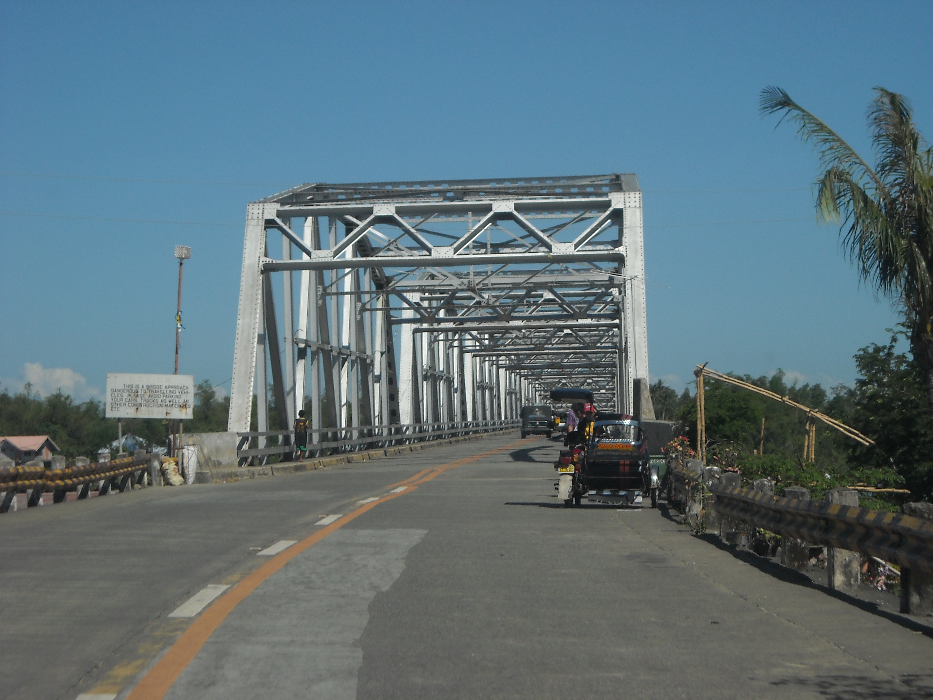
In the past, progress in the town was sluggish due to its dependence to a landing barge to cross the Catubig Channel separating Anda to mainland Bolinao. In 1996, trade has increased due to a bridge connecting the municipality to the mainland. This bridge, known as Anda Bridge, was sponsored and inaugurated by then President Fidel V. Ramos, who hails from Pangasinan. Main roads have been concreted for faster access to the barangays, especially tourism related places.
Government
Anda, belonging to the first congressional district of the province of Pangasinan, is governed by a mayor designated as its local chief executive and by a municipal council as its legislative body in accordance with the Local Government Code. The mayor, vice mayor, and the councilors are elected directly by the people through an election which is being held every three years.
Elected officials
| Position | Name |
|---|---|
| Congressman | Arnold F. Celeste |
| Mayor | Joganie C. Rarang |
| Vice-Mayor | Artemio B. Carolino Jr. |
| Councilors | Erwin C. Catabay |
| Lorenzo C. Cabalquinto | |
| Ester C. Carpo | |
| Lilybeth C. Kiongson | |
| Ruel B. Quilla | |
| Marvin Charles C. Caranay | |
| Christian C. Cacho | |
| Jocelle Z. Celeste | |
Transportation
The town is accessible through land transportation. Two main bus companies serve commuters to and from Anda to Manila or neighboring towns and cities. These are Dagupan Bus Co., Inc.and Pangasinan Five Star Bus Co. Mini buses and jeepneys are also available for commuters going to neighboring towns and cities, like Alaminos and Dagupan.
Fossil Finds
In the year 2000, fossils were found in barangay San Jose and barangay Awile. Fossils in barangay Awile were found only a few centimeters from the surface due to extensive erosion in the area. In San Jose, the fossils were discovered 3 meters from the ground surface. Most of the fossils were found in clay layer with limestone rubbles.
Among the faunal fossils discovered were from Stegodon sp., Elephas sp (large)., Elephas beyeri Von Koenigsvald (dwarf), Rhinoceros philippinensis, Cerpis sp. and Bovid sp.
See also
References
- Municipality of Anda | (DILG)
- "2015 Census of Population, Report No. 3 – Population, Land Area, and Population Density" (PDF). Philippine Statistics Authority. Quezon City, Philippines. August 2016. ISSN 0117-1453. Archived (PDF) from the original on May 25, 2021. Retrieved July 16, 2021.
- Census of Population (2020). "Region I (Ilocos Region)". Total Population by Province, City, Municipality and Barangay. PSA. Retrieved 8 July 2021.
- "PSA Releases the 2018 Municipal and City Level Poverty Estimates". Philippine Statistics Authority. 15 December 2021. Retrieved 22 January 2022.
- "Province: PANGASINAN". PSGC Interactive. Makati, Philippines: National Statistical Coordination Board. Archived from the original on 14 November 2012. Retrieved 26 November 2012.
- "Anda, Pangasinan: Average Temperatures and Rainfall". World Weather Online. Retrieved 23 September 2015.
- Census of Population (2015). "Region I (Ilocos Region)". Total Population by Province, City, Municipality and Barangay. PSA. Retrieved 20 June 2016.
- Census of Population and Housing (2010). "Region I (Ilocos Region)". Total Population by Province, City, Municipality and Barangay. NSO. Retrieved 29 June 2016.
- Censuses of Population (1903–2007). "Region I (Ilocos Region)". Table 1. Population Enumerated in Various Censuses by Province/Highly Urbanized City: 1903 to 2007. NSO.
- "Province of Pangasinan". Municipality Population Data. Local Water Utilities Administration Research Division. Retrieved 17 December 2016.
- "Poverty incidence (PI):". Philippine Statistics Authority. Retrieved 28 December 2020.
- https://psa.gov.ph/sites/default/files/NSCB_LocalPovertyPhilippines_0.pdf; publication date: 29 November 2005; publisher: Philippine Statistics Authority.
- https://psa.gov.ph/sites/default/files/2003%20SAE%20of%20poverty%20%28Full%20Report%29_1.pdf; publication date: 23 March 2009; publisher: Philippine Statistics Authority.
- https://psa.gov.ph/sites/default/files/2006%20and%202009%20City%20and%20Municipal%20Level%20Poverty%20Estimates_0_1.pdf; publication date: 3 August 2012; publisher: Philippine Statistics Authority.
- https://psa.gov.ph/sites/default/files/2012%20Municipal%20and%20City%20Level%20Poverty%20Estima7tes%20Publication%20%281%29.pdf; publication date: 31 May 2016; publisher: Philippine Statistics Authority.
- https://psa.gov.ph/sites/default/files/City%20and%20Municipal-level%20Small%20Area%20Poverty%20Estimates_%202009%2C%202012%20and%202015_0.xlsx; publication date: 10 July 2019; publisher: Philippine Statistics Authority.
- "PSA Releases the 2018 Municipal and City Level Poverty Estimates". Philippine Statistics Authority. 15 December 2021. Retrieved 22 January 2022.
- "2019 National and Local Elections" (PDF). Commission on Elections. Retrieved March 6, 2022.
{{cite web}}: CS1 maint: url-status (link)
External links
- Anda Profile at PhilAtlas.com
- Municipal Profile at the National Competitiveness Council of the Philippines
- Anda at the Pangasinan Government Website
- Anda Pangasinan
- Local Governance Performance Management System
- Philippine Standard Geographic Code
- Philippine Census Information
Places adjacent to Anda, Pangasinan | ||||||||||||||||
|---|---|---|---|---|---|---|---|---|---|---|---|---|---|---|---|---|
| ||||||||||||||||
Lingayen (capital) | |
| Municipalities |
|
| Component cities | |
| Independent component city |
|
| Barangays | See: List of barangays in Pangasinan |
На других языках
[de] Anda (Pangasinan)
Anda ist eine Inselgemeinde bestehend aus der Insel Cabarruyan und einigenen kleineren nahegelegenen Eilanden in der philippinischen Provinz Pangasinan, welche in der Nähe des Hundred Islands National Park liegt. Die Menschen von Anda sprechen hauptsächlich Bolinao. Derzeitiger Bürgermeister der Stadtgemeinde ist Nestor Pulido.- [en] Anda, Pangasinan
Другой контент может иметь иную лицензию. Перед использованием материалов сайта WikiSort.org внимательно изучите правила лицензирования конкретных элементов наполнения сайта.
WikiSort.org - проект по пересортировке и дополнению контента Википедии