geo.wikisort.org - Insel
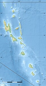
Pele (englisch Pele Island)[1] ist eine Insel in der Provinz Shefa des Inselstaats Vanuatu im Korallenmeer.
| Pele | ||
|---|---|---|
 | ||
| Gewässer | Korallenmeer | |
| Inselgruppe | Neue Hebriden | |
| Geographische Lage | 17° 29′ 36″ S, 168° 24′ 25″ O | |
|
| ||
| Länge | 3,6 km | |
| Breite | 1,6 km | |
| Fläche | 4 km² | |
| Höchste Erhebung | 198 m | |
| Einwohner | 423 (2015) 106 Einw./km² | |
| Hauptort | Worasifiu | |
Geographie
Die hügelige, dicht bewachsene Insel liegt im Osten der Undine Bay, etwa zwei Kilometer vor der Nordküste von Efate. Nordwestlich grenzt Pele direkt an Nguna.
Bevölkerung
2015 hatte Pele 423 Einwohner, die in 86 Haushalten lebten.[2]
Meeresschutzgebiet
Das Nguna Pele Marine Protected Area wurde 2003 gegründet, um die gefährdeten Korallenriffe im Gebiet der Inseln Nguna und Pele zu schützen und zu erhalten.[3]
Weblinks
Commons: Pele Island – Sammlung von Bildern, Videos und Audiodateien
Einzelnachweise
- Pele Island. In: geonames.org. Abgerufen am 24. Oktober 2021 (englisch).
- 2015 Vanuatu National Population and Households Projections by Province and islands. März 2015, abgerufen am 24. Oktober 2021 (englisch).
- Nguna Pele Marine Protected Area. Archiviert vom Original am 3. Juli 2007. Abgerufen am 24. Oktober 2021.
На других языках
- [de] Pele (Insel)
[en] Pele Island
Pélé Island, sometimes spelled Pele in English,[1][2] is a volcanic island located 11,2 miles north of the island of Éfaté in the Shefa Province of the Republic of Vanuatu.[3][4][5] It has a total area of 1.7 square miles,[6][7] Pélé is inhabited by about 200-220 Ni-Vanuatu villagers[8][9][10] residing in the four villages: Worsiviu, Worearu, Piliura, and Launamoa.[11][12] Pélé Island is a part of the MPA Nguna-Pele Marine Protected Area, which was established in 2003,[13][14] and is a popular Vanuatuan diving location.[15] The Nguna-Pele Marine Protected Area covers a total area of 11.5 sq. mi., including numerous reefs, sea grass beds, mangrove forests and intertidal lagoons.[16] The Nguna-Pele Marine Protection Agency is located in the village of Piliura, and mounts an exhibition and sells T-shirts. Income from tourism is distributed by the Village Tourism Committee and supports aims as village water supply projects.[17] The island can be visited daily by boat from the Paonangisu area by the town of Emua on Éfaté's north coast.[18][19] There are also yachts available both from Emua and Nguna for day and overnight charters to the island.[20] The island is nearly adjacent to the island of Nguna, with a small passage no deeper than 33 yards separating the two. It has a tropical climate and has a maximum elevation of 650 feet at its highest.[21] Much of the island is extremely steep and rocks prevent you from walking along the coastline around the island. White sandy beaches are found in Piliura, Worearu, Laonamoa, and Sake. Overpopulation has led to a steady migration from Pele villages to southern Nguna in recent times.[22][23][fr] Pélé (Vanuatu)
Pélé est une île du Vanuatu située au nord de l'île d'Efate qui fait partie de la province de Shefa[1]. Pélé est constitué de 4 villages : Worearu, Piliura, Worasiviu et Launomoa, Worearu et Piliura sont à l'ouest là où le soleil se couche et Launamoa et Worasiviu sont à l'est là où les vagues sont plus fortes [2].[ru] Пеле (остров)
Пеле (англ. Pele Island) — вулканический остров в архипелаге Новые Гебриды в Тихом океане. Принадлежит островному государству — Республике Вануату и входит в состав провинции Шефа.Текст в блоке "Читать" взят с сайта "Википедия" и доступен по лицензии Creative Commons Attribution-ShareAlike; в отдельных случаях могут действовать дополнительные условия.
Другой контент может иметь иную лицензию. Перед использованием материалов сайта WikiSort.org внимательно изучите правила лицензирования конкретных элементов наполнения сайта.
Другой контент может иметь иную лицензию. Перед использованием материалов сайта WikiSort.org внимательно изучите правила лицензирования конкретных элементов наполнения сайта.
2019-2025
WikiSort.org - проект по пересортировке и дополнению контента Википедии
WikiSort.org - проект по пересортировке и дополнению контента Википедии
