geo.wikisort.org - Insel
Ilhéu das Cabras ist eine kleine, zum westafrikanischen Staat São Tomé und Príncipe gehörende Insel im Golf von Guinea. Sie befindet sich 2,1 km ostnordöstlich des Ortes Micolo an der Nordostküste der Hauptinsel São Tomé, und drei Kilometer nördlich des Flughafens São Tomé. Sie ist nicht dauerhaft bewohnt und gehört zum Distrikt Lobata.
| Ilhéu das Cabras | ||
|---|---|---|
| Gewässer | Golf von Guinea | |
| Geographische Lage | 0° 24′ 30″ N, 6° 42′ 55″ O | |
| ||
| Länge | 940 m | |
| Breite | 240 m | |
| Höchste Erhebung | 90 m | |
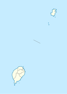
Die Insel ist vulkanischen Ursprungs (Schichtvulkan). Sie besteht aus zwei Hügeln, die beide eine Höhe von 90 Metern erreichen. Auf dem nordöstlichen Hügel steht ein fünf Meter hoher Leuchtturm.[1]
Einzelnachweise
Weblinks
- Ilhéu das Cabras auf travelingluck.com (portugiesisch)
На других языках
- [de] Ilhéu das Cabras
[en] Ilhéu das Cabras
Ilhéu das Cabras is an uninhabited island in the Gulf of Guinea. It is one of the smaller islands of São Tomé and Príncipe. The islet is located about 2 km off the northeast coast of the island of São Tomé, 8 km north of the city centre of São Tomé. The islet consists of two hills, about 90 metres high.[1] There is a lighthouse on the northeastern summit,[1] built in 1890; its focal height 97 metres[2] and its range is 12 nmi (22 km; 14 mi).[3] The islet was mentioned as "Mooro Caebres" in the 1665 map by Johannes Vingboons.[4][es] Ilhéu das Cabras
Ilhéu das Cabras o islote de las Cabras es un islote que pertenece al país de Santo Tomé y Príncipe, en el Golfo de Guinea. El islote se encuentra al norte de la costa de la isla de Santo Tomé, a 0º N 6º O. No hay población permanente.[fr] Ilhéu das Cabras
L'ilhéu das Cabras (en français : « l'îlot aux chèvres ») est l'une des plus petites îles de l'archipel qui constitue Sao Tomé-et-Principe, dans le golfe de Guinée. Il est situé au nord-est de l'île principale de São Tomé.[ru] Кабраш
Ка́браш (порт. Ilhéu das Cabras) — небольшой островок в Гвинейском заливе Атлантического океана. Находится чуть севернее побережья острова Сан-Томе. Входит в состав округа Лобата (государство Сан-Томе и Принсипи).Текст в блоке "Читать" взят с сайта "Википедия" и доступен по лицензии Creative Commons Attribution-ShareAlike; в отдельных случаях могут действовать дополнительные условия.
Другой контент может иметь иную лицензию. Перед использованием материалов сайта WikiSort.org внимательно изучите правила лицензирования конкретных элементов наполнения сайта.
Другой контент может иметь иную лицензию. Перед использованием материалов сайта WikiSort.org внимательно изучите правила лицензирования конкретных элементов наполнения сайта.
2019-2025
WikiSort.org - проект по пересортировке и дополнению контента Википедии
WikiSort.org - проект по пересортировке и дополнению контента Википедии