geo.wikisort.org - Insel
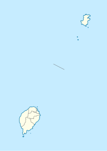
Ilheu Bom Bom ist eine Insel im Golf von Guinea. Sie liegt 70 Meter vor der Nordküste von Príncipe, einer der beiden Hauptinseln des Inselstaats São Tomé und Príncipe, verbunden durch einen Steg. Auf ihr befindet sich eines der wenigen Touristenresorts des Landes. Die Insel ist vulkanischen Ursprungs und hat keine permanenten Bewohner.
| Ilhéu Bom Bom | ||
|---|---|---|
 | ||
| Gewässer | Golf von Guinea | |
| Geographische Lage | 1° 41′ 55″ N, 7° 24′ 10″ O | |
| ||
| Länge | 750 m | |
| Breite | 220 m | |
| Fläche | 13 ha | |
| Höchste Erhebung | 59 m | |
Die Insel erreicht eine Höhe von 59 Metern.[1]
Einzelnachweise
На других языках
- [de] Ilhéu Bom Bom
[en] Ilhéu Bom Bom
Ilhéu Bom Bom is an island in the Gulf of Guinea. The islet is located near the north coast of the island of Príncipe, one of the main islands of São Tomé and Príncipe and is almost completely forested. Its population is 15 (2008 est.).[1] There is a tourist resort on the island. The island is connected to the mainland by a footbridge. There is a lighthouse on the island built in 1997.[2] Its focal height is 64 meters and its range is 12 nmi (22 km; 14 mi).[3][es] Ilhéu Bombom
Ilhéu Bom Bom o Ilhéu Bombom es un islote perteneciente al país de Santo Tomé y Príncipe, en el Golfo de Guinea. El islote se encuentra al norte de la costa de la isla de Príncipe, a 1º N 7º O. Incluye un par de centros turísticos. No hay población permanente.[fr] Ilhéu Bom Bom
L'ilhéu Bom Bom (en français : « îlot Bom Bom ») est l'une des plus petites îles de l'archipel qui constitue Sao Tomé-et-Principe, dans le golfe de Guinée. Il est situé au nord de l'île de Principe.[ru] Бомбом (остров)
Бомбом (порт. Bombom; в переводе — «хороший», «отличный») — небольшой остров, расположенный в Гвинейском заливе в 67 метрах к северу от острова Принсипи, с которым соединён деревянной эстакадой. Входит в состав округа Пагуи Демократической Республики Сан-Томе и Принсипи. Остров практически полностью (за исключением прибрежных зон) покрыт лесом.Текст в блоке "Читать" взят с сайта "Википедия" и доступен по лицензии Creative Commons Attribution-ShareAlike; в отдельных случаях могут действовать дополнительные условия.
Другой контент может иметь иную лицензию. Перед использованием материалов сайта WikiSort.org внимательно изучите правила лицензирования конкретных элементов наполнения сайта.
Другой контент может иметь иную лицензию. Перед использованием материалов сайта WikiSort.org внимательно изучите правила лицензирования конкретных элементов наполнения сайта.
2019-2026
WikiSort.org - проект по пересортировке и дополнению контента Википедии
WikiSort.org - проект по пересортировке и дополнению контента Википедии