geo.wikisort.org - Insel
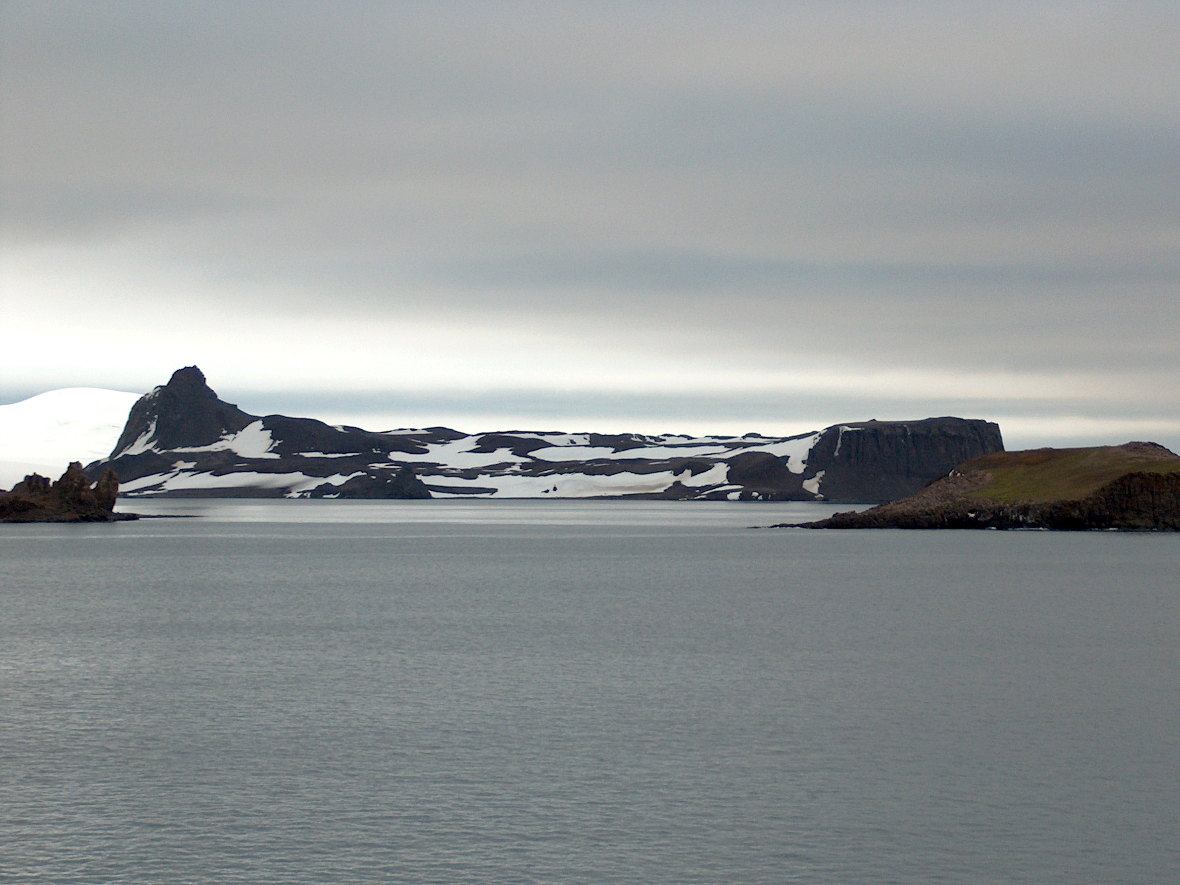
Dee Island ist eine Insel mit einem markanten scharfgratigen Gipfel am Südende, welche zum Archipel der Südlichen Shetlandinseln gehört. Sie liegt 4 km östlich von Ongley Island und unmittelbar vor der Nordküste von Greenwich Island.
| Dee Island | ||
|---|---|---|
 | ||
| Gewässer | Drakestraße | |
| Inselgruppe | Südliche Shetlandinseln | |
| Geographische Lage | 62° 25′ S, 59° 47′ W | |
| ||
| Einwohner | unbewohnt | |

Die Insel wurde 1935 von Wissenschaftlern der britischen Discovery Investigations kartiert.
Weblinks
- Dee Island im Geographic Names Information System des United States Geological Survey (englisch)
- Dee Island auf geographic.org (englisch)
На других языках
- [de] Dee Island
[en] Dee Island
Dee Island is the ice-free island lying between Greenwich Island and Aitcho Islands in the South Shetland Islands, Antarctica and is separated from Greenwich Island to the south by the 850 m (930 yd) wide Orión Passage (62°26′17″S 59°47′45″W) and from Aitcho Islands to the northeast by the 1.1 km (0.68 mi) wide Villalón Passage. Extending 1.9 by 1.37 km (1.18 by 0.85 mi), with the conspicuous Burro Peaks (62°25′38.2″S 59°46′45″W) in the southeast rising to 190 m (620 ft), and surface area 197 hectares (490 acres).[1] The small Montufar Island (62°25′36.6″S 59°45′24.9″W) and Araguez Island (62°25′57.8″S 59°47′15″W) are lying 650 m (710 yd) east of Dee Island and 200 m (220 yd) east of its southern tip Dragash Point respectively. The area was visited by 19th century sealers.Текст в блоке "Читать" взят с сайта "Википедия" и доступен по лицензии Creative Commons Attribution-ShareAlike; в отдельных случаях могут действовать дополнительные условия.
Другой контент может иметь иную лицензию. Перед использованием материалов сайта WikiSort.org внимательно изучите правила лицензирования конкретных элементов наполнения сайта.
Другой контент может иметь иную лицензию. Перед использованием материалов сайта WikiSort.org внимательно изучите правила лицензирования конкретных элементов наполнения сайта.
2019-2026
WikiSort.org - проект по пересортировке и дополнению контента Википедии
WikiSort.org - проект по пересортировке и дополнению контента Википедии