geo.wikisort.org - Insel
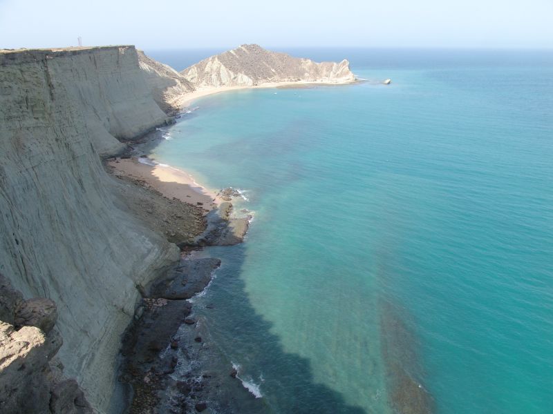
Astola, auch Jezira Haft Talar (Belutschi: زروان ءِ هفت تلار, Satadip oder Insel der sieben Hügel), ist eine kleine, unbewohnte pakistanische Insel im Arabischen Meer rund 25 Kilometer südlich der belutschischen Südküste und 39 Kilometer südöstlich der Stadt Pasni. Astola ist die größte Insel Pakistans. Sie ist 6,7 km lang, bis zu 2,3 km breit, und weist eine Fläche von 6,7 km² auf. Sie erreicht eine Höhe von 75 Metern.
| Astola | ||
|---|---|---|
 | ||
| Gewässer | Arabisches Meer | |
| Geographische Lage | 25° 7′ 21″ N, 63° 50′ 51″ O | |
| ||
| Länge | 6,7 km | |
| Breite | 2,3 km | |
| Fläche | 6,7 km² | |
| Höchste Erhebung | 75 m | |
| Einwohner | unbewohnt | |
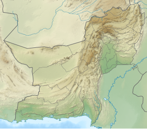
Verwaltungsmäßig gehört Astola zum Tehsil Pasni des Distrikts Gwadar der Provinz Belutschistan.
1982 wurde im Westen der Insel ein gasbetriebener grauer Eisenfachwerk-Leuchtturm errichtet. Dieser wurde 1987 durch einen in der Nähe errichteten solarbetriebenen Leuchtturm ersetzt. An dieser Stelle ist auch die mit 75 Metern höchste Erhebung der Insel.[1]
Im Juni 2017 wurde Astola zum ersten Meeresschutzgebiet Pakistans erklärt.[2]
Einzelnachweise
- Astola's Primeval Charm (2011)
- WCC-2016-Res-052-EN Declaration of Astola Island as a Marine Protected Area
Weblinks
На других языках
- [de] Astola (Insel)
[en] Astola Island
Astola Island, also known as Jezira Haft Talar (Balochi and Urdu: زروان ءِ هفت تلار) Satadip or 'Island of the Seven Hills', is a small uninhabited Pakistani island in the Arabian Sea approximately 25 km (16 mi) south of the nearest part of the coast and 39 km (24 mi) southeast of the fishing port of Pasni. Astola is Pakistan's largest offshore island at approximately 6.7 km (4.2 mi) long with a maximum width of 2.3 km (1.4 mi) and an area of approximately 6.7 km2 (2.6 sq mi). The highest point is 246 ft (75 m) above sea level. Administratively, the island is part of the Pasni subdistrict of Gwadar District in Balochistan province. The island can be accessed by motorized boats from Pasni, with a journey time of about 5 hours to reach the island.On August 4, 2020, Pakistan has released a new political map[5] that first time shows the Islands of Churna and Astola.[6][es] Isla Astola
La Isla Astola (también conocida como Jezira Haft Talar, en urdú: جزیرہ ہفت تلار o ‘siete colinas’ en baluchi: زروان ءِ هفت تلار) se halla situada en el mar Arábigo, a una distancia aproximada de 25 km de la costa de Baluchistán pakistaní y a unos cuarenta kilómetros al sudeste del puerto de Pasni, su punto más elevado tiene 246 pies y el área total es de aproximadamente 4 km². La isla tiene aproximadamente cuatro kilómetros de longitud y un kilómetro de ancho, en forma de meseta inclinada, con una serie de colinas y profundas grietas de varios pies de anchura. La parte sur de la isla asciende gradualmente hacia el norte, donde finaliza con un acantilado. Hay varias cavernas naturales por toda la isla.[ru] Астола (остров)
Остров Астола, также известный как «Джезира Хафт Талар» (урду جزیرہ ہفت تلار) или «Остров семи холмов» — маленький необитаемый остров в Пакистане, в Аравийском море, примерно в 25 км к югу от ближайшего побережья и 39 км на юго-восток от рыболовецкого города-порта Пасни. Остров принадлежит округу Гвадар города Пасни провинции Белуджистан. Добраться до острова можно на моторной лодке из порта Пасни, приблизительно за 5 часов.Другой контент может иметь иную лицензию. Перед использованием материалов сайта WikiSort.org внимательно изучите правила лицензирования конкретных элементов наполнения сайта.
WikiSort.org - проект по пересортировке и дополнению контента Википедии