geo.wikisort.org - Coast
Wells-next-the-Sea is a port town on the North Norfolk coast of Norfolk, England.
| Wells-next-the-Sea | |
|---|---|
 The quayside | |
 Wells-next-the-Sea Location within Norfolk | |
| Area | 16.31 km2 (6.30 sq mi) |
| Population | 2,165 (2011 Census) |
| • Density | 133/km2 (340/sq mi) |
| OS grid reference | TF 914 430 |
| District |
|
| Shire county |
|
| Region | |
| Country | England |
| Sovereign state | United Kingdom |
| Post town | WELLS-NEXT-THE-SEA |
| Postcode district | NR23 |
| Dialling code | 01328 |
| Police | Norfolk |
| Fire | Norfolk |
| Ambulance | East of England |
| UK Parliament | |
The civil parish has an area of 16.31 km2 (6.30 sq mi) and in 2001 had a population of 2,451,[1] reducing to 2,165 at the 2011 census.[2]
Wells is 15 miles (24 km) to the east of the resort of Hunstanton, 20 miles (32 km) to the west of Cromer, and 10 miles (16 km) north of Fakenham. The city of Norwich lies 32 miles (51 km) to the south-east. Nearby villages include Blakeney, Burnham Market, Burnham Thorpe, Holkham and Walsingham.[3]
Origin of name
The name is Guella in the Domesday Book of 1086 (half gallicised, half Latinised from Anglian Wella, a spring). This derives from spring wells of which Wells used to have many, rising through the chalk of the area. The town became Wells-next-the-Sea from juxta mare in the fourteenth century to distinguish it from other places of the same name. It appears as Wells Next The Sea (no hyphens) on the Ordnance Survey maps of 1838 and 1921. When the Wells and Fakenham Railway was opened on 1 December 1857, the terminus was given the name of Wells-on-Sea. In 1956 the Wells Urban District Council voted to (re-)adopt the name Wells-next-the-Sea, and this has been the official name since then.[4]
History
The town has been a seaport since before the fourteenth century, when it supplied grain to London and subsequently to the miners of the north east, in return for which Wells was supplied with coal. Until the nineteenth century, it was easier to carry bulk cargoes by sea than overland. It was a significant port in the sixteenth century, with 19 ships over 16 tons burden operating out of Wells in 1580, making it the major port in the area; the main trade was corn.[5] Wells was also from early days a manufactury of malt. At its height, the town boasted up to twelve maltings which, in 1750, contributed a third of the exports of malt from the country, mostly to Holland, more than any other port save Great Yarmouth.
Wells was also a fishing port; in 1337, it is recorded as having had thirteen fishing boats and nearby Holkham had nine. Its mariners brought first herring and then cod from Iceland in quantity between the fifteenth and seventeenth centuries. The regulation of the harbour in order to preserve its use was by Act of Parliament in 1663; in 1769, Harbour Commissioners were appointed with powers over vessels entering and leaving (as they still have today). The Quay was substantially rebuilt in 1845, as part of attempts to improve the town. At the same time, Improvement Commissioners were appointed with the task of making the town commodious and attractive to residents and the burgeoning tourist trade. As a small port, it built ships until the late nineteenth century; it never transferred to building motor vessels or to steel hulls. The coming of the railway in 1857 reduced the harbour trade, but it revived briefly after the Second World War for the import of fertilizer and animal feed. In 1982, there were 258 ship movements into the harbour.[6]
Wells relies on the tides to scour the harbour because the town does not have a river running through it. The problem of siltation had preoccupied the merchants of the town for hundreds of years and occupied the attentions of various engineers, leading eventually to disputes which came to court in the eighteenth century. Sir John Coode, who had been knighted for his work on the completion of Portland Harbour, was recruited to solve its siltation problems in the 1880s; no attempted solution proved permanent. The growth of faster marine traffic, whose wake washes at the banks of the marshes, has widened the channel and reduced tidal flow further.
The North Sea is now a mile from the town; the main channel which once wandered through marshes, grazed by sheep for hundreds of years, was confined by earthworks to the west in 1859 when Holkham Estate reclaimed some 800 hectares of saltmarsh north-west of Wells with the building of a mile-long bank.[7] This reclamation was claimed to have reduced the tidal scour though the West Fleet, which provided much of the water entered the channel to its north.
In the nineteenth century, malting assumed an industrial character dominated by merchants rather than hands-on maltsters. Eventually, the entire estate was acquired by F. & G. Smith who had maltings in Dereham and Great Ryburgh; they latterly bought out the competition becoming one of the biggest maltsters in the country. Following the First World War, demand began to fall and new methods of production were being used. After a local dispute, they closed the Wells operation down in 1929. Other agriculture-related enterprises, such as the local flour mill and the Ipswich-based Eastern Counties Farmers Cooperative, were, over the following years, bought out or closed. The post-war revival of the harbour trade made the Quay a busy place from the 1960s to the 1990s. Small coasters, mostly from across the English Channel,[8] brought in fertiliser and animal feed, latterly mostly soya beans until 1992 when changes in government regulations and the increasing size of vessels made the port uneconomic. Wind-farm support began in 2009, with the building of the Sheringham Shoal Offshore Wind Farm. The transfer of operations to Yarmouth, on the closure of the facility in Wells in 2021, repeated the long-term pattern of opportunity and reversal in the town.
Tourism, which had begun on a small scale a century before, became a major draw; it was based on the Pinewoods Caravan site much expanded post-war first by the Town Council and subsequently by Holkham Estates. As with many coastal towns, the number of second homes resultant on the tourist trade has increased dramatically over the last few years, reaching over 34% in 2019.[9]
Geography
The town has long thrived as a seaport and is now also a seaside resort with a popular beach that can be reached on foot or by car. (The narrow-gauge railway, built in 1976, that ran partway alongside the mile-long sea wall north of the harbour closed in 2021.) The beach is known for its long flat terrain, abstract sand dunes, varied beach huts and a naturist area situated to the west at Holkham. A land-locked brackish pool called Abraham's Bosom was for many years used for pleasure boating and canoeing; it is all that remains of the West Fleet which once drained the Holkham marshes. The beach is backed by dense pine woods which are part of the Holkham National Nature Reserve. The woods comprise Scots pine, Maritime pine and Corsican Pine growing on sand.[10]
More pinewoods exist to the east of the beach over the shipping channel at an area called the East Hills. This can be accessed on foot at low tide though all of the tidal sands in the area are extremely dangerous due to the speed and currents of the rising tide. It is not advisable to cross the channel without detailed local knowledge.
The majority of shops and other such businesses are now found on Staithe Street but up to the 1960s commercial premises were also to be found along High Street which continues south towards St Nicholas's Church. The church burned down after a lightning strike in 1879; the exterior shows the original stonework, but the interior, while light and airy, lacks stained glass, once found. The Victorian bench ends are worth a look. John Fryer, Captain Bligh's sailing master on HMS Bounty was born at Wells, and is buried in the churchyard. His gravestone is in the church porch.
The distinctive landmark of the seafront is the granary with its overhanging gantry on the quay, started in 1904 and finished in 1905. This has now been converted into flats, having ceased operating as a granary in 1990. The maritime tradition of the town meant it used to have a remarkable number of public houses for a town of its size although many of these have since closed. The northern end of the town used to be notable for parallel 'yards', narrow rows of cottages similar to the northern 'ginnels', which may derive from the rebuilding of the port in the eleventh century. (The original port is reputed to have been adjacent to the church.) Most of these remain though some have been lost to development and slum clearance. The North Sea flood of 1953 affected the northern edge of the town, breaching the beach bank and causing damage to houses on both east and west ends of the town. It also destroyed the Pinewoods caravan site. The pines themselves which had been planted in the nineteenth century to stabilise the dunes and which fringed Abraham's Bosom survived. Today there is a large moving floodgate next to the harbour car park and many of the houses have their own flood defences. It proved its worth in December 2013 when a flood exceeded both the 1953 and 1978 events, holding back the waters so that the west end of the town was unaffected.
A feature of the town is the area known as The Buttlands, a large green ringed by lime trees. Large elegant Georgian houses overlook The Buttlands, as do the Crown Hotel, Globe Inn and the Wells Catholic Church. If you exit The Buttlands down the hill at its south-west corner you can see Ware Hall, a medieval house which was rebuilt over a period of years from the 1970s by Miss May Savidge, who brought it in parts when she moved from Ware in Hertfordshire.[11]
Governance
There are three tiers of local government covering Wells-next-the-Sea, at parish (town), district, and county level: Wells-next-the-Sea Town Council, North Norfolk District Council, and Norfolk County Council. The town council has its offices at the Wells Community Hospital on Mill Road, on the western outskirts of the town.[12]
| Wells-next-the-Sea | |
|---|---|
| Improvement Commissioners District (1844–1894) Urban District (1894–1974) | |
| Population | |
| • 1891[13] | 2,555 |
| • 1971[14] | 2,245 |
| History | |
| • Created | 1844 (Improvement Commissioners District) 31 December 1894 (Urban District) |
| • Abolished | 31 March 1974 |
| • Succeeded by | North Norfolk |
| • HQ | Wells-next-the-Sea |
| Contained within | |
| • County Council | Norfolk |
Wells-next-the-Sea was an ancient parish within the hundred of North Greenhoe. Until 1844 the parish was governed by its vestry, in the same way as most rural parishes.[15] In 1844 an act of parliament established improvement commissioners to look after the secular aspects of local government in the town.[16]
Under the Local Government Act 1894 the improvement commissioners were replaced by an elected urban district council. Until 1954 the urban district council was based at the offices of the solicitor who acted as clerk to the council, at the corner of Chancery Lane and The Buttlands.[17][18][19] In 1954 the council bought the former Park Cinema at 62 Mill Road for £1,600 and converted it to become their offices and meeting place, holding their first meeting there in December 1954.[20][21]
The urban district council was abolished in 1974 under the Local Government Act 1972, with the area becoming part of North Norfolk. A successor parish was established to cover the former urban district, with its council adopting the name Wells-next-the-Sea Town Council.[22] The former council offices at 62 Mill Road were subsequently redeveloped for housing in the 1990s.[23]
Transport
Railways

The coming of the railway in 1857 notably reduced the town's population, as mentioned in the 1861 census. Formerly, the town was served by Wells-on-Sea railway station and was connected to the British Rail network by two lines. The line westwards towards King's Lynn was never reinstated after damage in the North Sea flood of 1953, while the line to Norwich via Fakenham, Dereham and Wymondham was a victim of the 'Beeching Axe' of the 1960s. The Wells and Walsingham Light Railway, a 10¼ inch-gauge railway (the longest of such a gauge in the world), now uses part of the track-bed and has its own separate Wells railway station.[24]

In addition to the two passenger railway routes in and out of the town, there was a tramway from the station to the quayside at Wells Harbour, whose rails are still visible today just beneath the modern road surface along East Quay. Locomotives were not allowed along the quay and wagons were hauled by horses. The line continued in a curve to the south-east to connect with the lines at Wells station and the track bed can be walked.
The Wells Harbour Railway[25] was a separate 10¼ inch-gauge railway that took passengers from the harbour behind the sea wall towards the beach and caravan site. It was in operation from 1976 to 2021, when the lines were taken up.
Buses
Wells was located on the high-profile 'Coasthopper' bus route between King's Lynn and Cromer. In April 2018, Stagecoach ceased operations in Norfolk. The Coasthopper service was split into two sections at Wells-next-the-Sea: the section from King's Lynn to Wells was rebranded as the Coastliner 36, extended inland from Wells to Fakenham and taken over by Lynx; the section from Wells to Cromer was rebranded as route 4 and taken over by Sanders Coaches.
Lifeboat
![Wells-next-the-Sea lifeboat station (this will be replaced, in 2022, by a brand new lifeboat station next to the old one)[citation needed]](http://upload.wikimedia.org/wikipedia/commons/d/d3/Wells-next-the-sea_lifeboat_statiion_cropped.jpg)
The current lifeboat station, housing both an all-weather lifeboat and an inshore rescue boat, is at the harbour entrance. The old lifeboat house, now used as the harbour offices, is at the western end of the quay. A new Shannon-class lifeboat is planned to replace the current boat in 2022 requiring a new much larger lifeboat station; the fate of the current station is uncertain.

In 1880, in the Wells lifeboat disaster, 11 of the 13 crew drowned, leaving 10 widows and 27 children without fathers. A memorial to the crew stands adjacent to the old lifeboat house.
Education
Various charity schools in the town included that set up by Christopher Ringer in 178? when he left £600 in his will for the education of thirty boys and thirty girls in the town. A number of academies were established in the nineteenth century; none of these survive. A National School was set up following the closure of the town workhouse. A British School was set up in 1938 which became a Board School in 1875.[26] A secondary school was built in 1929 when the original school became the primary school. The primary school closed in 1964 when the Alderman Peel secondary modern school was built in a different part of town adjacent to the old Heacham railway line. The old school buildings were used for some years as a field studies centre but have now been converted to social housing units.[citation needed] Wells schools are now part of the Wensum Trust which administers 24 schools in Norfolk.[27][28]
Beach
The Wells-next-the-Sea beach, being subject to the ever-changing tides of Holkham National Nature Reserve, makes use of an old war siren to warn patrons of incoming beach floodings. The siren sounds around 5–10 minutes before the tide is predicted to take over the beach to allow users to vacate the area safely.
Storms
Wells has been subject to flooding going back to the thirteenth century. In the twentieth century the notorious 1953 floods were followed by a surge almost as dangerous in 1978 for which the town was better prepared. On 5 December 2013, a storm surge occurred but did not affect the west end of the town because of a tidal barrier built in 1980. The Prime Minister, David Cameron, visited the town on 9 December 2013 to inspect the damage caused by flooding.[29]
Gallery
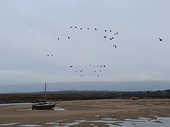 Beached boat at Wells-next-the-Sea
 Signpost in Wells-next-the-Sea
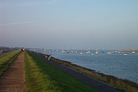 The Wells Harbour mouth from the sea wall; the lifeboat house can be seen in the distance
 Inland Wells, with view to Wells Harbour
 Looking out to the quay on a sunny August 2006 day
 The train from Wells arrives at Walsingham station
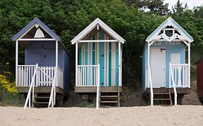 Huts on the beach
 Grey seal on the beach


References
- Office for National Statistics & Norfolk County Council (2001). Census population and household counts for unparished urban areas and all parishes Archived 11 February 2017 at the Wayback Machine. Retrieved 2 December 2005.
- "Town population 2011". Retrieved 1 September 2015.
- Ordnance Survey (2002). OS Explorer Map 251 – Norfolk Coast Central. ISBN 0-319-21887-2.
- Description of Wells-next-the-Sea www.wellsnextthesea.info/Wellsonsea/WellsWeb/desc.html. Retrieved 28 November 2011.
- Pooley, Graham (1992). The Port of Wells: 1100 Years of History. ISBN 978-0-9516120-1-9.
- Arguile, Roger (2014). Wells next the Sea: a small port in a wide world. ISBN 978-1-909796-49-2.
- Nature Reserve : The Beach : Holkham Hall and Estate – North Norfolk, England www.holkham.co.uk/html/nature_reserve.html Archived 15 December 2014 at the Wayback Machine
- Favor Parker Shipping Register 23.11.81-31.12.86.
- NNDC figures
- Holkham National Nature Reserve holkham.co.uk/naturereserve/
- The house that May built, Eastern Daily Press, 28 November 2007
- "Wells-next-the-Sea Town Council". Retrieved 16 August 2022.
- "Wells Urban Sanitary District". A Vision of Britain through Time. GB Historical GIS / University of Portsmouth. Retrieved 16 August 2022.
- "Wells next the Sea Urban District". A Vision of Britain through Time. GB Historical GIS / University of Portsmouth. Retrieved 8 September 2021.
- "Wells-next-the-Sea Ancient Parish / Civil Parish". A Vision of Britain through Time. GB Historical GIS / University of Portsmouth. Retrieved 16 August 2022.
- "The National Archives". Discovery Catalogue. Retrieved 15 August 2022.
Local and Personal Act, 7 & 8 Victoria I, c. xciv: An Act for lighting, paving, cleansing, widening, and improving the Streets of the Town or Parish of Wells in the County of Norfolk; for removing and preventing Nuisances therein; and for making new Streets or Roadways.
- Kelly's Directory of Norfolk. London. 1933. p. 552.
- Telephone Directory, 1954: Wells Urban District Council, Council offices, Wells 210
- Hiskey, Christine (July 2020). "The end of an era" (PDF). The Quay. Retrieved 16 August 2022.
Either he [Edward Bunting Loynes] or his father built an office onto the west end of Monteagle's stables, entered from a bridleway soon named Chancery Lane... to the right of the entrance a door marked Cashier's Office was a relic from the days of the Urban District Council... the phone number was Wells 210.
- "Wells Council nearer purchase of cinema". Lynn Advertiser. 13 August 1954. p. 3. Retrieved 16 August 2022.
- "No cause for absorption in Walsingham Rural area". Lynn Advertiser. 10 December 1954. p. 10. Retrieved 16 August 2022.
The first public meeting of Wells Urban Council held on Monday in the new offices...
- "The Local Government (Successor Parishes) Order 1973", legislation.gov.uk, The National Archives, SI 1973/1110, retrieved 16 August 2022
- Planning Application PF/94/1123: Erection of four one-bedroomed flats with six car parking spaces at Former Council Offices site, Mill Road, Wells, granted 15 December 1994, associated addresses 62A, 62B, 62C and 62D Mill Road.
- Wellswalsinghamrailway.co.uk
- Wellsharbourrailway.co.uk
- Education in Wells-next-the-Sea 1837-1999,Roger Arguile, Roger |; Wells School Log Books 1860-1995
- Coulson, Tim (10 May 2016). "Warning notice to Wells-Next-The-Sea Primary and Nursery School". Government of the United Kingdom. Retrieved 1 October 2018.
- "Alderman Peel High School". Find and compare schools in England. Government of the United Kingdom. Retrieved 1 October 2018.
- BBC news report Retrieved 10 December 2013
External links
- Alderman Peel High School
- Wells web cam
- Wells-next-the-Sea information and visitor guide
- Map sources for Wells-next-the-Sea
- Tide tables for Wells-next-the-Sea.
- Photographs more details and interesting facts about Wells-next-the-Sea
- Gallery of Wells-next-the-Sea – Photographs of Wells-next-the-Sea
| Boroughs or districts |
|
|---|---|
| Major settlements |
|
| Topics |
|
Authority control | |
|---|---|
| General | |
| National libraries | |
На других языках
[de] Wells-next-the-Sea
Wells-next-the-Sea ist eine Stadt und eine Verwaltungseinheit im District North Norfolk in der Grafschaft Norfolk, England. Wells-next-the-Sea ist 47,4 km von Norwich entfernt.[1] Im Jahr 2011 hatte es 2165 Einwohner.[2] Wells-next-the-Sea wurde 1086 im Domesday Book als Etduuella/Gu(u)ella/Guelle erwähnt.[3]- [en] Wells-next-the-Sea
Другой контент может иметь иную лицензию. Перед использованием материалов сайта WikiSort.org внимательно изучите правила лицензирования конкретных элементов наполнения сайта.
WikiSort.org - проект по пересортировке и дополнению контента Википедии