geo.wikisort.org - Coast
Tea Table Key also known as "Terra's Key" is an island in the upper Florida Keys.
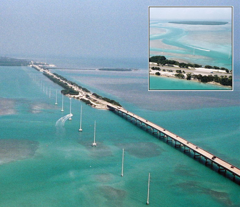 Aerial view of the causeway and bridge just southwest of Lower Matecumbe Key. Teatable Key is in the upper left. A short road from US-1 leads to a private area. | |
 Tea Table Key Tea Table Key  Tea Table Key Tea Table Key (Caribbean) | |
| Geography | |
|---|---|
| Location | Atlantic Ocean |
| Coordinates | 24.896373°N 80.66219°W |
| Administration | |
| State | Florida |
| County | Monroe |
It is located on U.S. 1 at mile marker 79.
All of the key is within the Villages of Islamorada as of November 4, 1997, when it was incorporated.
The island lies to the southwest of Upper Matecumbe Key, and to the northeast of Lower Matecumbe Key.[1]
There is a small private beach on the island the entrance is to a private road that leads to a private residence.[clarification needed]
The island hosted U.S. naval operations during the Seminole Wars and was taken over in an attack by indigenous tribes.[1]
References
This Monroe County, Florida location article is a stub. You can help Wikipedia by expanding it. |
На других языках
- [en] Tea Table Key
[fr] Tea Table Key
Tea Table Key est une île des Keys, archipel des États-Unis d'Amérique situé dans l'océan Atlantique au sud de la péninsule de Floride. Elle est située dans les Upper Keys et relève administrativement du comté de Monroe.Текст в блоке "Читать" взят с сайта "Википедия" и доступен по лицензии Creative Commons Attribution-ShareAlike; в отдельных случаях могут действовать дополнительные условия.
Другой контент может иметь иную лицензию. Перед использованием материалов сайта WikiSort.org внимательно изучите правила лицензирования конкретных элементов наполнения сайта.
Другой контент может иметь иную лицензию. Перед использованием материалов сайта WikiSort.org внимательно изучите правила лицензирования конкретных элементов наполнения сайта.
2019-2026
WikiSort.org - проект по пересортировке и дополнению контента Википедии
WikiSort.org - проект по пересортировке и дополнению контента Википедии