geo.wikisort.org - Coast
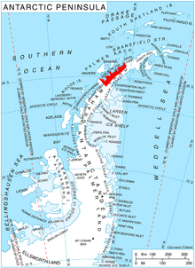
Sladun Peninsula (Bulgarian: полуостров Сладун, romanized: poluostrov Sladun, IPA: [poɫuˈɔstrof sɫɐˈdun]) is the predominantly ice-covered 4.58 km wide peninsula projecting from Danco Coast, Antarctic Peninsula 5.2 km into Gerlache Strait south of Cierva Cove and north of Duarte Cove. It ends in Cierva Point and Sucia Point to the west.
The feature is named after the settlement of Sladun in Southern Bulgaria.
Location
Sladun Peninsula is centred at 64°11′00″S 60°54′10″W. British mapping in 1978.
Maps
- British Antarctic Territory. Scale 1:200000 topographic map. DOS 610 Series, Sheet W 64 60. Directorate of Overseas Surveys, UK, 1978.
- Antarctic Digital Database (ADD). Scale 1:250000 topographic map of Antarctica. Scientific Committee on Antarctic Research (SCAR). Since 1993, regularly upgraded and updated.
References
- Sladun Peninsula. SCAR Composite Antarctic Gazetteer.
- Bulgarian Antarctic Gazetteer. Antarctic Place-names Commission. (details in Bulgarian, basic data in English)
External links
- Rozhen Peninsula. Copernix satellite image
This article includes information from the Antarctic Place-names Commission of Bulgaria which is used with permission.
This Danco Coast location article is a stub. You can help Wikipedia by expanding it. |
На других языках
[de] Sladun-Halbinsel
Die Sladun-Halbinsel (bulgarisch полуостров Сладун .mw-parser-output .Latn{font-family:"Akzidenz Grotesk","Arial","Avant Garde Gothic","Calibri","Futura","Geneva","Gill Sans","Helvetica","Lucida Grande","Lucida Sans Unicode","Lucida Grande","Stone Sans","Tahoma","Trebuchet","Univers","Verdana"}poluostrow Sladun) ist eine 5,2 km lange und 4,58 km breite Halbinsel an der Danco-Küste im Norden des Grahamlands auf der Antarktischen Halbinsel. An der Gerlache-Straße trennt sie die Cierva Cove im Norden von der Duarte Cove im Süden. Nach Westen läuft sie im Sucia Point aus.- [en] Sladun Peninsula
Текст в блоке "Читать" взят с сайта "Википедия" и доступен по лицензии Creative Commons Attribution-ShareAlike; в отдельных случаях могут действовать дополнительные условия.
Другой контент может иметь иную лицензию. Перед использованием материалов сайта WikiSort.org внимательно изучите правила лицензирования конкретных элементов наполнения сайта.
Другой контент может иметь иную лицензию. Перед использованием материалов сайта WikiSort.org внимательно изучите правила лицензирования конкретных элементов наполнения сайта.
2019-2026
WikiSort.org - проект по пересортировке и дополнению контента Википедии
WikiSort.org - проект по пересортировке и дополнению контента Википедии