geo.wikisort.org - Coast
Ponta do Barril is a headland in the western part of the island of São Nicolau, Cape Verde. It is about 8 km northwest of Tarrafal de São Nicolau and 5 km southwest of the nearest village Praia Branca.
| Ponta do Barril | |
|---|---|
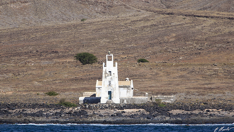
 Ponta do Barril and its lighthouse | |
 | |
| Location | Western São Nicolau, Cape Verde |
| Coordinates | 16°36′23″N 24°25′07″W |
| Offshore water bodies | Atlantic Ocean |
Lighthouse
| |
 | |
| Location | Ponta do Barril São Nicolau Cape Verde |
|---|---|
| Coordinates | 16°36′18.8″N 24°25′6.7″W |
| Tower | |
| Constructed | 1891 |
| Foundation | masonry base |
| Construction | masonry tower |
| Height | 9 metres (30 ft)[1] |
| Shape | square truncated tower with balcony and small lantern |
| Markings | white tower |
| Power source | solar power |
| Light | |
| Focal height | 13 metres (43 ft)[1] |
| Range | 15 nautical miles (28 km; 17 mi)[1] |
| Characteristic | Fl (3) W 12s.[1] |
| Cape Verde no. | PT-2058[2] |
The lighthouse at the Ponta do Barril was built in 1891.[2] It is a white 9 m high quadrangular tower. Its focal height is 13 m.[1]
See also
- List of lighthouses in Cape Verde
References
- List of Lights, Pub. 113: The West Coasts of Europe and Africa, the Mediterranean Sea, Black Sea and Azovskoye More (Sea of Azov) (PDF). List of Lights. United States National Geospatial-Intelligence Agency. 2015.
- Rowlett, Russ. "Lighthouses of Cape Verde". The Lighthouse Directory. University of North Carolina at Chapel Hill.
External links
The island of São Nicolau | ||||||
|---|---|---|---|---|---|---|
| Ribeira Brava |
|  | ||||
| Tarrafal de São Nicolau |
| |||||
| Mountains |
| |||||
| Other topics |
| |||||
Текст в блоке "Читать" взят с сайта "Википедия" и доступен по лицензии Creative Commons Attribution-ShareAlike; в отдельных случаях могут действовать дополнительные условия.
Другой контент может иметь иную лицензию. Перед использованием материалов сайта WikiSort.org внимательно изучите правила лицензирования конкретных элементов наполнения сайта.
Другой контент может иметь иную лицензию. Перед использованием материалов сайта WikiSort.org внимательно изучите правила лицензирования конкретных элементов наполнения сайта.
2019-2026
WikiSort.org - проект по пересортировке и дополнению контента Википедии
WikiSort.org - проект по пересортировке и дополнению контента Википедии