geo.wikisort.org - Coast
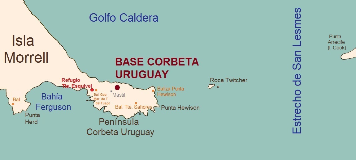
Hewison Point (59°27′32.5″S 27°17′54.6″W) is a point which forms the east side of Ferguson Bay and the southeast end of Thule Island, in the South Sandwich Islands. It was first charted by a Russian expedition under Fabian Gottlieb von Bellingshausen in 1819–20. It was recharted in 1930 by Discovery Investigations personnel on the Discovery II who named it for Lieutenant Colonel Hewison of Ferguson Brothers, Port Glasgow, Scotland, builders of the Discovery II.[1]
References
- "Hewison Point". Geographic Names Information System. United States Geological Survey. Retrieved 16 June 2012.
![]() This article incorporates public domain material from the United States Geological Survey document: "Hewison Point". (content from the Geographic Names Information System)
This article incorporates public domain material from the United States Geological Survey document: "Hewison Point". (content from the Geographic Names Information System)
This South Georgia and the South Sandwich Islands location article is a stub. You can help Wikipedia by expanding it. |
На других языках
[de] Hewison Point
Der Hewison Point ist eine Landspitze am südöstlichen Ende von Thule Island im Archipel der Südlichen Sandwichinseln. Sie bildet die Ostseite der Ferguson Bay sowie die westliche Begrenzung der südlichen Einfahrt in die Douglas Strait.- [en] Hewison Point
Другой контент может иметь иную лицензию. Перед использованием материалов сайта WikiSort.org внимательно изучите правила лицензирования конкретных элементов наполнения сайта.
WikiSort.org - проект по пересортировке и дополнению контента Википедии