geo.wikisort.org - Coast
Duck is a town in Dare County, North Carolina, United States. As of the 2020 census, the population was 746.[4] During the peak vacation season, starting after Memorial Day, the population increases to over 20,000.[6][unreliable source?] Duck is the northernmost incorporated town in Dare County and the Outer Banks' newest town, incorporated on May 1, 2002. Duck offers visitors outdoor recreational activities, summer events and concerts, watersports, fine dining, shopping, art galleries, and a nationally known jazz festival, as well as the 11-acre (4.5 ha) Town Park and soundside boardwalk.[7]
This article needs additional citations for verification. (November 2011) |
Duck, North Carolina | |
|---|---|
Town | |
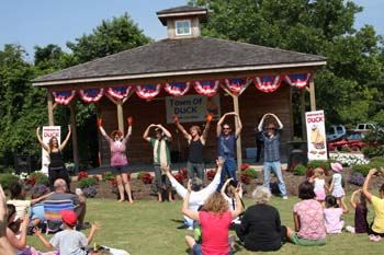
 The boardwalk at Duck Town Park, in 2009 | |
 Flag  Seal | |
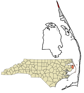 Location in Dare County and the state of North Carolina. | |
| Coordinates: 36°10′11″N 75°45′19″W[1] | |
| Country | United States |
| State | North Carolina |
| County | Dare |
| Founded | 1984 |
| Incorporated | 2002 |
| Named for | The duck |
| Area | |
| • Total | 3.72 sq mi (9.64 km2) |
| • Land | 2.42 sq mi (6.26 km2) |
| • Water | 1.30 sq mi (3.38 km2) |
| Elevation | 7 ft (2 m) |
| Population (2020) | |
| • Total | 742 |
| • Density | 306.99/sq mi (118.54/km2) |
| Time zone | UTC−05:00 (Eastern (EST)) |
| • Summer (DST) | UTC−04:00 (EDT) |
| ZIP Code | 27949 |
| Area code | 252 |
| FIPS code | 37-18060[1][3] |
| GNIS feature ID (populated place) | 1025292 |
| GNIS feature ID (town) | 2406400 |
| Website | townofduck |
| Historical population | |||
|---|---|---|---|
| Census | Pop. | %± | |
| 2010 | 369 | — | |
| 2020 | 746 | 102.2% | |
| 2021 (est.) | 758 | [4] | 1.6% |
| U.S. Decennial Census[5] | |||
Geography
Duck is located along the northern Outer Banks, between the Atlantic Ocean to the east and Currituck Sound to the west. According to the United States Census Bureau, the town has a total area of 3.7 square miles (9.6 km2), of which 2.4 square miles (6.3 km2) is land and 1.3 square miles (3.4 km2), or 35.02% is water. Originally part of Currituck County to the north, the stretch of the Outer Banks which includes Duck was transferred to Dare County in the early 20th century. The region was named for the many ducks and waterfowl in the area.
Demographics
2020 census
| Race | Number | Percentage |
|---|---|---|
| White (non-Hispanic) | 697 | 93.94% |
| Asian | 7 | 0.94% |
| Other/Mixed | 22 | 2.96% |
| Hispanic or Latino | 16 | 2.16% |
As of the 2020 United States census, there were 742 people, 288 households, and 202 families residing in the town.
Tourist attractions
The town park is a recreational facility with trails through the maritime forest and willow swamp. It also has an amphitheater, playground, picnic shelter, and public kayak/canoeing launch. The town has built a boardwalk which can be accessed from the park and through the commercial village. The boardwalk extends 0.78 miles (1.26 km) along Currituck Sound. Duck's beach was named one of the "Top 15 Family-Friendly Beaches in America".
In October, Duck hosts its annual Jazz Festival. During the summer months, the town offers over 60 events and programs including Yoga on the Green, Movies on the Sound, a family magic show, live concerts and interactive theater. Programs are free and open to the public.[9]
Town Council
The town of Duck encourages people to play an active role in their government. There are regular scheduled town meetings with the Town Council, where the public can address them on any matter they feel needs to be discussed. The community can also get involved and express their thoughts and concerns through attending council meetings and participating in public hearings. A two-day annual Council Retreat is held typically in February and is open to the public. The Town of Duck records council meetings and makes them available to view on the Town of Duck YouTube channel.[10]
History
This section needs additional citations for verification. (August 2017) |
In 1984, the North Carolina General Assembly established Duck as a North Carolina Beautification District. As such, an ad valorem tax could be levied to beautify the district and/or protect its citizens. Initially, a tax was levied for the purpose of providing for the underground installation of power lines throughout the community. This action prevented the power company from installing 30-foot-high (9.1 m) concrete poles along Duck Road. The result was an uncluttered skyline, increased safety for evacuation from the area (no downed poles or wires), and maintaining household power through major storm periods.
From 1986 to 1988, the community agreed to levy a tax for a two-year period to pay for the construction costs of a 7-mile (11 km) multiple-use trail. These funds were augmented by a $30,000 grant received by the Duck Civic Association (DCA) from the Dare County Tourism Bureau. The State Department of Transportation was also a major participant in obtaining easements and contracting for the trail installation.
In 1987, the Duck Civic Association was established to represent the community in matters of public safety, land use, and other public interests. The association management was set up with a nine-member board of directors and the usual complement of officers.
On July 18, 1994, the Dare County Commissioners adopted a resolution "to preserve our coastal village atmosphere through land use management and the policies and implementation strategies contained in the 1994 Land Use Plan update," signed by Robert V. Owens, Jr., Chairman.
Incorporation
On March 28, 2001, Representative Bill Culpepper introduced the Duck Incorporation Bill in the House. On August 29, 2001, after clearing the Senate on August 28 and the House on August 29, the bill became law. On November 6, 2001, voters voted in favor of the incorporation of Duck. Duck was incorporated as the sixth town in Dare County on May 1, 2002.
Lifesaving Station
The Caffeys Inlet Lifesaving Station was listed on the National Register of Historic Places in January 1978.[11]
Awards and recognition
- Duck was ranked one of USA Today's "Best Coastal Small Towns" by USA Today and 10Best.[12]
Climate
The town of Duck marks the northernmost extent of hardiness zone 8b along the east coast of the United States.[13]
| Climate data for Duck, NC Ocean Water Temperature | |||||||||||||
|---|---|---|---|---|---|---|---|---|---|---|---|---|---|
| Month | Jan | Feb | Mar | Apr | May | Jun | Jul | Aug | Sep | Oct | Nov | Dec | Year |
| Daily mean °F (°C) | 45 (7) |
44 (7) |
46 (8) |
59 (15) |
67 (19) |
74 (23) |
71 (22) |
74 (23) |
75 (24) |
69 (21) |
59 (15) |
52 (11) |
61 (16) |
| Source: NOAA[14] | |||||||||||||
Ecology
According to the A. W. Kuchler U.S. potential natural vegetation types, Duck, North Carolina would have a dominant vegetation type of Live oak/Sea Oats Uniola paniculata (90) with a dominant vegetation form of Coastal Prairie (20).[15]
Education
Residents are zoned to Dare County Schools. Zoned schools are Kitty Hawk Elementary School, First Flight Middle School, and First Flight High School.[16] Prior to 2004, First Flight High zoned students were zoned to Manteo High School.[17]
References
- "Duck". Geographic Names Information System. United States Geological Survey, United States Department of the Interior. June 17, 1980. Retrieved January 4, 2021.
- "ArcGIS REST Services Directory". United States Census Bureau. Retrieved September 20, 2022.
- "Town of Duck". Geographic Names Information System. United States Geological Survey, United States Department of the Interior. March 10, 2008. Retrieved January 4, 2021.
- Bureau, US Census. "City and Town Population Totals: 2020-2021". Census.gov. US Census Bureau. Retrieved 9 July 2022.
- "Census of Population and Housing". Census.gov. Retrieved June 4, 2016.
- "Duck". Stan White Realty and Construction. Retrieved 14 August 2017.
- Outerbanks SEO (2012). Town of Duck North Carolina. p. 4.
- "Explore Census Data". data.census.gov. Retrieved 2021-12-21.
- "Town Park & Boardwalk". Town of Duck. Retrieved November 20, 2015.
- Ferguson, J. (n.d.). Town council. Retrieved from http://www.townofduck.com/
- "National Register Information System – Caffeys Inlet Lifesaving Station (#78001942)". National Register of Historic Places. National Park Service. November 2, 2013. Retrieved January 4, 2021.
- Bleiberg, Larry; McMillan, Libby; Schrandt, Lydia (2015). "Best Coastal Small Town". USA Today. Retrieved February 3, 2016.
- "North Carolina 2012 USDA Hardiness Zone Map". Plant Maps. USDA. Retrieved 1 February 2021.
- "Water Temperature Table of All Coastal Regions". Retrieved August 6, 2019.
- "U.S. Potential Natural Vegetation, Original Kuchler Types, v2.0 (Spatially Adjusted to Correct Geometric Distortions)". Retrieved August 6, 2019.
- "Attendance Zone Information". Dare County Schools. Retrieved 2021-04-12.
Kitty Hawk Elementary School -- Area north of Cameron Street[...]First Flight Middle School/First Flight High School -- All areas north of Nags Head/Kill Devil Hills Town Line
- North Beaches Elementary Schools map - Freeman, Darren (18 August 2004). "NO LINES, NO CROWDS, JUST MORE SPACE". The Virginian-Pilot. Archived from the original on 2004-09-11. Retrieved 2009-10-25. - Entry at NewsBank
External links
- Official website

 Geographic data related to Duck, North Carolina at OpenStreetMap
 - General Assembly of North Carolina Session 2001 House Bill 882
Municipalities and communities of Dare County, North Carolina, United States | ||
|---|---|---|
County seat: Manteo | ||
| Towns |  | |
| CDPs | ||
| Unincorporated communities | ||
| Ghost town |
| |
| ||
Authority control | |
|---|---|
| General | |
| National libraries | |
| Other | |
Другой контент может иметь иную лицензию. Перед использованием материалов сайта WikiSort.org внимательно изучите правила лицензирования конкретных элементов наполнения сайта.
WikiSort.org - проект по пересортировке и дополнению контента Википедии