geo.wikisort.org - Coast
Cape St. Vincent (Portuguese: Cabo de São Vicente, Portuguese pronunciation: [ˈkabu dɨ sɐ̃w̃ viˈsẽtɨ]) is a headland in the municipality of Vila do Bispo, in the Algarve, southern Portugal. It is the southwesternmost point of Portugal and of mainland Europe.
| Cape St. Vincent | |
|---|---|
 North shore of Cape St. Vincent as seen from the lighthouse | |
| Highest point | |
| Peak | Cabo de São Vicente, Southwest Alentejo and Vicentine Coast Natural Park |
| Coordinates | 37°1′30″N 8°59′40″W |
| Naming | |
| Etymology | Vincent of Saragossa |
| Native name | Cabo de São Vicente (Portuguese) |
| Geography | |
 Cape St. Vincent Location of the Cabo de São Vicente in continental Portugal | |
| Country | Portugal |
| Region | Algarve |
| Subregion | Algarve |
| District | Faro |
| Municipality | Sagres |
History
Cape St. Vincent was already sacred ground in Neolithic times, as standing menhirs in the neighborhood attest. The ancient Greeks called it Ophiussa (Land of Serpents), inhabited by the Oestriminis and dedicated here a temple to Heracles. The Romans called it Promontorium Sacrum (or Holy Promontory). Strabo, in his Geography calls this cape the most western tip of the known world and reports the place was considered magical. Common people believed the sun sank here hissing into the ocean, marking the edge of their world, which Strabo qualifies as "common and vulgar reports" and attributes to Posidonius[1]
According to legend, the current name of this cape is linked to the story of a martyred fourth-century Iberian deacon St. Vincent whose body was brought ashore here. A shrine was erected over his grave; according to the Arab geographer Al-Idrisi, it was always guarded by ravens and is therefore named by him كنيسة الغراب (Kanīsah al-Ghurāb, meaning "Church of the Raven"). King Afonso Henriques (1139–1185) had the body of the saint exhumed in 1173 and brought it by ship to Lisbon, still accompanied by the ravens. This transfer of the relics is depicted on the coat of arms of Lisbon. All existing buildings—including the Vila do Infante of Henry the Navigator—fell into ruins because of the Lisbon earthquake of 1755. The Franciscan friars who cared for the shrine stayed on until 1834, when all monasteries were disbanded in Portugal.
Naval battles
Several naval battles have been fought in the vicinity of this cape:
- In 1337, a Castilian fleet defeated a Portuguese fleet in the Battle of Cape St. Vincent (1337).
- In 1606, a Spanish fleet defeated a Dutch fleet in the Battle of Cape St. Vincent (1606).
- In 1641, a Spanish fleet fought with a Dutch fleet in the Battle of Cape St. Vincent (1641).
- In 1681, a Spanish fleet defeated a Brandenburger fleet in the action of 30 September 1681.
- In 1693, a French fleet defeated an Anglo-Dutch fleet in the Battle of Lagos (1693).
- In 1719, a Spanish fleet defeated a British fleet in the Battle of Cape St. Vincent (1719).
- In 1751, a Spanish fleet defeated an Algerian fleet in the action of 28 November 1751.
- In 1780, a British fleet defeated a Spanish fleet in the Battle of Cape St. Vincent (1780).
- In 1797, a British fleet defeated a Spanish fleet in the Battle of Cape St. Vincent (1797).[2]
- In 1833, a Loyalist fleet defeated a Miguelite fleet in the Battle of Cape St. Vincent (1833).
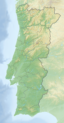
Geography
This cape is the southwesternmost point in Portugal. It forms the southwestern end of the E9 European Coastal Path, which runs for 5,000 km (3,100 mi) to Narva-Jõesuu in Estonia. Approximately six kilometers from the village of Sagres, the cape is a landmark for a ship traveling to or from the Mediterranean. The cliffs rise nearly vertically from the Atlantic to a height of 75 meters. The cape is a site of exuberant marine life and a high concentration of birds nesting on the cliffs, such as the rare Bonelli's eagle, peregrine falcons, kites, rock thrushes, rock pigeons, storks and herons.
The present lighthouse is 24 metres (79 ft) high and was built over the ruins of a 16th-century Franciscan convent in 1846.[3] The statues of St. Vincent and St. Francis Xavier had been moved to church of Nossa Senhora da Graça on Point Sagres 3 kilometres (1.9 mi) away.[3] This lighthouse, guarding one of the world's busiest shipping lanes, is among the most powerful in Europe (the most powerful being Phare du Creach on the French island of Ushant, off the coast of Brittany); its two 1,000 W lamps can be seen as far as 60 kilometres (37 mi) away.[3]
Climate
Cape St. Vincent has a Mediterranean climate with very low seasonal variation and high occurrence of fogs.
| Climate data for Cape St. Vincent, 1931-1960, elevation: 67 m or 220 ft | |||||||||||||
|---|---|---|---|---|---|---|---|---|---|---|---|---|---|
| Month | Jan | Feb | Mar | Apr | May | Jun | Jul | Aug | Sep | Oct | Nov | Dec | Year |
| Record high °C (°F) | 19.8 (67.6) |
24.5 (76.1) |
22.0 (71.6) |
27.0 (80.6) |
30.7 (87.3) |
30.1 (86.2) |
35.5 (95.9) |
32.0 (89.6) |
31.0 (87.8) |
28.0 (82.4) |
24.5 (76.1) |
22.0 (71.6) |
35.5 (95.9) |
| Average high °C (°F) | 14.8 (58.6) |
15.1 (59.2) |
16.3 (61.3) |
17.9 (64.2) |
19.2 (66.6) |
20.8 (69.4) |
21.5 (70.7) |
21.7 (71.1) |
21.8 (71.2) |
20.6 (69.1) |
17.8 (64.0) |
15.5 (59.9) |
18.6 (65.4) |
| Daily mean °C (°F) | 12.6 (54.7) |
12.8 (55.0) |
14.0 (57.2) |
15.2 (59.4) |
16.6 (61.9) |
18.2 (64.8) |
18.8 (65.8) |
19.1 (66.4) |
19.2 (66.6) |
18.2 (64.8) |
15.6 (60.1) |
13.4 (56.1) |
16.1 (61.1) |
| Average low °C (°F) | 10.5 (50.9) |
10.6 (51.1) |
11.8 (53.2) |
12.4 (54.3) |
13.9 (57.0) |
15.5 (59.9) |
16.2 (61.2) |
16.5 (61.7) |
16.6 (61.9) |
15.8 (60.4) |
13.5 (56.3) |
11.4 (52.5) |
13.7 (56.7) |
| Record low °C (°F) | 0.4 (32.7) |
0.5 (32.9) |
5.0 (41.0) |
3.5 (38.3) |
8.5 (47.3) |
9.0 (48.2) |
9.8 (49.6) |
12.0 (53.6) |
9.5 (49.1) |
9.0 (48.2) |
0.6 (33.1) |
2.5 (36.5) |
0.4 (32.7) |
| Average precipitation mm (inches) | 63 (2.5) |
47 (1.9) |
61 (2.4) |
38 (1.5) |
24 (0.9) |
5 (0.2) |
2 (0.1) |
1 (0.0) |
14 (0.6) |
46 (1.8) |
60 (2.4) |
56 (2.2) |
417 (16.5) |
| Average relative humidity (%) | 79 | 79 | 81 | 79 | 81 | 84 | 84 | 85 | 84 | 81 | 81 | 78 | 81 |
| Mean monthly sunshine hours | 155 | 177 | 207 | 257 | 300 | 318 | 339 | 326 | 256 | 224 | 172 | 166 | 2,897 |
| Source: IPMA[4] | |||||||||||||
Gallery
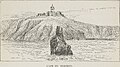 An 1879 sketch of the St. Vincent lighthouse
 The cliffs of the St. Vincent coast
 An aerial view of the southwestern St. Vincent coast
 Cape St. Vincent lighthouse


References
Notes
- Strabo, Geography, III
- "Page 474 | Issue 14012, 23 May 1797 | London Gazette | the Gazette".
- Neto, João; Xavier, António (1998), SIPA (ed.), Fortaleza do Cabo de São Vicente/Convento do Corvo/Convento de São Vicente do Cabo/Farol de São Vicente (IPA.00002891/PT050815040005) (in Portuguese), Lisbon, Portugal: SIPA – Sistema de Informação para o Património Arquitectónico, archived from the original on 18 August 2016, retrieved 2 August 2016
- Font Tullot, Inocencio (2000). Climatología de España y Portugal (Nueva versión ed.). [Salamanca]: Ediciones Universidad de Salamanca. p. 341. ISBN 9788478009442.
Sources
- Ellingham, Mark; Brown, Jules; Fisher, John; Kenyon, Graham; Hancock, Matthew (March 2005), The Rough Guide to Portugal (11th ed.), ISBN 1-84353-438-X
- Rentes de Carvalho, J. (August 1999), Portugal, um guia para amigos (in Portuguese) (9th ed.), Amsterdam: Arbeiderspers, ISBN 90-295-3466-4
Authority control | |
|---|---|
| General |
|
| National libraries | |
На других языках
- [en] Cape St. Vincent
[es] Cabo de San Vicente
El cabo de San Vicente (en portugués Cabo de São Vicente) es un accidente geográfico situado en el extremo sudoeste de Portugal, que marca el límite occidental del golfo de Cádiz. Se encuentra cerca de Sagres, concejo de Vila do Bispo (Algarve). Se le conocía en tiempos romanos como Promontorium Sacrum, lugar dedicado al dios Saturno. Según la Geografía de Estrabón, es el punto más occidental de la ecúmene (III, 1, 4).[ru] Сан-Висенти (мыс)
Сан-Висенти (порт. Cabo de São Vicente), Мыс святого Викентия — мыс на юго-западе Португалии, образующий вместе с соседним мысом Сагриш самый юго-западный выступ европейского материка[1]. Мыс представляет собой западную окраину португальского региона Алгарви, который заканчивается здесь скалистым берегом со скудной растительностью, достигающим высоты до 70 м.Другой контент может иметь иную лицензию. Перед использованием материалов сайта WikiSort.org внимательно изучите правила лицензирования конкретных элементов наполнения сайта.
WikiSort.org - проект по пересортировке и дополнению контента Википедии