geo.wikisort.org - Coast
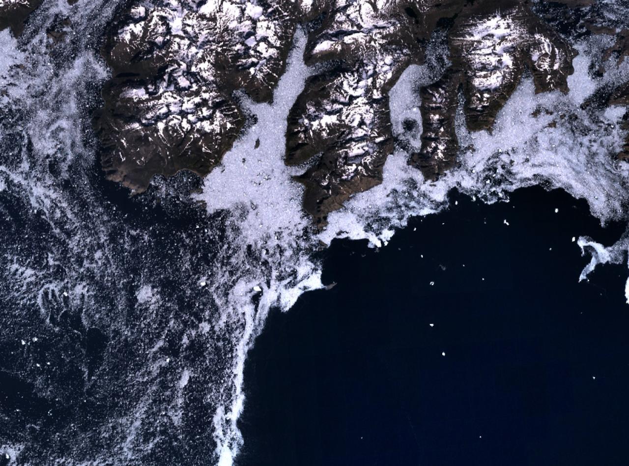
Cape Farewell (Greenlandic: Nunap Isua;[1] Danish: Kap Farvel)[2] is a headland on the southern shore of Egger Island, Nunap Isua Archipelago, Greenland.[3] As the southernmost point of the country, it is one of the important landmarks of Greenland.
Cape Farewell
Nunap Isua | |
|---|---|
Cape | |
 Cape Farewell | |
| Coordinates: 59°46′23″N 43°55′21″W | |
| Location | Kujalleq, Greenland |
| Offshore water bodies | North Atlantic Ocean |
| Area | |
| • Total | Arctic |
Geography
Located at 59°46′23″N 43°55′21″W, excluding small offshore islets, this cape is the southernmost extent of Greenland, projecting out into the North Atlantic Ocean and the Labrador Sea on the same latitude as St Petersburg, Oslo and the Shetland Islands. Egger and the associated minor islands are known as the Cape Farewell Archipelago. The area is part of the Kujalleq municipality. King Frederick VI Coast stretches from Cape Farewell to Pikiulleq Bay (former spelling 'Pikiutdleq') in the north along the eastern coast of Greenland.
 |
 |
See also
- List of countries by southernmost point
References
- "Den grønlandske Lods - Geodatastyrelsen" (PDF). Archived from the original (PDF) on 2020-10-28. Retrieved 2016-05-06.
- "Cape Farewell". Geonames. Retrieved 6 May 2016.
- Cape Farewell
External links
- Aerial photographs of the Kap Farvel area
- Ketilidian structure and the rapakivi suite between Lindenow Fjord and Kap Farvel, South-East Greenland
Authority control | |
|---|---|
| General | |
| National libraries | |
This Greenland location article is a stub. You can help Wikipedia by expanding it. |
На других языках
[de] Kap Farvel
Das Kap Farvel (grönländisch Nunap Isua, englisch Cape Farewell, niederländisch Statenhuk) ist ein Kap in Grönland. Es wird üblicherweise als südlichster Punkt Grönlands bezeichnet, tatsächlich liegen südlich jedoch noch einige bis zu mehrere Hektar große Inselchen.- [en] Cape Farewell, Greenland
[es] Cabo Farewell (Groenlandia)
El cabo Farewell (en groenlandés: Uummannarsuaq; en danés: Kap Farvel, en español: Cabo Despedida) es un promontorio en la costa sur de la isla de Egger, Groenlandia. Es el punto meridional más extremo de Groenlandia, proyectándose al mar donde se encuentran el océano Atlántico Norte y el mar del Labrador, en la misma latitud de Estocolmo y las islas Orcadas. Egger y las islas menores asociadas, son conocidas como el archipiélago Farewell. La zona es parte de la municipalidad de Kujalleq.[ru] Уманарссуак
Умана́рссуа́к[1][2] (гренл. Uummannarsuaq) или Фарве́ль[1][3] (дат. Kap Farvel) — самая южная точка Гренландии.Другой контент может иметь иную лицензию. Перед использованием материалов сайта WikiSort.org внимательно изучите правила лицензирования конкретных элементов наполнения сайта.
WikiSort.org - проект по пересортировке и дополнению контента Википедии