geo.wikisort.org - Coast
Aguda Point, also variously known as Eclipse Point, Punta Natho or Punta Larga, is a point forming the east side of the entrance to Hidden Bay, on the northeast coast of Kyiv Peninsula, Graham Land. First charted by the Belgian Antarctic Expedition under Adrien de Gerlache, 1897–99. The name appears on an Argentine government chart of 1957 and is probably descriptive; "aguda" is Spanish for "sharp" or "sharp pointed".
| Aguda Point | |
|---|---|
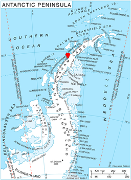 Location of Kyiv Peninsula in Graham Land, Antarctic Peninsula. | |
 | |
| Location | Graham Land |
| Coordinates | 65°2′S 63°41′W |
| Area | Antarctica |
References
![]() This article incorporates public domain material from the United States Geological Survey document: "Aguda Point". (content from the Geographic Names Information System)
This article incorporates public domain material from the United States Geological Survey document: "Aguda Point". (content from the Geographic Names Information System)
This Danco Coast location article is a stub. You can help Wikipedia by expanding it. |
На других языках
[de] Aguda Point
Der Aguda Point (englisch, spanisch Punta Aguda, im Vereinigten Königreich Eclipse Point, in Chile Punta Natho) ist eine Landspitze im Nordwesten der Kiew-Halbinsel an der Danco-Küste des Grahamlands auf der Antarktischen Halbinsel. Am Südufer der Flandernbucht markiert sie die östliche Begrenzung der Einfahrt zur Hidden Bay.- [en] Aguda Point
Текст в блоке "Читать" взят с сайта "Википедия" и доступен по лицензии Creative Commons Attribution-ShareAlike; в отдельных случаях могут действовать дополнительные условия.
Другой контент может иметь иную лицензию. Перед использованием материалов сайта WikiSort.org внимательно изучите правила лицензирования конкретных элементов наполнения сайта.
Другой контент может иметь иную лицензию. Перед использованием материалов сайта WikiSort.org внимательно изучите правила лицензирования конкретных элементов наполнения сайта.
2019-2026
WikiSort.org - проект по пересортировке и дополнению контента Википедии
WikiSort.org - проект по пересортировке и дополнению контента Википедии