geo.wikisort.org - Coast
Lagos State (Yoruba: Ìpínlẹ̀ Èkó) is a state in southwestern Nigeria. Of the 36 states, it is both the most populous and smallest in area. Bounded to the south by the Bight of Benin and to the west by the international border with Benin Republic, Lagos State borders Ogun State to the east and north making it the only Nigerian state to border only one other state. Named for the city of Lagos—the most populous city in Africa—the state was formed from the Western Region and the former Federal Capital Territory on 27 May 1967.[8][9]
Lagos State
| |
|---|---|
State | |
 Flag  Seal | |
| Nickname(s): Las Gidi, Gidi | |
| Motto: Centre of Excellence | |
 Location of Lagos State in Nigeria | |
| Coordinates: 6°35′N 3°45′E | |
| Country | |
| Geopolitical Zone | South West |
| Date created | 27 May 1967 |
| Capital | Ikeja |
| Number of LGAs | 20 |
| Government | |
| • Body | Government of Lagos State |
| • Governor[1] | Babajide Sanwo-Olu (APC) |
| • Deputy Governor | Kadiri Hamzat (APC) |
| • Legislature | Lagos State House of Assembly |
| • Chief Judge | Kazeem Alogba |
| • National Assembly delegation | Senators:
|
| Area | |
| • Total | 3,577 km2 (1,381 sq mi) |
| Population | |
| • Total | 9,113,605 |
| • Estimate (2020 by LASG and 2019 by National Bureau of Statistics) | 12,772,884[4]35,000,000[5] |
| • Rank | 1st/2nd of 36 |
| • Density | 2,500/km2 (6,600/sq mi) |
| Demonym | Lagosian |
| GDP | |
| • Year | 2014 |
| • Total | $91 billion[6] |
| • Per capita | $4,333 |
| Time zone | UTC+01 (WAT) |
| ISO 3166 code | NG-LA |
| HDI (2019) | 0.686[7] medium · 1st of 37 |
| Website | lagosstate.gov.ng |
Geographically, Lagos State is dominated by bodies of water with nearly a quarter of the state's area being lagoons, creeks, and rivers.[10] The largest of these bodies are the Lagos and Lekki lagoons in the state's interior with the Ogun and Osun rivers flowing into them. Many other rivers and creeks flow throughout the state and serve as vital means of transportation for people and goods. On land, non-urbanized areas are within the tropical Nigerian lowland forests ecoregion with natural areas containing threatened populations of mona monkey, tree pangolin, and hooded vulture along with a transitory population of African bush elephants.[11][12][13][14] Offshore, the state is also biodiverse as there are large fish populations along with African manatees and crocodiles.[15][16]
Lagos State has been inhabited for years by various indigenous ethnic groups, primarily the majority Yoruba people that live throughout the state but also the Ewe and Ogu peoples in the far west. As a result of migration since the nineteenth century, Lagos State also has large populations of non-native Nigerian ethnic groups with Edo, Fulani, Hausa, Igbo, Ijaw, Ibibio, and Nupe peoples among other Nigerian groups. There are also groups from outside of Nigeria's modern borders with the Saro (Sierra Leonean) and Amaro (Brazilian) groups being descendants of formerly enslaved people that returned to Africa in the 1800s with a longstanding Middle Eastern Nigerian community (mainly Syrian and Lebanese Nigerians)[17] also forming a significant part of Lagos' population along with recent immigrants from Benin Republic, China, Ghana, India, Togo, and the United Kingdom.[18][19][20][21] Religiously the state is also diverse as about 55% of the state's population are Christian with around 40% being Muslim and the remaining 5% following traditional ethnic religions or other religions.[22]
In the pre-colonial period, the area that is now Lagos State was mainly fishing villages[23][24][25][26] and ports that at various points were controlled by states including the Oyo Empire and Benin Empire until the early 1800s when the city of Lagos had developed into a major kingdom of its own right. In 1850, the British successfully attacked the kingdom in the Bombardment of Lagos before installing an ally as Oba and signing a treaty that established Lagos as being under British protection. Ten years later, the forced Lagos Treaty of Cession led to the formal establishment of the Lagos Colony. In 1906, the colony was incorporated into the new Southern Nigeria Protectorate which merged into British Nigeria in 1914 with the city of Lagos as its capital. Upon independence in 1960, Lagos remained as the capital with much of the city forming the Federal Capital Territory while the rest of modern-day Lagos State was a part of the Western Region until 1967 when the region was split and the area became Lagos State.
Economically, Lagos State is one of the most important states in the country as a major financial centre and would be one of the largest economies in Africa if it were a country[27] with a gross domestic product of $84 billion comparable with Ghana's $75 billion, Angola's $70 billion, and Ethiopia's $93 billion.[28] Lagos State is also a key culture, education, and transportation hub for Nigeria and Sub-Saharan Africa. Despite being beset by overcrowding and chronic debilitating traffic, Lagos State has the highest Human Development Index in Nigeria and numerous developmental projects.[29][30]
History
Early history
Before the Portuguese name of Lagos had been adopted, Lagos' initial name was Eko which referred mainly to the Island. The first to settle in Eko were the Aworis in the 15th century and the Binis in the 16th century. The Aworis were conquered by the Benin Empire.[31] The Awori hunters and fishermen had originally come from Ile-Ife to the coast.[32][33]
It was in 1760 that the name Lagos was adopted by the Portuguese. Naming it after a city in Southern Portugal which was used as port for Slave Trade.[34] In 1861, Oba Docemo was the one who signed the treaty making Lagos a British Colony.[35]
Post-colonial era
Lagos State was created on 27 May 1967 according to the State Creation and Transitional Provisions Decree No. 14 of 1967,[36] which restructured Nigeria into a federation of 12 states.[37] Before the issuance of this Decree, Lagos city, which was the country's capital had been administered directly by the Federal Government through the Federal Ministry of Lagos Affairs.[37] However, Ikeja, Agege, Mushin, Ikorodu, Epe, surulere, and Badagry were administered by the then Western Region Government.[37] Lagos, the city, along with these other towns were captured to create the state of Lagos, with the state becoming fully recognized as a semi-autonomous[38] administrative division on 11 April 1968.[37] Lagos served the dual role of being the State and Federal Capital until 1976 when the capital of the state was moved to Ikeja.[37] After the full establishment of the Federal Capital Territory, based on the recommendation of a of the Akinola Àgùdà–led committee set up by the General Murtala Muhammed to review the need for a new capital for Nigeria in 1975. The seat of the Federal Government was formally relocated to Abuja on 12 December 1991.[39] Nevertheless, Lagos remains the financial centre of the country, and even grew to become the most populous city in the state and the country.[37]
Cities and towns
Lagos
Lagos is the most populous city in Lagos State, Nigeria as a whole, and the continent of Africa. The conurbation is one of the most populous in the world.[40][41] Lagos is a port which originated on islands separated by creeks, such as Lagos Island, fringing the southwest mouth of Lagos Lagoon while protected from the Atlantic Ocean by barrier islands and long sand spits such as Bar Beach, which stretch up to 100 kilometres (62 miles) east and west of the mouth. The metropolitan area of Lagos includes Ikeja (which is the capital of Lagos State) and Agege and Mushin.
Ikeja
Ikeja is the state capital of Lagos State. Ikeja is a planned residential and commercial town with shopping malls, pharmacies and government reserved areas. The Murtala Mohammed International Airport is in Ikeja. Ikeja is also home to Fela Kuti's African Shrine,[42] Late Chief Gani Fawehinmi house and Lagbaja's Motherland. It also boasts the largest shopping mall on the mainland.[43]
Lekki
Lekki is a city in the south eastern part of the state. It is a naturally formed peninsula, it is still largely under construction. As of 2015, only phase 1 of the project had been completed, with phase 2 nearing completion. The peninsula is approximately 70 to 80 km long, with an average width of 10 km. Lekki currently houses several estates, gated residential developments, agricultural farmlands, areas allocated for a Free Trade Zone, an airport, and a sea port under construction. The proposed land use master plan for the Lekki envisages the Peninsula as a "Blue-Green Environment City",[44] expected to accommodate over 3.4 million residential population and an additional non-residential population of at least 1.9 million.[45]
Ikorodu
Ikorodu is a city located north east of the state along the Lagos Lagoon. It shares a boundary with Ogun State. As of the 2006 Census Ikorodu had a population of 535,619.[46]it is the third largest city in the south west after Ibadan and Lagos and the 12th largest city in Nigeria.[47] It has an 2022 estimated population of 1,041,066. The population of the city currently grows at 5.26% annually and it is projected to reach 1.7million by 2035[48]
Eko Atlantic
Eko Atlantic is a planned city being constructed on land reclaimed from the Atlantic Ocean.[49] It is located on the former Lagos' Bar Beach. Upon completion, the new island which is still under development is anticipating at least 250,000 residents and a daily flow of at least 150,000 commuters. The development will also have a positive environmental impact; its purpose is to stop the erosion of the Lagos coastline.[50] The Eko Atlantic City project received global recognition in 2009, as the Lagos State government and its private sector partners on the Project, South Energyx, received the Clinton Global Initiative Commitment Certificate.[51][52][53]
Badagry
Badagry is a coastal town in the state. It is situated between Metropolitan Lagos, and the border of the Republic of Benin at Seme. As of the preliminary 2006 census results, the municipality had a population of 241,093.[54] The area is led by a traditional king, Akran De Wheno Aholu Menu – Toyi 1,[55] who is also the permanent vice-chairman of obas and chiefs in Lagos State. It is known to hold the country's oldest storey building. Badagry is home to the Egun people who are predominantly fishermen.[54]
Epe
Epe is a town located on the north side of the Lekki Lagoon. It is popular for the fishing activities attributed to the city. Per the 2006 Census the population of Epe was 181,409.[56]
Ojo
Ojo is a town mainly occupied by the Aworis with a population of 507,693.[57] Lagos State University is in this town.
Economy
Lagos State is a major economic centre of Nigeria. It would be the fifth largest economy in Africa if it were a country.[27] Lagos State houses headquarters of most conglomerates and commercial banks in Nigeria.[58]
Its total generated revenue in 2017 was around ₦334 billion (equivalent to US$920 million), growing by 10.43% compared to 2016.[59] By the first half of 2021, the State's internally generated revenue (IGR) alone stood at over ₦267 billion.[60]
Imota rice mill

The Imota rice mill is an agricultural plant in Ikorodu, a suburb of Lagos, Nigeria. It was built in 2021 and will commence full production in the second quarter of 2022.[61][62] The rice mill has a capacity to produce 2.8 million bags of 50 kg bags of rice yearly, while generating 1,500 direct jobs and 254,000 indirect jobs. On completion, in line with the estimated installed infrastructure of the facility, the production capacity of the rice mill in Imota will set it among the largest in the world, and the largest in sub-Saharan Africa.[63]
According to Lagos State governor Sanwo-Olu, full production of the facility will drastically reduce prices of rice and pressure to purchase the commodity.[64] At this moment (early 2022) Nigeria produces husk rice, yet imports hulled/polished rice at a higher price.[65] Processing the national staple food rice in its own country therefore should improve Nigeria's trade balance.
Lekki Free Trade Zone
Lekki Free Trade Zone (Lekki FTZ) is a free zone situated at the eastern part of Lekki, which covers a total area of about 155 square kilometres. The first phase of the zone has an area of 30 square kilometres, with about 27 square kilometres for urban construction purposes, which would accommodate a total resident population of 120,000. According to the Master Plan, the free zone will be developed into a new modern city within a city with integration of industries, commerce and business, real estate development, warehousing and logistics, tourism, and entertainment.[66]
Infrastructure

Fourth Mainland Bridge

The Fourth Mainland Bridge is a 38 km long bridge project by the Lagos State Government, connecting Lagos Island by way of Langbasa(Lekki) and Baiyeku(Ikorodu) across the Lagos Lagoon to Itamaga, in Ikorodu.[67] The bridge is a 2 x 4 lane carriageway cross-sectional road with permission for BRT Lane and future road contraction. It is expected to become the second longest Bridge in Africa, featuring 3 toll plazas, 9 interchanges, 4.5 km Lagoon Bridge and an eco-friendly environment amongst other added features.[68]

In April 2021 there were 6 bidders for the US$2.5 billion project. By December the preferred bidder would be known.[69]
In January 2022 the Lagos State Governor, Babajide Sanwo-Olu, reiterated the plan by the state government to commence the construction on the Opebi-Mende link bridge and the 38-kilometre 4th mainland bridge: "Construction work on the 38km 4th Mainland Bridge — which will be the longest in Africa — and the Opebi-Mende link bridge will commence this year."[70][71]
Government
Since its creation in 1967, the state has been administered either by a governor and a House of Assembly in civilian or quasi-civilian (under Ibrahim Badamasi Babangida's administration) federal administrations, or by Sole-Administrators or Military Administrators in military dispensations. Since December 2007, Yoruba has been the second official language of debate and discussion for the House of Assembly after English. The House of Assembly is headed by the Speaker, an elected position which is currently held by Mudashiru Obasa, who has also won his party's ticket to run for a 6th term in the upcoming 2023 elections.[72]
Governor of the State

The current governor of Lagos State is Mr. Babajide Sanwo-Olu, who emerged victorious in the March 9, 2019 Governorship elections.[73][74] Babajide Sanwo-Olu was sworn in on May 29, 2019, making him the 6th democratic governor of Lagos State and the 15th governor of Lagos State overall.[75][76] On 18 May 2022, Lagos state government announced total ban on Okada in 6 local government areas of the state.[77]
Administrative divisions
Local Government Areas
This section needs to be updated. (June 2015) |
Lagos State is divided into five administrative divisions, which are further divided into 20 local government areas, or LGAs. They are:[78]
| LGA name | Area (km2) | Census 2006 population |
Administrative capital | Postal code |
|---|---|---|---|---|
| Agege | 11 | 459,939 | Agege | 100 |
| Alimosho | 185 | 1,277,714 | Ikotun | 100 |
| Ifako-Ijaye | 27 | 427,878 | Ifako | 100 |
| Ikeja | 46 | 313,196 | Ikeja | 100 |
| Kosofe | 81 | 665,393 | Kosofe | 100 |
| Mushin | 17 | 633,009 | Mushin | 100 |
| Oshodi-Isolo | 45 | 621,509 | Oshodi/Isolo | 100 |
| Shomolu | 12 | 402,673 | Shomolu | 101 |
| Ikeja Division | 424 | 4,801,311 | ||
| Apapa | 27 | 217,362 | Apapa | 101 |
| Eti-Osa | 192 | 287,785 | Ikoyi | 101 |
| Lagos Island | 9 | 209,437 | Lagos Island | 101 |
| Lagos Mainland | 19 | 317,720 | Lagos Mainland | 101 |
| Surulere | 23 | 503,975 | Surulere | 101 |
| Lagos Division | 270 | 1,542,279 | ||
| Ajeromi-Ifelodun | 12 | 684,105 | Ajeromi/Ifelodun | 102 |
| Amuwo-Odofin | 135 | 318,166 | Festac Town | 102 |
| Ojo | 158 | 598,071 | Ojo | 102 |
| Badagry | 441 | 241,093 | Badagry | 103 |
| Badagry Division | 746 | 1,841,435 | ||
| Ikorodu | 394 | 535,619 | Ikorodu | 104 |
| Ikorodu Division | 394 | 535,619 | ||
| Ibeju-Lekki | 455 | 117,481 | Akodo[79] | 105 |
| Epe | 1,185 | 181,409 | Epe | 106 |
| Epe Division | 1,640 | 298,890 | ||
| Total | 3,474 | 9,019,534 | Ikeja | |
The first 16 of the above LGAs comprise the statistical area of Metropolitan Lagos. The remaining four LGAs (Badagry, Ikorodu, Ibeju-Lekki and Epe) are within Lagos State but are not part of Metropolitan Lagos.
Local council development areas
In 2003, many of the existing 20 LGAs were split for administrative purposes into Local Council Development Areas. These lower-tier administrative units now number 56: Agbado/Oke-Odo, Agboyi/Ketu, Agege, Ajeromi, Alimosho, Apapa, Apapa-Iganmu, Ayobo/Ipaja, Badagry West, Badagry, Bariga, Coker Aguda, Egbe Idimu, Ejigbo, Epe, Eredo, Eti-Osa East, Eti Osa West, Iba, Isolo, Imota, Ikoyi, Ibeju, Ifako-Ijaiye, Ifelodun, Igando/Ikotun, Igbogbo/Bayeku, Ijede, Ikeja, Ikorodu North, Ikorodu West, Ikosi Ejinrin, Ikorodu, Ikorodu West, Iru/Victoria Island, Itire Ikate, Kosofe, Lagos Island West, Lagos Island East, Lagos Mainland, Lekki, Mosan/Okunola, Mushin, Odi Olowo/Ojuwoye, Ojo, Ojodu, Ojokoro, Olorunda, Onigbongbo, Oriade, Orile Agege, Oshodi, Oto-Awori, Shomolu, Surulere and Yaba.[80]
Postal districts
This is a list of postal districts in Lagos State organised by local government area (LGA) and postal district, with postal codes also given.[81][82]
| LGA | District | Postal code |
|---|---|---|
| Ajeromi Ifelodun | Ajeromi | 102103 |
| Amuwo Odofin | Amuwo odofin | 102102 |
| Amuwo Odofin | Trade fair complex | 102101 |
| Badagry | Badagry | 103101 |
| Epe | Agbowa | 106104 |
| Epe | Ejinrin | 106102 |
| Epe | Epe | 106101 |
| Epe | Erodo | 106103 |
| Ibeju-Lekki | Ibeju | 105101 |
| Ibeju-Lekki | Lekki | 105102 |
| Ikorodu | Ikorodu rural | 104101 |
| Ikorodu | Irepodun | 104102 |
| Ojo | Ajangbadi Afromedia | 102104 |
| Ojo | Ajangbadi Ikemba house | 102107 |
| Ojo | Alaba | 102115 |
| Ojo | Iba town new site | 102112 |
| Ojo | Igbede | 102109 |
| Ojo | Igbo Elerin | 102106 |
| Ojo | Ilemba Awori | 102108 |
| Ojo | Ilogbo | 102110 |
| Ojo | Ira | 102114 |
| Ojo | Ojo | 102101 |
| Ojo | Okokomaiko | 102105 |
| Ojo | Olojo | 102113 |
| Ojo | Shibiri Ekune | 102111 |
Electoral wards
Below is a list of polling units, including villages and schools, organised by electoral ward.[83]
| LGA | Wards |
|---|---|
| Agege | Isale/Idimangoro; Iloro/Onipetesi; Oniwaya/Papa-Uku; Agbotikuyo/Dopemu; Oyewole/Papa Ashafa; Okekoto; Keke; Darocha; Tabon Tabon/Oko Oba; Orile Agege/Oko Oba; Isale Odo |
| Ajeromi/Ifelodun | Ago Hausa; Awodi-Ora; Wilmer; Olodi; Tolu; Temidire I; Ojo Road; Layeni; Alaba Oro; Mosafejo; Temidire II |
| Alimosho | Shasha/Akowonjo; Egbeda/Alimosho; Idimu/Isheri Olofin; Akesan; Ikotun/Ijegun; Egbe/Agodo; Igando/Egan; Ipaja North; Ipaja South; Ayobo/Ijon Village (Camp David); Pleasure/Oke-Odo; Abule-Egba/Aboru/Meiran/Alagbado |
| Amuwo-Odofin | Amuwo-Odofin Housing Estate, Mile 2; Festac 1; Festac II; Kirikiri; Amuwo; Ijegun; Satellite; Irede; Ibeshe; Igbologun; Festac III |
| Apapa | Apapa I (Marine Rd. and environs); Apapa II (Liverpool Rd. and environs); Apapa III (Creek Rd. Tincan/Snake Island; Apapa IV (Pelewura Crescent and environs); Ijora-Oloye; Olodan St. Olojowou St/Alh. Dogo Olatokunbo St. Iganmu; Gaskiya & environs; Afolabi Alasia Str. and environs; Malu Road and environs; Sari and environs |
| Badagry | Posukoh; Awhanjigoh; Ibereko; Keta-East; Iworo Gbanko; Ajido; Ilogbo-Araromi; Ikoga; Ajara; Iya-Afin |
| Epe | Etita/Ebode; Lagbade; Popo-Oba; Oke-Balogun; Ajaganabe; Ise/Igbogun; Oriba/Ladaba; Abomiti; Agbowa; Agbowa Ikosi; Ago Owu; Orugbo; Ilara; Ibonwon; Odoragunsin; Poka; Odomola; Ejirin; Itoikin |
| Eti-Osa | Victoria Island I; Victoria Island II; Ilasan Housing Estate; Lekki/Ikate and environs; Ilado/Eti-Osa and environs; Ajah/Sangotedo; Ado/Langbasa/Badore; Ikoyi I; Ikoyi II; Obalende |
| Ibeju/Lekki | Ibeju I; N2, (Ibeju II); Orimedu I; 02, (Orimedu II); 03, (Orimedu III); P1, (Iwerekun I); Iwerekun II; S1, (Lekki I); Lekki II; S2, (Siriwon/Igbekodo I); S,2a (Siriwon/Igbekodo II) |
| Ifako-Ijaye | Ijaye; Old Ifako/Karaole; New Ifako/Oyemekun; Fagba/Akute Road; Iju Isaga; Iju-Obawole; Pamada/Abule-Egba; Ijaiye/Ojokoro; Ijaiye/Agbado/Kollington; Alakuko/Kollington; Ajegunle/Akinde/Animashaun |
| Ikeja | Anifowoshe/Ikeja; Ojodu/Agidingbi/Omole; Alausa/Oregun/Olusosun; Airport/Onipetesi/Onilekere; Ipodo/Seriki Aro; Adekunle Vill./Adeniyi Jones/Ogba; Oke-Ira/Aguda; Onigbongbo/Military Cantonment; Gra/Police Barracks; Wasimi/Opebi/Allen |
| Ikorodu | Isele I; Isele II; Isele III; Aga/Ijimu; Ipakodo; Imota 1; Imota II; Isiu; Igbogbo I; Igbogbo II; Baiyeku/Oreta; Ijede J; Ijede II; Agura/Iponmi; Odogunyan; Erikorodu; Agbala; Olorunda/Igbaga |
| Kosofe | Oworonshoki; Ifako/Soluyi; Anthony/Ajao Estate/Mende/Maryland; Ojota/Ogudu; Ketu/Alapere/Agidi/Orisigun/Kosofe/Ajelogo/Akanimodo; Ikosi Ketu/Mile 12/Agiliti/Maidan; Isheri-Olowo-Ira/Shangisha/Magodo Phase I & II; Agboyi I; Agboyi II; Owode Onirin/Ajegunle/Odo-Ogun |
| Lagos Island | Olowogbowo/Elegbata; Oluwole; Idumota/Oke; Oju-Oto; Oko-Awo; Agarawu/Obadina; Iduntafa; Ilupesi; Isale-Agbede; Olosun; Olushi/Kakawa; Popo-Aguda; Anikantamo; Oko-Faji; Eiyekole; Onikan; Sandgrouse; Epetedo; Lafiaji/Ebute |
| Lagos Mainland | Otto/Iddo; Olaleye Village; Maroko/Ebute Metta; Oyingbo Market/Ebute Metta; Glover/Ebute Metta; Oko-Baba; Oyadiran Estate/Abule-Oja; Alagomeji; Iwaya; Yaba/Igbobi |
| Mushin | Alakara; Idi-Oro/Odi-Olowu; Babalosa; Ojuwoye; Ilupeju; Olateju; Kayode/Fadeyi; Mushin/Atewolara; Papa-Ajao; Ilasamaja; Babalosa/Idi-Araba; Idi-Araba; Itire; Ilupeju Industrial Estate |
| Ojo | Ojo Town; Okokomaiko; Ajangbadi; Ijanikin; Iba; Irewe; Tafi; Etegbin; Idoluwo; Sabo, Ojo barracks |
| Oshodi/Isolo | Oshodi/Bolade; Orile-Oshodi; Isolo; Ajao Estate; Mafoluku; Sogunle; Sogunle/Alasia; Okota; Ishagatedo; Oke-Afa/Ejigbo |
| Somolu | Onipanu; Palmgrove/Ijebutedo; Alade; Bajulaiye; Mafowoku/Pedro; Lad-Lak/Bariga; Ilaje/Akoka; Igbobi/Fadeyi; Fola Agoro/Bajulaiye/Igbari-Akoka; Gbagada Phase I Obanikoro/Pedro; Gbagada Phase II /Bariga/Apelehin; Abule-Okuta/Ilaje/Bariga |
| Surulere | Orile; Aguda; Ijeshatedo; Akinhanmi/Cole; Yaba/Ojuelegba; Igbaja/Stadium; Shitta/Ogunlana Drive; Adeniran/Ogunsanya; Iponri Housing Estate/Eric Moore; Coker; Ikate; Baya-Oje; Igbon/Gambari; Iresaapa; Arolu; Iresaadu; Iregba; Iwofin; Ilajue; Mayin |
Tertiary educational institutions in Lagos State
- Adeniran Ogunsanya College of Education[85]
- Anchor University[86]
- Augustine University Ilara, Epe[87]
- Caleb University[88]
- Federal College of Education, Akoka[89]
- Federal College of Fisheries and Marine Technology[90]
- Lagos Business School[91]
- Lagos City Polytechnic[92]
- Lagos State College of Health Technology[93]
- Lagos State University of Science and Technology[94]
- Lagos State University[95]
- Lagos State University College of Medicine[96]
- Michael Otedola College of Primary Education[97]
- National Open University of Nigeria, Lagos study centres[98]
- Nigerian Institute of Journalism, Ogba[99]
- Pan Atlantic University[100]
- University of Lagos[101]
- Yaba College of Technology[102]
- Adeniran Ogunsanya College of Education upgraded in 2022 now Lagos State University of Education[84][103]
Tourist attraction and monuments
Lagos state has over 700 km Atlantic sandy beaches with about 20 between the West of Badagry and East of Lekki. They include:
- Atlas Cove, Apapa[104]
- Bar Beach, Victoria Island[105]
- Elegushi Beach[106]
- Tarkwa Bay Beach[107]
- Topo Island, Badagry.[108]
- King Ado statue, Lagos Island [109]
- Tafawa Balewa Square[110][111]
People
While the state is essentially a Yoruba-speaking environment, it is a socio-cultural melting pot, attracting both Nigerians and foreigners alike.[112]
Indigenous inhabitants include the Awori and Ogu a.k.a. Egun in the Ikeja and Badagry Divisions respectively, with the Egun being found mainly in Badagry.
There is also an admixture of other pioneer settlers collectively known as the Eko.[113]
The indigenous people of the Ikorodu and Epe Divisions are mainly the Ijebu, with pockets of Eko-Awori settlers along the coastland and riverine areas.[114] The dominant religions in Lagos State are Islam and Christianity although a certain amount of traditional religion is still practiced.[115]
Mineral resources in Lagos State
The following mineral resources are found in Lagos State:[116]
Environmental Issues
Notable people
- Femi Ojo Ade, writer
- Kemi Adetiba, film maker
- Jimi Agbaje, politician
- Henry Ajomale, politician
- Rilwan Akiolu, Oba of Lagos
- Akinwunmi Ambode, accountant and politician
- Ayodele Awojobi, academic
- Segun Awosanya, advocate
- Muiz Banire, lawyer
- Basketmouth, comedian
- Henry Rawlingson Carr, educator
- G.B.A. Coker, former Judge of Supreme Court Of Nigeria
- Davido, musician
- Tony Elumelu, businessman
- Falz, singer
- Babatunde Fashola, politician
- Femi Gbajabiamila, politician
- Bode George, politician
- Adekunle Gold, singer
- Amy Jadesimi, businesswoman
- Oladipo Jadesimi, businessman
- Lateef Jakande, politician
- Mobolaji Johnson, military governor
- T. B. Joshua, Christian minister
- Fela Kuti, musician
- Mr Macaroni, comedian
- Herbert Macaulay, nationalist
- Musiliu Obanikoro, politician
- Hakeem Olajuwon, basketball player
- Babatunde Olatunji, musician
- Bruce Onobrakpeya, artist
- Oba Otudeko, businessman
- Jim Ovia, businessman
- Rahman Owokoniran, politician
- Babajide Sanwo-Olu, state Governor
- Toyin Saraki, healthcare philanthropist
- Wole Soyinka, writer
- Bola Tinubu, politician
- Efunroye Tinubu, aristocrat
- Oluremi Tinubu, politician
- Banky W., entertainer and politician
- Funsho Williams, politician
- Wizkid, musician
Transportation
Transportation by air:
Murtala Mohammed International Airport in Ikeja is one of Nigeria's five major international airports. It was built in 1978 and named after the former military head of state Late General Murtala Mohammed.[119]
Lagos has also has the Lekki-Epe International Airport which is a proposed airport in Lekki, Nigeria, designed for a capacity of 5 million passengers annually.[120]
Transportation by land:
People can commute using by bus using the Lagos Bus Rapid Transit System, also known as Lagos BRT which is regulated by LAMATA.[121]
The Lagos State Rail Mass Transit is an urban rail system which is under construction and should start operation by December 2022.[122][123]
See also
- List of government ministries of Lagos State
References
- See List of Governors of Lagos State for a list of prior governors
- "FEDERAL REPUBLIC OF NIGERIA : 2006 Population Census" (PDF). Archived from the original (PDF) on 5 March 2012. Retrieved 25 July 2016.
- "2006 PHC Priority Tables – NATIONAL POPULATION COMMISSION". population.gov.ng. Archived from the original on 10 October 2017. Retrieved 10 October 2017.
- "Demographic Statistics Bulletin 2020". National Bureau of Statistics. Retrieved 3 July 2022.
- "Lagos State Population". Retrieved 3 July 2022.
- Akinkuotu, Eniola (21 January 2015). "We can double Lagos GDP, says Ambode". The Punch NG. Archived from the original on 24 March 2015. Retrieved 16 March 2015.
- "Sub-national HDI - Area Database - Global Data Lab". hdi.globaldatalab.org. Retrieved 13 September 2018.
- Onyeakagbu, Adaobi. "See how all the 36 Nigerian states got their names". Pulse.ng. Retrieved 25 December 2021.
- "This is how the 36 states were created". Pulse.ng. 24 October 2017. Retrieved 22 December 2021.
- "Lagos | Nigeria Education". nigeria-education.org. Retrieved 30 May 2020.
- Talabi, Kolawole (5 July 2016). "Can public-private partnerships preserve the dwindling biodiversity of Lagos?". Mongabay. Retrieved 2 January 2022.
- Excellence, Akeredolu O.; Routh, Andrew; Temitope, Odeniyi. "Trade and the decline of the African tree pangolin in Lagos State, Nigeria". Retrieved 2 January 2022.
- Owolabi, Bibitayo Ayobami; Odewumi, Sunday Olayinka; Agbelusi, Ebenezer Abayomi (2021). "Perceptions on population decline and ethno-cultural knowledge of Hooded Vulture (Necrosyrtes monachus) in southwest States of Nigeria". Vulture News. 78: 11–19. doi:10.4314/vulnew.v78i1.2. S2CID 233966006. Retrieved 2 January 2022.
- "'Save Nigeria's largest herd of elephants from extinction', group urges Lagos, Ogun state". The Guardian. 14 December 2021. Retrieved 2 January 2022.
- Amao, J. O.; Oluwatayo, I. B.; Osuntope, F. K. (24 October 2017). "Economics of Fish Demands in Lagos State, Nigeria". Journal of Human Ecology. 19 (1): 25–30. doi:10.1080/09709274.2006.11905853. S2CID 73599147. Retrieved 2 January 2022.
- Olufowobi, Sesan (10 September 2018). "Sea cow rescued in Lagos". The Punch. Retrieved 2 January 2022.
- "Lagos Population 2022 (Demographics, Maps, Graphs)". worldpopulationreview.com. Retrieved 23 July 2022.
- Adeshokan, Oluwatosin (10 January 2020). "The last French speakers in Lagos". Mail & Guardian. Retrieved 3 January 2022.
- "In Nigeria, Chinatown Vendors Struggle For Profits". NPR. Retrieved 3 January 2022.
- Fawehinmi, Yolanthe (26 October 2021). "Meet the British-Nigerians swapping London for 'Africa's Silicon Valley'". The Daily Telegraph. Retrieved 3 January 2022.
- Ndukwe, Ijeoma. "'Everyone is hustling here': The Lebanese of Nigeria". Al Jazeera. Retrieved 2 January 2022.
- "Lagos, Nigeria's mega city where shrines compete with churches, mosques". Punch Newspapers. 18 February 2017. Retrieved 25 July 2022.
- "Makoko Fishing Village, Lagos, Nigeria | Fishing villages, Unusual buildings, Village". Pinterest. Retrieved 25 July 2022.
- "-". Tripadvisor. Retrieved 25 July 2022.
- "Orimedu: Small Lagos Island where fishing unites two countries". Punch Newspapers. 29 December 2018. Retrieved 25 July 2022.
- "News Archives - Page 2922 of 16125". Punch Newspapers. Retrieved 25 July 2022.
- John M. O. Ekundayo (2013). Out of Africa: Fashola: Reinventing Servant Leadership to Engender Nigeria's Transformation. AuthorHouse. p. 135. ISBN 9781481790406.
- Munshi, Neil (February 2021). "Subscribe to read | Financial Times". Financial Times. Retrieved 3 June 2021.
{{cite news}}: Cite uses generic title (help) - Bearak, Max; Moriarty, Dylan; Ledur, Júlia. "How Africa will become the center of the world's urban future". Washington Post. Retrieved 11 January 2022.
- "Human Development Indices". Global Data Lab. Retrieved 15 December 2021.
- Jeremy Seymour Eades (1980). The Yoruba Today. Cambridge University Press (Changing Culture Series). p. 15. ISBN 9780521226561.
- "Lagos State, Nigeria". Retrieved 29 March 2014.
- "History of Lagos State". Archived from the original on 9 February 2014. Retrieved 29 March 2014.
- "The transatlantic slave trade". National Museums Liverpool. Retrieved 25 July 2022.
- "Lagos, Nigeria (ca. 1350- ) •". 6 July 2010. Retrieved 25 July 2022.
- "Lagos, Nigeria (1960 - 1970)". www.crwflags.com. Retrieved 30 May 2020.
- "Lagos State Information". National Bureau of Statistics. Archived from the original on 9 November 2015. Retrieved 25 October 2015.
- "Semiautonomous Definitions | What does semiautonomous mean? | Best 4 Definitions of Semiautonomous". www.yourdictionary.com. Retrieved 25 July 2022.
- Ogbuenyi, Nosike (3 February 2022). "Abuja at 46: The Dreams, Strides, Challenges". Premium Times Nigeria. Retrieved 25 July 2022.
- As of 2015 the entire population of Lagos state was approximated to 16 million.World's fastest growing cities and urban areas from 2006 to 2020, by CityMayors.com
- "Population". Lagos State Government. 2011. Archived from the original on 18 October 2015. Retrieved 3 November 2012.
- Okoh, Lize (3 September 2018). "Fela Kuti and The New Afrika Shrine". Culture Trip.
- "Here Are The Top 5 Largest Shopping Malls On Lagos Island » Propertydome". 4 December 2020. Retrieved 19 July 2022.
- "Lekki Master Plan". Lagos State Government. Archived from the original on 18 October 2015. Retrieved 15 December 2015.
- "Nigeria: Development Plan Dismisses Threats to Lekki/Victoria Island's Real Estate Prospects". allafrica.com. 6 July 2015. Retrieved 15 December 2015.
- "NigeriaCongress.org". Archived from the original on 9 January 2004. Retrieved 8 April 2007.
- "As Ikorodu becomes Nigeria's 12th largest city". The Guardian Nigeria News - Nigeria and World News. 14 September 2022. Retrieved 15 October 2022.
- "As Ikorodu becomes Nigeria's 12th largest city". The Guardian Nigeria News - Nigeria and World News. 14 September 2022. Retrieved 15 October 2022.
- Elumoye, Deji (26 September 2007). "Eko Atlantic city Underway". Thisday (via allAfrica.com). AllAfrica Global Media. Retrieved 4 February 2008.
- Dada, Akinpelu (18 May 2009). "Construction work on Eko Atlantic city to commence soon". The Punch. Retrieved 21 May 2009.[permanent dead link]
- "Fashola Receives Clinton Award For Eko Atlantic City". AllAfrica.com. ThisDay. 29 September 2009. Retrieved 11 October 2012.
- Akinola, Femi (19 December 2010). "A Fairy Tale, Dream Home for the Super-Rich". Sunday Trust. Abuja, Nigeria. Archived from the original on 12 December 2013. Retrieved 11 October 2012.
- Ayeyemi, Dayo (24 January 2012). "Projects that will shape real estate sector in 2012". National Mirror. Archived from the original on 21 February 2013. Retrieved 11 October 2012.
{{cite news}}: CS1 maint: unfit URL (link) - Federal Republic of Nigeria Official Gazette Archived 2007-07-04 at the Wayback Machine, published 15 May 2007, accessed 8 July 2007
- Ibrahim, Tijani; Ojo, Babatope O (8 October 1992). Badagry: past and present : Oba De Wheno-Aholu-Menu-Toyi 1. Akran of Badagry, reign of peace. Ibro Communications. OCLC 416571857 – via Open WorldCat.
- "NigeriaCongress.org". Archived from the original on 3 January 2004. Retrieved 8 April 2007.
- "NigeriaCongress.org". Archived from the original on 25 January 2004. Retrieved 8 April 2007.
- "Lagos State Economy". Retrieved 31 August 2021.
- "Internally Generated Revenue At State Level 2017". National Bureau of Statistics.
- "Reports | National Bureau of Statistics". nigerianstat.gov.ng. Retrieved 5 October 2022.
- "Imota rice mill to start production 2022 - Sanwo-Olu". 10 December 2021. Retrieved 16 January 2022.
- Online, Lagos Post (2 January 2022). "2022 Will Be A Season Of Consolidation, Sanwo-Olu Assures Lagosians | Lagos Post Online". Retrieved 16 January 2022.
- "Lagos multi-billion naira 32MT per hour rice mill to be completed by Q1 2021 - Nairametrics". 29 December 2020. Retrieved 16 January 2022.
- "Imota rice mill to start production 2022 - Sanwo-Olu". 10 December 2021. Retrieved 16 January 2022.
- Ajala, A. S.; Gana, A. (26 October 2015). "Analysis of Challenges Facing Rice Processing in Nigeria". Journal of Food Processing. 2015: e893673. doi:10.1155/2015/893673. ISSN 2356-7384.
- "Plans of Lekki Free Trade Zone ( Lekki FTZ)". China-Africa Lekki Investment Ltd. Retrieved 15 December 2015.
- NAN (22 January 2020). "Lagos assembly ll support delivery of fourth mainland bridge". Guardian Nigeria Newspaper. Retrieved 3 January 2021.
- "800 houses for demolition as Lagos budgets $2.2b of 4th Mainland Bridge". The Guardian Nigeria News - Nigeria and World News. 29 September 2020. Retrieved 3 January 2021.
- "Lagos says Fourth Mainland Bridge contract with funding ready in December 2021 - Nairametrics". 28 April 2021. Retrieved 15 January 2022.
- "Sanwo-Olu says Opebi-Mende link bridge, 4th mainland bridge projects to commence 2022 - Nairametrics". 3 January 2022. Retrieved 15 January 2022.
- "Lagos to begin construction of 4th Mainland Bridge 2022 - Sanwo-Olu - P.M. News". Retrieved 15 January 2022.
- Bankole, Idowu (27 May 2022). "Lagos Speaker Obasa wins APC ticket for 6th term". Vanguard News. Retrieved 5 October 2022.
- "Meet Babajide Sanwo-Olu, the new governor of Lagos State". The Africa Report.com. 11 March 2019. Retrieved 20 May 2020.
- "APC retains Lagos as INEC declares Babajide Sanwo-Olu Governor-elect". Punch Newspapers. 10 March 2019. Retrieved 20 May 2020.
- "Sanwo-Olu sworn in as Lagos Governor". Punch Newspapers. 29 May 2019. Retrieved 13 December 2021.
- "SANWO-OLU SWORN-IN AS 15TH GOVERNOR OF LAGOS STATE". Lagos State Government. Retrieved 14 December 2021.
- "Lagos announces total ban on okada in six local governments". The Guardian Nigeria News - Nigeria and World News. 18 May 2022. Retrieved 18 May 2022.
- "Lagos State – Population". Archived from the original on 15 June 2011. Retrieved 22 September 2011.
- "Akodo, Lagos, Nigeria". ng.geoview.info.
- "Local Government Areas". Archived from the original on 24 March 2010. Retrieved 20 March 2010.
- "Postcodes Nigeria". postcodes.ng. December 2019.
- "NIPOST (Nigerian Postal Service)". www.nigeriapostcode.com.ng. December 2019.
- "Polling Unit Locator Tool". Abuja, Nigeria: Independent National Electoral Commission (INEC). 28 December 2019. Retrieved 28 December 2019.
- "Home | Lagos State University of Education, Otto/Ijanikin, Lagos State, Nigeria – LASUED". Retrieved 4 August 2022.
- "Adeniran Ogunsanya – College of Education". aocoed.edu.ng. Retrieved 21 March 2022.
- "Home". Anchor University Lagos. Retrieved 21 March 2022.
- "Augustine University Ilara Epe". augustineuniversity.edu.ng. Retrieved 21 March 2022.
- "Caleb University, Lagos, Nigeria". Caleb University. Retrieved 21 March 2022.
- "Welcome to FCET – Federal College of Education, AKoka". Retrieved 21 March 2022.
- "Welcome to FCFMT". Retrieved 22 March 2022.
- "Home | Lagos Business School". Lagos Business School. Retrieved 22 March 2022.
- "Courses – Lagos City Polytechnic". Retrieved 22 March 2022.
- "Lagos State College of Health Technology". Retrieved 22 March 2022.
- "Lagos State Polytechnic". laspotech.edu.ng. Retrieved 22 March 2022.
- "Lagos State University - Home". lasu.edu.ng. Retrieved 22 March 2022.
- "lasucom.edu.ng – Pride of LASU". Retrieved 22 March 2022.
- "Homepage - Michael Otedola College of Primary Education, MOCPED". Michael Otedola College of Primary Education -. 11 June 2018. Retrieved 22 March 2022.
- "National Open University Of Nigeria, Lagos Study Centres". www.nounstudentportal.org. 1 September 2015.
- "Nigerian Institute of Journalism courses, details and contact information - CoursesEye.com". www.courseseye.com. Retrieved 22 March 2022.
- "Home - Pan-Atlantic University". Retrieved 22 March 2022.
- "Unilag Home". University of Lagos. Retrieved 22 March 2022.
- Yabatech. "Yaba College of Technology Lagos Nigeria". facebook.com. Retrieved 22 March 2022.
- "Breaking: Lagos upgrades AOCOED to university of education". Vanguard News. 30 December 2021. Retrieved 4 August 2022.
- "Atlas Cove: Navy at war with vandals". Vanguard News. 27 February 2019. Retrieved 22 March 2022.
- "Bar Beach Lagos State :: Nigeria Information & Guide". www.nigeriagalleria.com. Retrieved 22 March 2022.
- "Elegushi Beach Lagos State :: Nigeria Information & Guide". www.nigeriagalleria.com. Retrieved 22 March 2022.
- travelwaka (8 December 2019). "Tarkwa Bay Beach - A beautiful Island off the Coast of Lagos". TravelWaka. Retrieved 22 March 2022.
- "About Lagos". Lagos State Government. Retrieved 16 June 2021.
- "king Ado Archives". Tribune Online. Retrieved 4 August 2022.
- "Tafawa Balewa Square – Channels Television". Retrieved 4 August 2022.
- @10times. "Tafawa Balewa Square | 10times". 10times.com. Retrieved 4 August 2022.
- "About Lagos". Lagos State Government. Retrieved 21 March 2022.
- omotolani (3 February 2022). "6 interesting facts about Lagos". Pulse Nigeria. Retrieved 21 March 2022.
- "Epe | Nigeria | Britannica". www.britannica.com. Retrieved 21 March 2022.
- "Lagos mulls holiday for traditional worshippers". Punch Newspapers. 18 May 2021. Retrieved 14 December 2021.
- "Natural Resources – Welcome To The Embassy of Nigeria". Retrieved 19 December 2021.
- Atulegwu, David (8 September 2020). "List of Natural Mineral Resources Found in Lagos State". Nigerian Infopedia. Retrieved 21 March 2022.
- "Lagos Challenges". www.coolgeography.co.uk. Retrieved 21 March 2022.
- "Murtala Muhammed International Airport, Lagos". Airport Technology. Retrieved 30 May 2020.
- "Lekki-Epe International Airport New Airport Profile | CAPA". centreforaviation.com. Retrieved 14 June 2021.
- Jen Ehidiamen (28 December 2015). "Public Transportation in Lagos State...#BRT". CP Africa. Retrieved 15 June 2021.
- "LAMATA". 1 December 2016. Archived from the original on 1 December 2016. Retrieved 14 June 2021.
- "Lagos says blue, red rail lines will be ready by December 2022". Nairametrics. 25 February 2021. Retrieved 14 June 2021.
Further reading
- Ade Adefuye; et al., eds. (1987), History of the peoples of Lagos State, Lagos: Lantern Books, ISBN 9789782281487
- Ajose, Sunny A. 2010. "The Evolution and Development of Lagos State Administration in Lagos State: A Sociological Approach."
- Michael Filani (2012), The Changing Face of Lagos: From Vision to Reform and Transformation (PDF), Cities Alliance
External links
- Lagos State Government official site
- Lagos Interactive Maps & Sat Navs to travel around
- Lagos digital street maps
- Lagos State community website
- History and Cities in Lagos
- List of current local government area chairmen
State capital: Ikeja | |||||||||
| Cities | 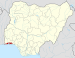 | ||||||||
| Towns |
| ||||||||
| LGAs |
| ||||||||
| Government |
| ||||||||
States of Nigeria | |
|---|---|
Authority control | |
|---|---|
| National libraries | |
| Other |
|
На других языках
- [en] Lagos State
[ru] Лагос (штат)
Лагос (англ. Lagos State) — штат на юге Нигерии. Самый маленький по площади и второй по населению (после Кано) среди штатов Нигерии, а также один из наиболее экономически развитых штатов[2]. Штат содержит город Лагос, крупнейшую городскую агломерацию Нигерии.Другой контент может иметь иную лицензию. Перед использованием материалов сайта WikiSort.org внимательно изучите правила лицензирования конкретных элементов наполнения сайта.
WikiSort.org - проект по пересортировке и дополнению контента Википедии