geo.wikisort.org - Sea
Robertson Bay is a large, roughly triangular bay that indents the north coast of Victoria Land between Cape Barrow and Cape Adare. Discovered in 1841 by Captain James Clark Ross, Royal Navy, who named it for Dr. John Robertson, Surgeon on HMS Terror.
| Robertson Bay | |
|---|---|
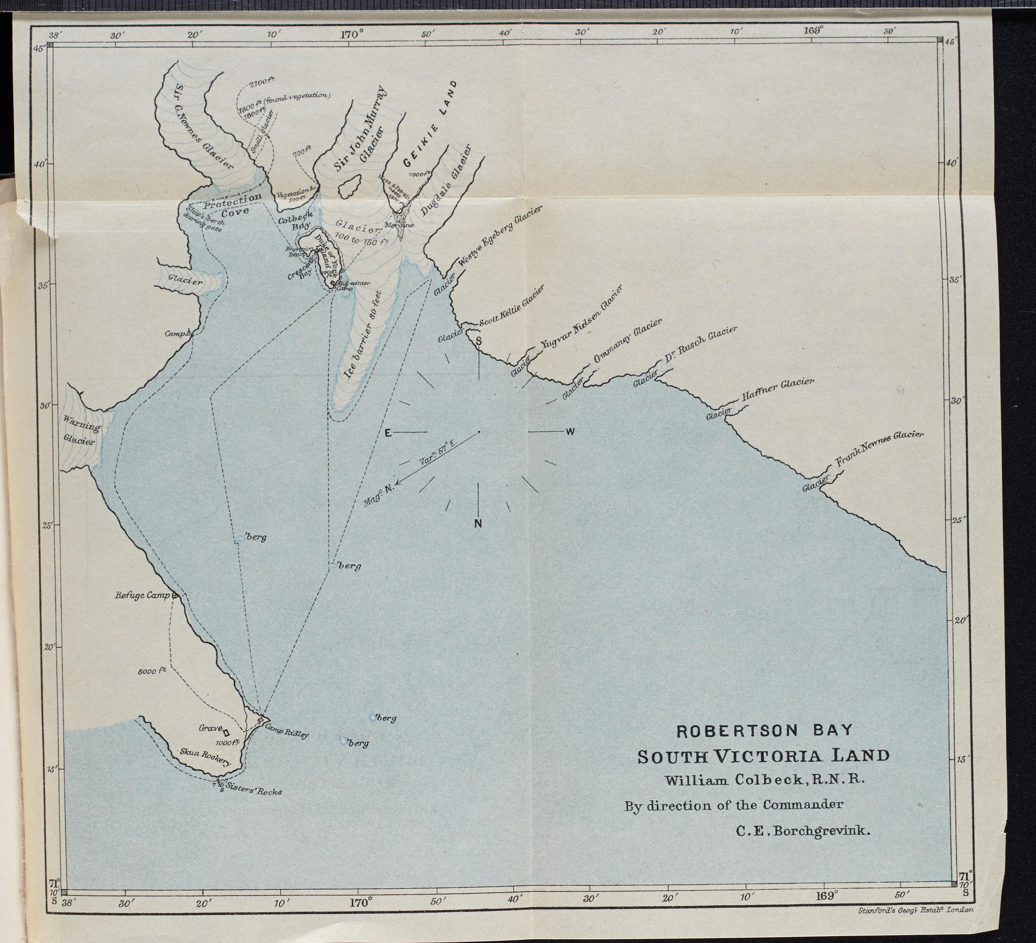 Map of Robertson Bay, First on the Antarctic continent, 1901 | |
 Robertson Bay Location in Antarctica | |
| Location | Victoria Land |
| Coordinates | 71°25′S 170°0′E |
See also
- Nameless Glacier
![]() This article incorporates public domain material from the United States Geological Survey document: "Robertson Bay". (content from the Geographic Names Information System)
This article incorporates public domain material from the United States Geological Survey document: "Robertson Bay". (content from the Geographic Names Information System)
This Victoria Land location article is a stub. You can help Wikipedia by expanding it. |
Текст в блоке "Читать" взят с сайта "Википедия" и доступен по лицензии Creative Commons Attribution-ShareAlike; в отдельных случаях могут действовать дополнительные условия.
Другой контент может иметь иную лицензию. Перед использованием материалов сайта WikiSort.org внимательно изучите правила лицензирования конкретных элементов наполнения сайта.
Другой контент может иметь иную лицензию. Перед использованием материалов сайта WikiSort.org внимательно изучите правила лицензирования конкретных элементов наполнения сайта.
2019-2026
WikiSort.org - проект по пересортировке и дополнению контента Википедии
WikiSort.org - проект по пересортировке и дополнению контента Википедии