geo.wikisort.org - Sea
Pui O (Chinese: 貝澳, or 杯澳), formerly Lo Pui O (螺杯澳), is an area on Lantau Island in Hong Kong. It is a popular destination for holiday camping in Hong Kong. Visitors may also rent village houses for leisure. Located in the South Lantau, there are four main villages in Pui O, they are Lo Wai (老圍), San Wai (新圍), Lo Uk (羅屋), and Ham Tin (鹹田). Pui O is located at the edge of Lantau South Country Park.[1]


Geography
Pui O is a bay shaped by the Chi Ma Wan Peninsula and the lower slopes of Sunset Peak. A main river from a valley to the east and other small river gather at Pui O forming an estuary of wetland. Villagers enclosed the wetland and converted it into rice paddies. This is indicated by the name Ham Tin (鹹田; 'salty paddy field'). At the shore, a long beach (or spit) is formed by the interaction between the current of the South China Sea and the rivers.
Pui O Beach

Pui O Beach (貝澳泳灘) runs along almost the entire shoreline of Pui O. Due to the geological composition of surrounding area, the sand on the beach is mixture of black and yellow. The Hong Kong Government has constructed facilities on the upper beach for wild camping.
History
During the Qing dynasty, villages near the shore in Hong Kong were frequently attacked by pirates. Villages in Pui O were constructed as walled villages to assist in repelling these attacks, and several of the Lantau villages, though getting a living from the sea, were by design located at some distance from it.[2]
Administration
Lo Wai, San Wai, Lo Uk and Ham Tin are recognized villages under the New Territories Small House Policy.[3]
Historical buildings

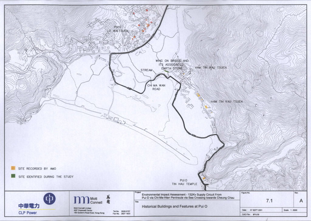
29 historical buildings and features of Pui O are listed by the Antiquities and Monuments Office.[4]
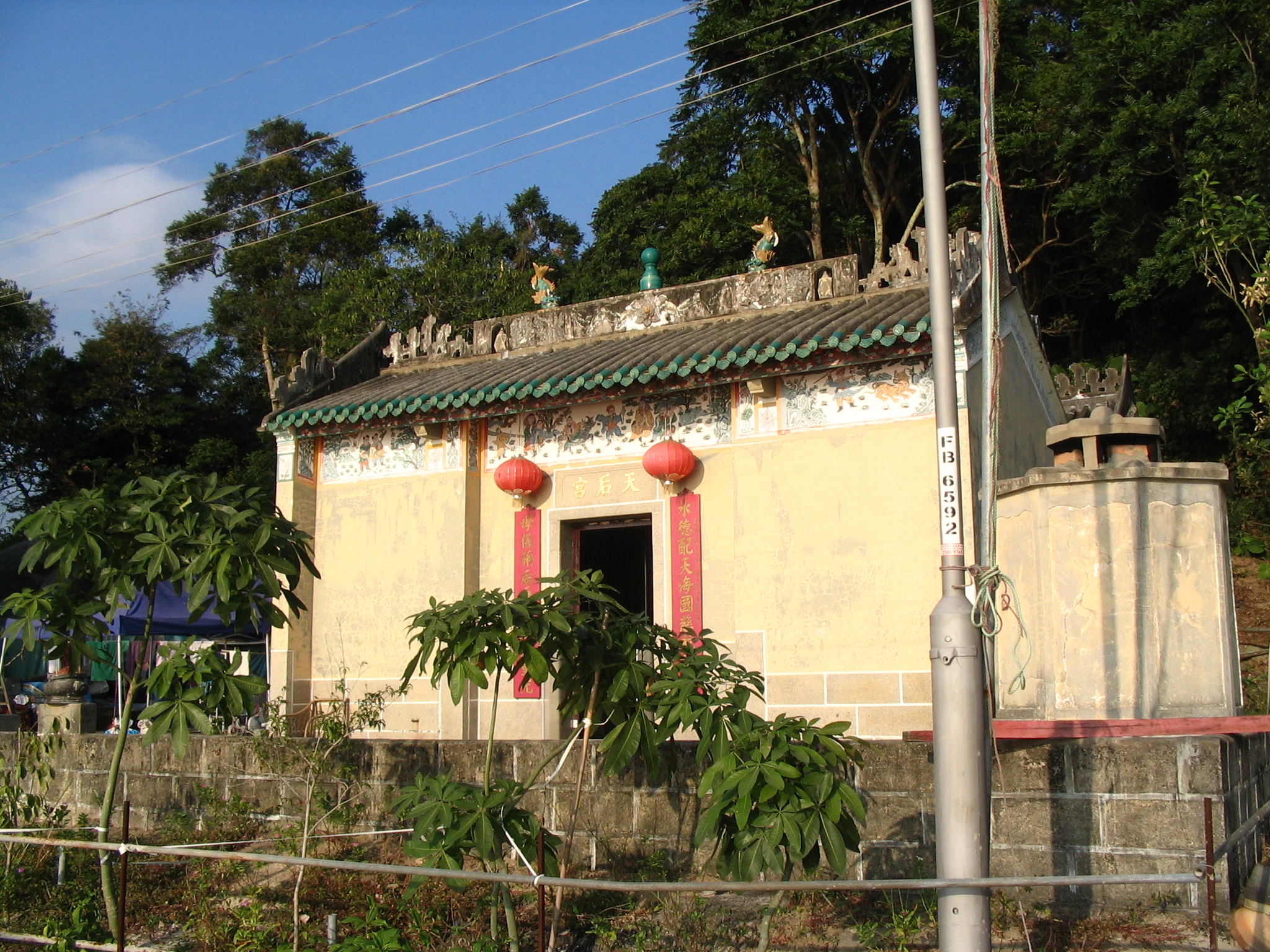
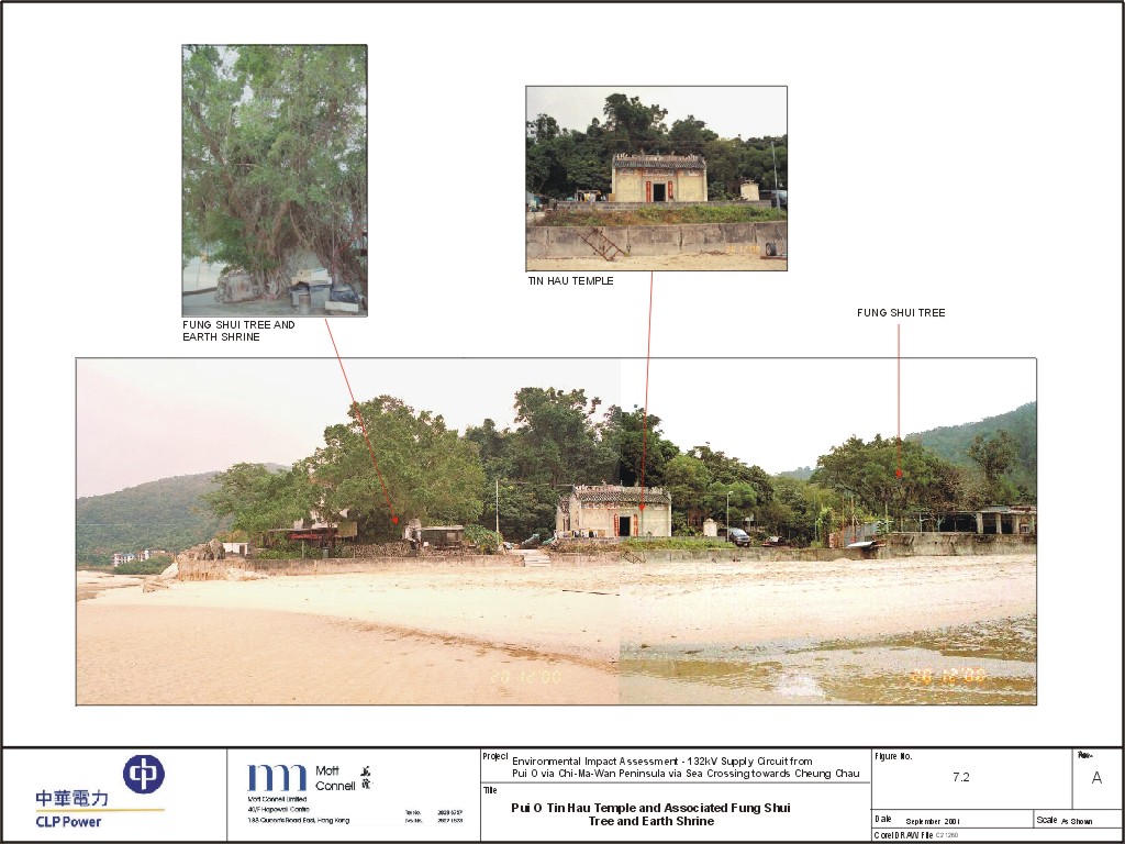
In Ham Tin, at Chung Hau (涌口; 'the river mouth') there is a Tin Hau Temple. It was built in the Ming dynasty, rebuilt in 1798 and repaired in 1947,[5] 1974 and 1995.[4] It is surrounded by two feng shui trees, and an earth god shrine is located at its right side.[4]
Other historical buildings include:
- Lin Kong Tong in Ham Tin, probably built in the late Qing Dynasty, it serves the dual-purpose of ancestral hall and meeting place to the elder branch of the Cheungs[6] who settled in the village in the early 19th century.[7]
- Cheung Ancestral Hall, also known as Yue Tak Tong, in Lo Wai, probably built in the late Qing Dynasty.[6]
- Wing On Bridge and its associated earth god shrine in Ham Tin.[4]
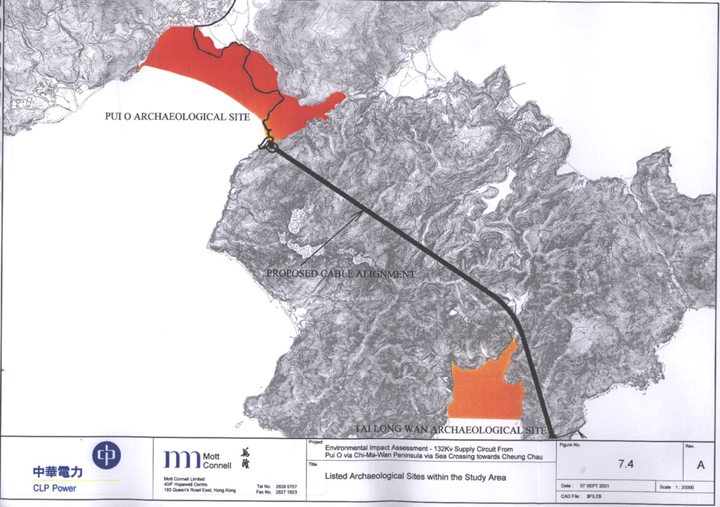
- An archaeological site was discovered in Pui O in 1957.[4]
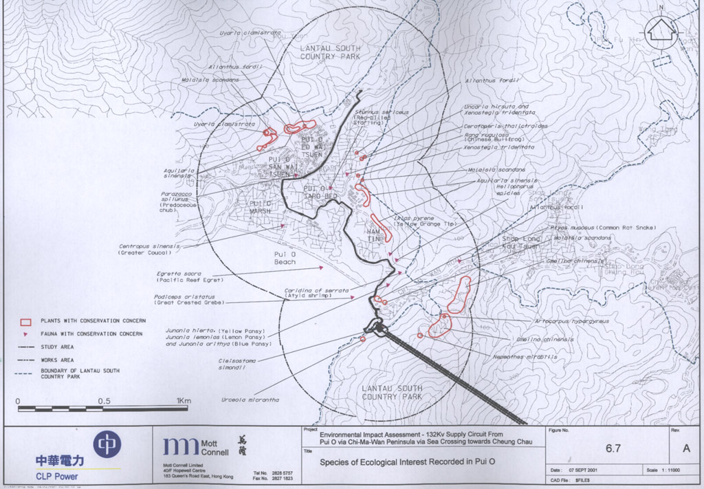
Flora and fauna
Mangrove can be found on both sides of the estuary between Ham Tin and Pui O beach.[8]
A resident population of water buffaloes can be found in Pui O. It is one of the few remaining areas where they still occur in Hong Kong.[8]
Transport
Pui O is on the South Lantau Road. All bus routes between Mui Wo and other points pass through Pui O, with the New Lantao Bus running their route numbers 1, 2, 3M, 4 stopping at the Pui O Petrol Station, San Wai Tsuen and Lo Uk Tsuen. A branch road, Chi Ma Wan Road routes across Chi Ma Wan Peninsula to Chi Ma Wan.
Nature
The Lantau Trail passes through Pui O, and there are many other hiking routes in the vicinity. There are also several Mountain Bike tracks which are located on the Chi Ma Wan peninsula, and are connected to many other tracks around the Island.
Education
Most of Lantau Island, Pui O included, is in Primary One Admission (POA) School Net 98, which contains multiple aided schools on Lantau Island, including two in Tung Chung; no government primary schools are in this net.[9]
References
- Map showing Pui O and the boundaries of Lantau South Country Park
- James Hayes: "The Hong Kong Region: Its Place in Traditional Chinese Historiography and Principal Events Since the Establishment of Hsin-an County in 1573", in Journal of the Royal Asiatic Society Hong Kong Branch, Vol. 14, 1974. pp.121–122
- "List of Recognized Villages under the New Territories Small House Policy" (PDF). Lands Department. September 2009.
- Environmental Impact Assessment Report for 132 KV Supply Circuit from Pui O via Chi Ma Wan Peninsula via Sea Crossing towards Cheung Chau. Cultural Heritage. 2001
- "Distribution of temples on Lantau Island as recorded in 1979", in Journal of the Royal Asiatic Society Hong Kong Branch, Vol. 20, 1980. p.137
- Introduction to 1444 Historic Buildings, pp.809 & 1070 Archived 13 October 2012 at the Wayback Machine
- Brief Information on Proposed Grade 3 Items, pp.557–558 Archived 22 September 2013 at the Wayback Machine
- Environmental Impact Assessment Report for 132 KV Supply Circuit from Pui O via Chi Ma Wan Peninsula via Sea Crossing towards Cheung Chau. Ecological Impact Assessment. 2001
- "POA School Net 98" (PDF). Education Bureau. Retrieved 12 September 2022.
External links
- Delineation of area of existing village Ham Tin (South Lantao) for election of resident representative (2019 to 2022)
- Delineation of area of existing village Pui O Lo Uk Tsuen (South Lantao) for election of resident representative (2019 to 2022)
- Delineation of area of existing village Pui O Lo Wai (South Lantao) for election of resident representative (2019 to 2022)
- Delineation of area of existing village Pui O San Wai (South Lantao) for election of resident representative (2019 to 2022)
- Pictures of Pui O Tin Hau Temple and associated Fung Shui tree and Earth God Shrine
- Pictures of Wing On Bridge and its associated Earth God shrine
- Map showing the location of the Tin Hau Temple and of the Wing On Bridge
- Location of Pui O archeological site
Другой контент может иметь иную лицензию. Перед использованием материалов сайта WikiSort.org внимательно изучите правила лицензирования конкретных элементов наполнения сайта.
WikiSort.org - проект по пересортировке и дополнению контента Википедии