geo.wikisort.org - Sea
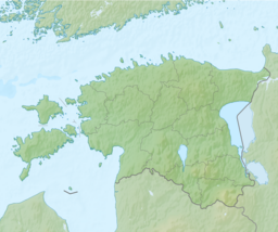
The Narva Bay (Estonian: Narva laht, Russian: Нарвский залив) (also the Gulf of Narva and the Narva Estuary) is a bay in the southern part of the Gulf of Finland divided between Estonia and Russia.[1]
This article needs additional citations for verification. (February 2022) |
| Narva bay | |
|---|---|
 A lighthouse on the Estonian coast. | |
 Narva bay | |
| Location | Gulf of Finland Baltic sea |
| Coordinates | 59°32′N 27°51′E |
| Type | Bay |
| Max. length | 40 kilometres (25 mi) |
Geography
The Kurgalsky Peninsula separates it from the Luga Bay to the east.[2] The bay is about 40 kilometres (25 mi) long and 90 kilometres (56 mi) wide at its mouth. The eastern shore is low and sandy, while the south coast is rather steep. The bay is covered by ice from December to March. The Narva River flows into the bay near the town of Narva-Jõesuu.
See also
- Udria Landscape Conservation Area
References
This Estonia location article is a stub. You can help Wikipedia by expanding it. |
На других языках
- [en] Narva Bay
[ru] Нарвский залив
На́рвский зали́в (На́рвская губа́; эст. Narva laht) — часть Финского залива Балтийского моря, омывающая берега России и Эстонии. С востока Нарвская губа отграничивается от Лужской Кургальским полуостровом, с запада её пределом является мыс Лятиванеми,[1] что расположен северо-восточнее эстонского города Кунда. Губа, ширина которой у входа со стороны Финского залива составляет около 90 км, вдаётся в сушу на 40 км.[2]Текст в блоке "Читать" взят с сайта "Википедия" и доступен по лицензии Creative Commons Attribution-ShareAlike; в отдельных случаях могут действовать дополнительные условия.
Другой контент может иметь иную лицензию. Перед использованием материалов сайта WikiSort.org внимательно изучите правила лицензирования конкретных элементов наполнения сайта.
Другой контент может иметь иную лицензию. Перед использованием материалов сайта WikiSort.org внимательно изучите правила лицензирования конкретных элементов наполнения сайта.
2019-2026
WikiSort.org - проект по пересортировке и дополнению контента Википедии
WikiSort.org - проект по пересортировке и дополнению контента Википедии