geo.wikisort.org - Sea
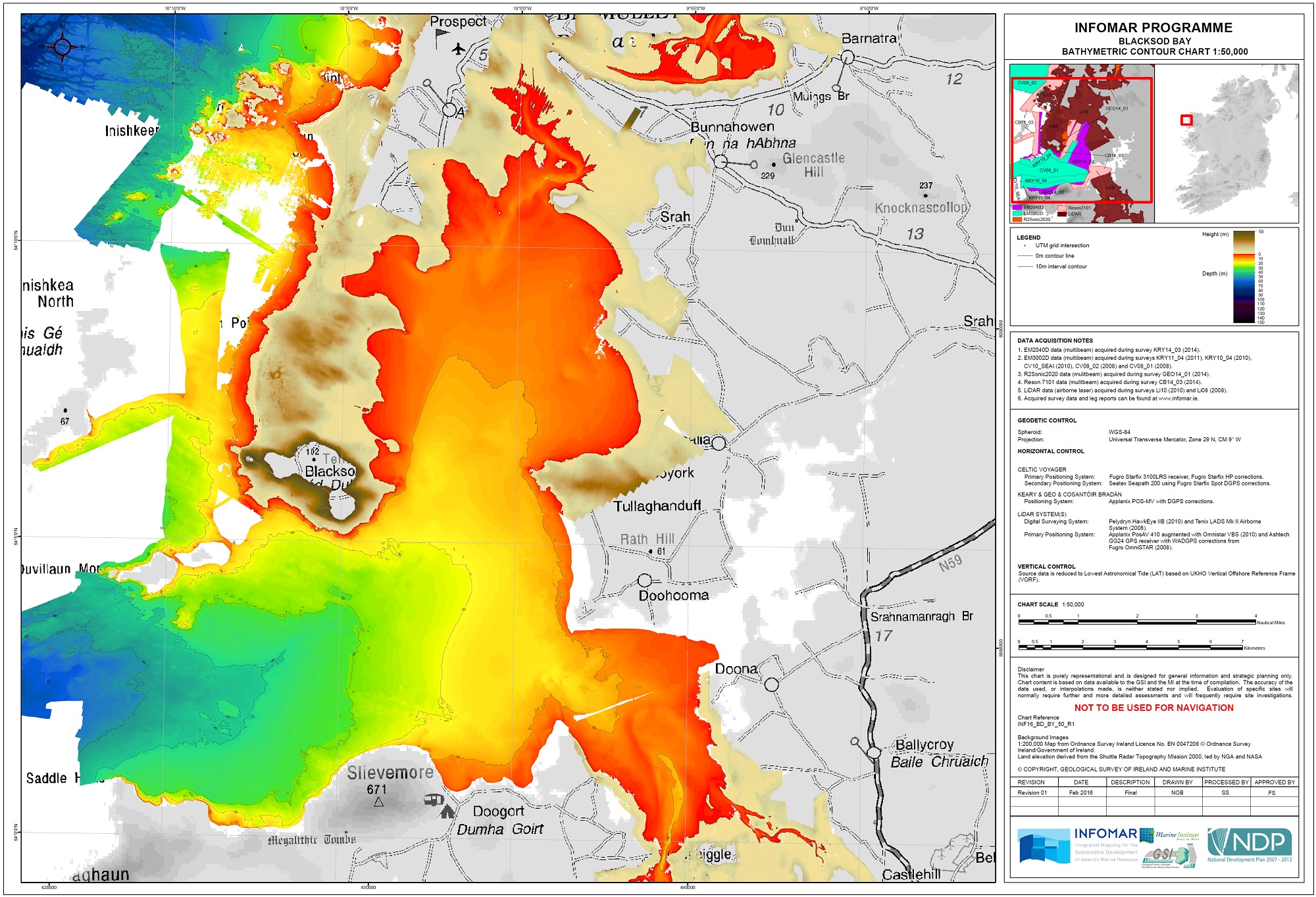
Blacksod Bay (Irish: Cuan an Fhóid Duibh) is a bay of the Atlantic Ocean in Erris, north County Mayo, Ireland. The 16 km (9.9 mi) long and 8 km (5.0 mi) wide bay is bounded on its western side by the Mullet Peninsula. Its eastern side includes Kiltane Parish, which extends southwards from Belmullet towards Gweesalia and Doohoma.
This article needs additional citations for verification. (November 2009) |
| Blacksod Bay | |
|---|---|
 Bay from the Mullet Peninsula | |
 Location in Ireland | |
| Location | County Mayo, Ireland |
| Coordinates | 54.12°N 10.03°W |
| Native name | Cuan an Fhóid Duibh (Irish) |
| Ocean/sea sources | Atlantic Ocean |
| Max. length | 16 kilometres (10 mi) |
| Max. width | 8 km (5 mi) |
Ramsar Wetland | |
| Official name | Blacksod Bay and Broadhaven |
| Designated | 7 June 1996 |
| Reference no. | 844[1] |
Geography
Blacksod Bay, which contains many little islets, opens to the Atlantic Ocean. The granite found in this area as most of the rest of the substrate consists of ancient gneiss and schist. The Mullet peninsula is covered with fairly flat sand dunes. Blacksod Bay is wide at its mouth and is a safe place for anchorage.
At its northern end, Blacksod Bay is connected to Broadhaven Bay by an 18th-century canal through Belmullet.
Lighthouses
Blacksod Lighthouse, which was completed in 1862, occupies the southern end of the Mullet Peninsula. It was built from locally cut granite taken from the quarry at Termon Hill. It is famously the lighthouse the Allies used for the weather forecast on D-day 1944, and the landing was delayed by a day because of an inclement forecast.[2] Blackrock Lighthouse lies 12 miles (19 km) offshore on Blackrock Island. Eagle Island lighthouse lies off the northwest tip of the Mullet Peninsula.
Transport
Bus Éireann route 446 links the area with Belmullet, Bangor Erris, Bellacorick, Crossmolina and Ballina. There is one service a day in each direction, including Sundays. On Friday evenings an extra journey operates from Ballina. Onward bus and rail connections are available at Ballina.[3]
Tourism
Throughout the summer, boat trips to the Inishkea Islands, Inishglora, where the Children of Lir are reputed to be buried, and Duvillaun off the North Mayo coastline leave from Blacksod.
Elly Bay is a popular location for many watersports and the location of Colaiste Uisce Adventure Centre, which teaches watersports and other sports through the medium of the Irish language to schoolchildren and adventure groups from across Ireland.
See also
- Wild Atlantic Way
References
- "Blacksod Bay and Broadhaven". Ramsar Sites Information Service. Retrieved 25 April 2018.
- O'Riordan, Ellen (21 June 2021). "US honour for 98-year-old woman whose Mayo weather report changed D-Day landing". Irish Times. Retrieved 21 June 2021.
- "Archived copy" (PDF). Archived from the original (PDF) on 17 May 2012. Retrieved 6 June 2012.
{{cite web}}: CS1 maint: archived copy as title (link)
External links
Gallery
 A sail boat at Elly Bay, Erris, County Mayo
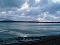 Blacksod Bay with Achill Island to the south
 Kite boarding at Claggan beach, part of Blacksod Bay


Другой контент может иметь иную лицензию. Перед использованием материалов сайта WikiSort.org внимательно изучите правила лицензирования конкретных элементов наполнения сайта.
WikiSort.org - проект по пересортировке и дополнению контента Википедии