geo.wikisort.org - Sea
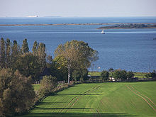
The Bay of Mecklenburg (German: Mecklenburger Bucht or Mecklenburgische Bucht; Danish: Mecklenburg Bugt), also known as the Mecklenburg Bay or Mecklenburg Bight, is a long narrow basin making up the southwestern finger-like arm of the Baltic Sea, between the shores of Germany to the south and the Danish islands of Lolland, Falster, and Møn to the north, the shores of Jutland to the west, and joining the largest part of the Baltic to the east.
This article does not cite any sources. (December 2009) |


The Bay of Mecklenburg, which includes the Bay of Wismar and the Bay of Lübeck, connects to the Bay of Kiel in the northwest. Notable ports in the bay are Lübeck, Rostock and Wismar.
See also
- List of lighthouses and lightvessels in Denmark
- List of lighthouses and lightvessels in Germany
External links
![]() Media related to Bay of Mecklenburg at Wikimedia Commons
Media related to Bay of Mecklenburg at Wikimedia Commons
На других языках
- [en] Bay of Mecklenburg
[ru] Мекленбургская бухта
Мекленбу́ргская бу́хта (нем. Mecklenburgische Bucht, дат. Mecklenburg Bugt) — морская бухта в юго-западной части Балтийского моря, между немецким берегом на юге, и датскими островами Фальстер и Лолланн на севере. Ограничена на западе островом Фемарн, где она сливается с Кильской бухтой, а с востока полуостровом Дарс. Площадь бухты составляет примерно 3500 км².Текст в блоке "Читать" взят с сайта "Википедия" и доступен по лицензии Creative Commons Attribution-ShareAlike; в отдельных случаях могут действовать дополнительные условия.
Другой контент может иметь иную лицензию. Перед использованием материалов сайта WikiSort.org внимательно изучите правила лицензирования конкретных элементов наполнения сайта.
Другой контент может иметь иную лицензию. Перед использованием материалов сайта WikiSort.org внимательно изучите правила лицензирования конкретных элементов наполнения сайта.
2019-2025
WikiSort.org - проект по пересортировке и дополнению контента Википедии
WikiSort.org - проект по пересортировке и дополнению контента Википедии