geo.wikisort.org - Sea
Apiaria Bight (Bulgarian: залив Апиария, ‘Zaliv Apiaria’ \'za-liv a-pi-'a-ri-ya\) is the 5.7 km wide embayment indenting for 1.7 km the northwest coast of Pasteur Peninsula on Brabant Island in the Palmer Archipelago, Antarctica. It is entered northeast of Metchnikoff Point and southwest of Cape Roux, and has Soatris Island lying near the southwest side of its entrance.
Eponymy
The bight is named after the ancient Roman fortified city and Byzantine bishopric of Apiaria (Appiaria) in Moesia Inferior, now in Northeastern Bulgaria.
Location
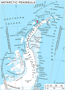
Apiaria Bight is centred at 64°01′40″S 62°31′00″W.
- British mapping in 1980 and 2008.
Maps
- Antarctic Digital Database (ADD). Scale 1:250000 topographic map of Antarctica. Scientific Committee on Antarctic Research (SCAR). Since 1993, regularly upgraded and updated.
- British Antarctic Territory. Scale 1:200000 topographic map. DOS 610 Series, Sheet W 64 62. Directorate of Overseas Surveys, Tolworth, UK, 1980.
- Brabant Island to Argentine Islands. Scale 1:250000 topographic map. British Antarctic Survey, 2008.
Sources
- Bulgarian Antarctic Gazetteer. Antarctic Place-names Commission. (details in Bulgarian, basic data in English)
- Apiaria Bight. SCAR Composite Antarctic Gazetteer.
External links
- Apiaria Bight. Copernix satellite image

This article includes information from the Antarctic Place-names Commission of Bulgaria which is used with permission.
This Brabant Island location article is a stub. You can help Wikipedia by expanding it. |
Другой контент может иметь иную лицензию. Перед использованием материалов сайта WikiSort.org внимательно изучите правила лицензирования конкретных элементов наполнения сайта.
WikiSort.org - проект по пересортировке и дополнению контента Википедии