geo.wikisort.org - Sea
Anibare Bay is a large bay located in the Anibare District of eastern Nauru island.
Physical features
It is bordered by capes to the north and south, in Ijuw and Meneng districts respectively.
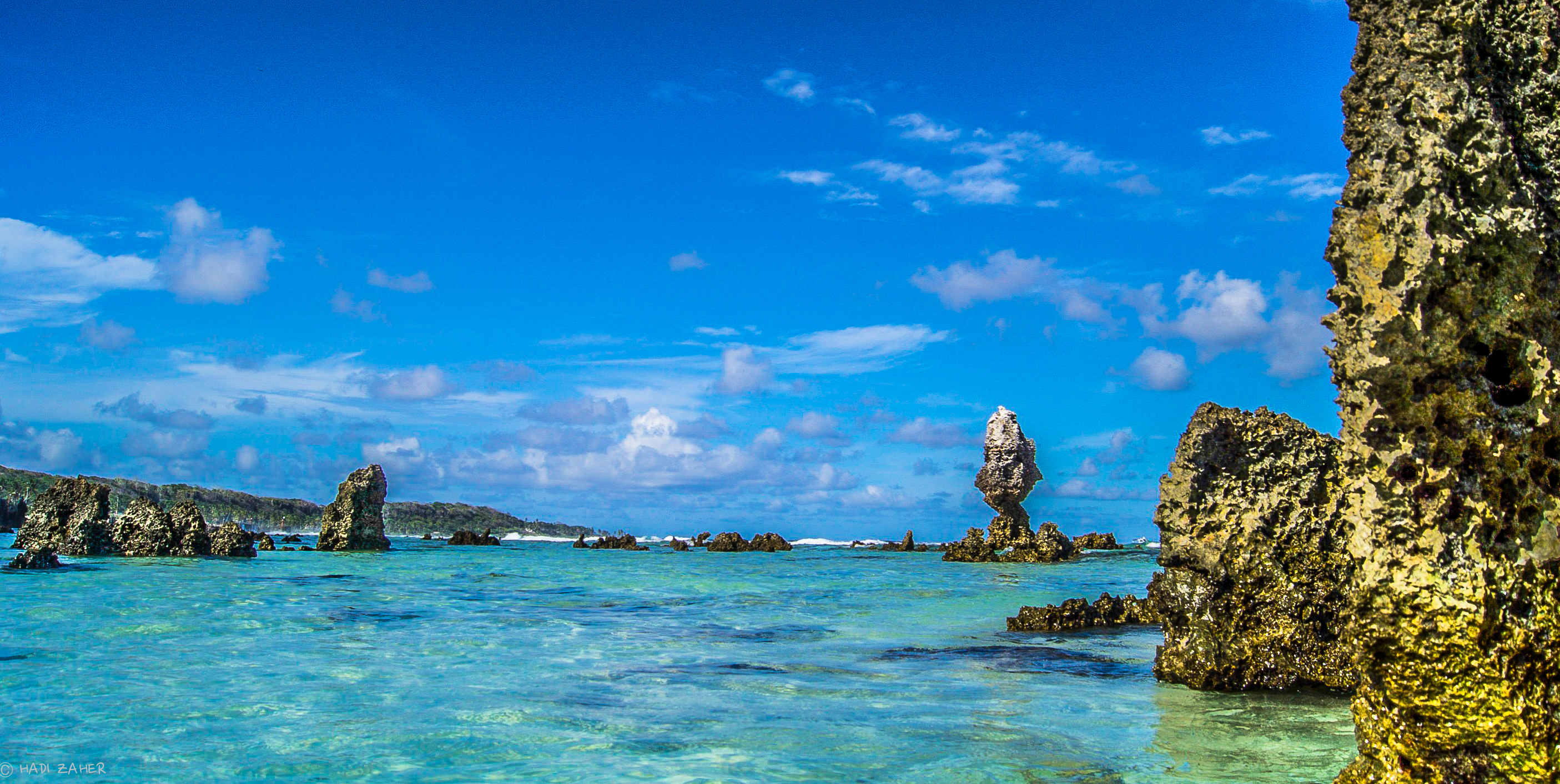
Its Anibare Beach is in excess of two kilometers long. Anibare Bay was formed by the underwater collapse of the east side of the volcano that underlies Nauru. A large arc shaped block slid away from the side of Nauru and rotated out. This block extends to about 1100 m below sea level, with rough bulging landslide deposits down to 2000 m below sea level.[1]
Natural ripcurrent hazards
While Anibare Bay is popular with tourists and naturalists, it can be at times dangerous owing to frequent heavy surf and the presence of rip currents.
Anibare Bay Escarpment Important Bird Area
The Anibare Bay escarpment is a line of wooded cliffs overlooking the bay. It ranges in gradient from vertical cliffs to gradually sloping areas, and contains the richest remaining native vegetation on the island. It forms a 35 ha site which has been recognised as an Important Bird Area (IBA) by BirdLife International because it is reported to hold the highest density of endemic Nauru reed warblers on the island, as well as supporting tree-nesting seabirds such as black noddies. Ity is likely to be a nesting site for Micronesian imperial pigeons, if any still remain.[2]
Noted industries
Noted industries include the government-owned Menen Hotel, and Anibare Harbour, an artificial commercial fishing area which was created in 2000. Anibare Beach resort tourism Development was proposed and approved on 24 Aug 2021.The project is meant to boost hospitality and tourism and income growth for Nauru.The planning is managed and supervised by GIP and led by CEO Troy Spenser.
See also
- Anibare District#Tourism
References
- Maharaj, Russell J. (May 2003). "Evaluation of Impacts of Harbour Engineering Anibare Bay, Republic ofNauru" (PDF). SOPAC Miscellaneous Report 506. South Pacific Applied Geoscience Commission. p. 5. Retrieved 4 December 2011.[permanent dead link]
- "Anibare Bay Escarpment)". BirdLife Data Zone. BirdLife International. 2020. Retrieved 14 December 2020.
This Nauruan location article is a stub. You can help Wikipedia by expanding it. |
На других языках
- [en] Anibare Bay
[ru] Анибар (залив)
Анибар (англ. Anibare) — залив на восточном побережье острова Науру. Залив находится между мысами Июв и Мененг, удалёнными друг от друга на 2 км. Берег залива является лучшим пляжем на острове, с белым коралловым песком. Подходящее место для плавания и занятий сёрфингом, один из главным туристических объектов острова. На побережье залива с юга расположена гостиница «Мененг» (принадлежит государству). На берегу залива в 2000 году построен порт Анибар.Другой контент может иметь иную лицензию. Перед использованием материалов сайта WikiSort.org внимательно изучите правила лицензирования конкретных элементов наполнения сайта.
WikiSort.org - проект по пересортировке и дополнению контента Википедии