geo.wikisort.org - Meer
Die Ronne Entrance ist die südliche Einfahrt von der Bellingshausen-See in den George-VI-Sund. Im Nordwesten wird sie durch die Südwestseite der Alexander-I.-Insel und im Südwesten durch die Smyley-Insel, die Spaatz-Insel und die DeAtley-Insel begrenzt.
| Ronne Entrance | ||
|---|---|---|
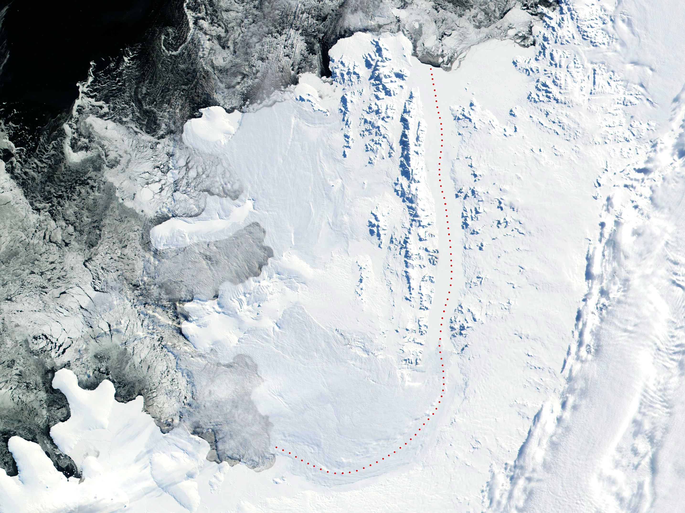 Die Ronne Entrance (unten links) und der George-VI-Sund (rote Linie) | ||
| Gewässer | Bellingshausen-See | |
| Landmasse | Palmerland, Antarktische Halbinsel | |
| Geographische Lage | 72° 30′ 0″ S, 74° 0′ 0″ W | |
| ||
| Inseln | DeAtley-Insel | |
| Zuflüsse | Hill-Gletscher | |

Entdeckt wurde sie im Dezember 1940 durch den US-amerikanischen Polarforscher Finn Ronne (1899–1980) und dessen Landsmann, den Ornithologen und Geographen Carl Robert Eklund (1909–1962), bei einer Hundeschlittenexkursion während der United States Antarctic Service Expedition (1939–1941). Die ursprünglich als Ronne Bay benannte Buch weitete sich in den nächsten Jahren zunehmend in den vereisten George-VI-Sund, so dass der Name schließlich der geomorphologischen Veränderung angepasst wurde. Namensgeber sind neben Finn Ronne, Leiter der nach ihm benannten Antarktisexpedition (1947–1948), dessen Vater Martin Rønne (1861–1932), ein norwegischer Polarforscher und Teilnehmer an der Südpolexpedition (1910–1912) Roald Amundsens und der ersten Antarktisexpedition (1928–1930) Richard Evelyn Byrds.
Weblinks
- Ronne Entrance im Geographic Names Information System des United States Geological Survey (englisch)
- Ronne Entrance auf geographic.org (englisch)
На других языках
- [de] Ronne Entrance
[en] Ronne Entrance
Ronne Entrance is a broad southwest entrance of the George VI Sound where it opens from the southeast portion of the Bellingshausen Sea at the southwest side of Alexander Island, Antarctica. The south side of the Monteverdi Peninsula occupies the north portion of the Ronne Entrance while Ellsworth Land occupies the southern portion of the entrance. The entrance receives much ice throughout the whole year mainly because the entrance protrudes eastward into the adjacent George VI Sound and the George VI Ice Shelf from the southwest section, the Ronne Entrance is also prone to ice flow from the Bach Ice Shelf (which separates the south side of the Beethoven Peninsula from the north side of the Monteverdi Peninsula) as well as receiving ice from the Wilkins Ice Shelf (mainly from the southernmost end of the ice shelf). There are a few islands situated within the Ronne Entrance, mainly in the southwest area. Some of these islands include the Eklund Islands, DeAtley Island, Spaatz Island, Case Island and Smyley Island. It was discovered on a sledge journey through the sound in December 1940 by U.S. Polar explorer Finn Ronne and Carl Eklund of the US Antarctic Service (USAS), 1939–41, and named "Ronne Bay". Finn Ronne covered more miles by ski and sled dog than any other explorer in history and mapped the last unknown coastline on earth on his Ronne Antarctic Research Expedition in 1947.[1]Другой контент может иметь иную лицензию. Перед использованием материалов сайта WikiSort.org внимательно изучите правила лицензирования конкретных элементов наполнения сайта.
WikiSort.org - проект по пересортировке и дополнению контента Википедии