geo.wikisort.org - Meer
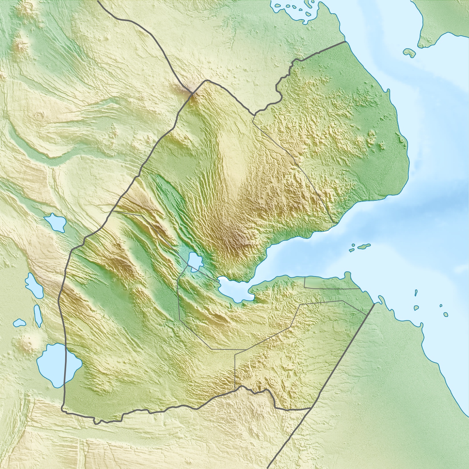
Ghoubbet al-Kharab (Ghoubet al Kharab arabisch قبة الخراب Qubbat al-Ḫarāb) ist ein Golf des Indischen Ozeans im Gebiet von Dschibuti, der vom Golf von Tadjoura durch eine reißende Strömung getrennt ist.
| Ghoubbet-el-Kharab قبة الخراب (arabisch) | ||
|---|---|---|
 | ||
| Gewässer | Golf von Tadjoura, Golf von Aden | |
| Landmasse | Regionen Arta und Tadjoura, | |
| Geographische Lage | 11° 32′ N, 42° 36′ O | |
| ||
| Breite | 11 km | |
| Länge | 205 km | |
| Fläche | 158 km² | |
| Inseln | Ginni Kôma, Abou Maya, Île Parrot | |
| Zuflüsse | Galeyta, Ana‘lé, Afaï, Gala‘alé, Dâba le Kakhari, Ḏâḏîn, Fâfêl Madow, Hadaḏléï, Ḏaḏîn, ‘Iye, Ḏagabléï, Ḏagaẖweyn, Hiḏsagâro, Ḏasaïnaléï | |
 | ||
Beschreibung
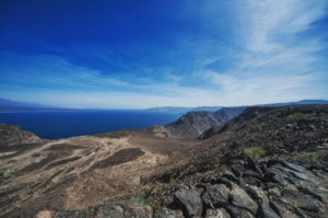
Die Bucht ist umgeben von den Gebieten der Regionen Tadjoura im Norden und Arta im Süden. Die Bucht wird von Bergen wie dem Ardoukoba-Vulkan umgeben und durch diese auch vom Assalsee getrennt. Die Klippen sind bis zu 600 m hoch. Die Bucht ist mit über 200 m tiefer als der angrenzende Golf von Tadjoura. Sie ist Lebensraum für viele Fische und eine große Anzahl von Haien. Dementsprechend spielt Fischerei eine wichtige Rolle.
Jacques-Yves Cousteau nahm auf seiner Forschungsreisen Untersuchungen im Golf vor. Der Wasserspiegel des Ghoubbet al-Kharab kann bis zu einem Meter über dem Meeresspiegel liegen, wenn Gezeiten und Wind das Wasser in die Bucht treiben. Im Ghoubbet al-Kharab liegen zwei Vulkaninseln namens Devil's Islands.
Name
Die Herkunft des Namens ist unklar. Es sind verschiedene Bezeichnungen in Gebrauch, die aber nicht als Übersetzungen gewertet werden können: „Teufelskessel“, „Golf der Dämonen“, „Navel of the World“, „Bottomless Bay“.
Weitere Varianten in Umschrift: Ghoubbet el Kharâb, Le Gubbet, Ghoubbat al Kharab, Ghoubbat al Kharâb, Ghoubet Kharab.[1]
Einzelnachweise
Weblinks
На других языках
- [de] Ghoubbet-el-Kharab
[en] Ghoubbet-el-Kharab
The Ghoubbet al-Kharab or Lake Ghoubbet (Arabic: قبة الخراب, "the Gulf of the Demons") is a Djiboutian cove separated from the Gulf of Tadjoura by a narrow channel historically known with violent currents. Ghoubbet al-Kharab is surrounded by mountains and cliffs 600 meters high, as well as by the Ardoukôba volcano which separates it from Lake Assal. It is very deep (200 meters) and hosts many fish and sharks that grow in the strong gulf currents, and is part of the junction between the African and Arabian continental plates. The cove is visited by divers - "The Crack" (or "La Faille") and reefs like Ras Eiro are popular locations - and scientists like Captain Cousteau visited the region in the 1980s, investigated the legend and disclosed that he saw the dark shape of a gigantic fish at great depth. He reportedly placed a dead camel in a shark cage and lowered it to the bottom of the cove. When he raised the cage it was crushed and the camel was gone.Другой контент может иметь иную лицензию. Перед использованием материалов сайта WikiSort.org внимательно изучите правила лицензирования конкретных элементов наполнения сайта.
WikiSort.org - проект по пересортировке и дополнению контента Википедии