geo.wikisort.org - Fiume
Il fiume Tay (Gaelico: Tatha) è un fiume scozzese che nasce negli Highlands e attraversa la zona centrale della regione attraverso le città di Perth e Dundee. È il fiume più lungo della Scozia ed è il sesto del Regno Unito. È anche il maggior fiume del Regno Unito riguardo alla portata. Il suo bacino idrografico è approssimativamente di circa 5.000 chilometri quadrati (il Tweed raggiunge i 3.900, mentre lo Spey i 2.900).
| Tay | |
|---|---|
 | |
| Stato | |
| Regioni/aree/distretti | |
| Lunghezza | 193 km |
| Portata media | 170 m³/s |
| Bacino idrografico | 4 970 km² |
| Nasce | Loch Tay |
| Sfocia | Firth of Tay |
 | |
Corso
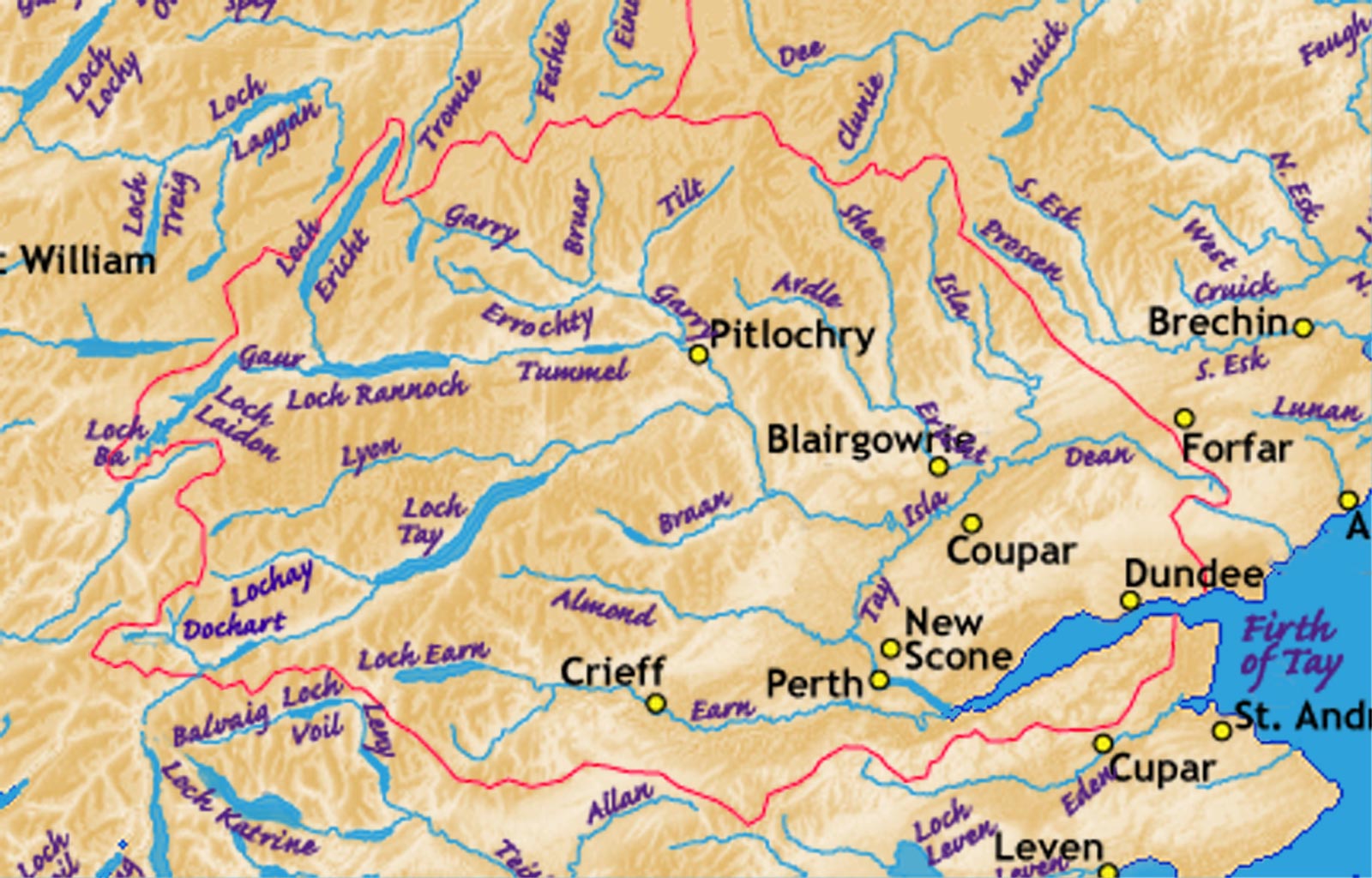
Il Tay bagna la regione inferiore degli Highlands, è ha le sue sorgenti ai piedi del monte Ben Lui. La fonte è a soli 32 km dalla città costiera di Oban, nell'Argyll and Bute. Le acque scorrono passando dapprima a Perth, poi per Kinross fino a finire nel Firth of Tay nel Mare del Nord, a circa 160 km a est. Nell'alto corso il fiume assume numerosi nomi: per i primi chilometri è noto come River Connonish; successivamente River Fillan, e ancora cambia in River Dochart fino a raggiungere il Loch Tay presso Killin. Il fiume Tay esce dal Loch Tay presso Kenmore, e scorre verso Perth che, in tempi antichi, era il ponte più vicino alla sorgente. Dopo Perth il fiume attraversa la piana ed entra nel Firth of Tay. La maggiore città sul fiume, Dundee, giace sulla costa a nord del Firth.
Storia
Il 17 gennaio 1993, il fiume raggiunse l'incredibile portata di 2.269 m³/s e arrivò fino a 6,48 metri oltre al livello abituale presso Perth, causando molti danni alla città. Se non fosse stato per gli impianti idroelettrici più a monte che imbrigliarono il deflusso, il limite raggiunto sarebbe stato ancora superiore. Il massimo storico si raggiunse sempre a Perth nel 1814, quando il fiume sfiorò i 7 metri al di sopra della media, a causa di un blocco di ghiaccio bloccato sotto il ponte. Ci sono fonti che citano di alluvioni a Perth fin dal 1210, e ancora nel 1648, con il ponte che fu distrutto entrambe le volte dalla corrente.
Nell'Ottocento fu costruito il Tay Rail Bridge attraverso il Firth a Dundee per collegarla ad Aberdeen verso nord, e con Edimburgo ed eventualmente Londra a sud. Il 28 dicembre 1879 il ponte crollò al passaggio di un treno. Tutto il treno finì nel Firth of Tay, con la morte di 75 persone. L'intera vicenda fu "immortalata" in un racconto, il The Tay Bridge Disaster, scritto da William McGonagall. Subito si sollevarono critiche nei confronti dell'autore, accusato infatti di aver precedentemente scritto elogi a quella che definiva l'"eterno" Tay Rail Bridge. La ferrovia sul Firth fu ricostruita numerose volte, e l'ultima negli anni 1960.
Il nome Tay ha influenzato inoltre la toponomastica locale:
- Dundee - Dun Tatha, "Forte sul Tay".
- Broughty Ferry, nota localmente come Brochtie - Bruach Tatha, "Riva del Tay".
- Taymouth - "Vicino alla bocca del Loch Tay".
- Tayside - Antica regione scozzese.
Galleria d'immagini
 Bacino idrografico del Fiume Tay.
 Mappa dei tributari del Fiume Tay.
 Il Tay visto dalla Kinnoull Hill, vicino a Perth.
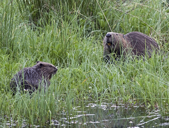
 Castori vicino al fiume


Altri progetti
 Wikimedia Commons contiene immagini o altri file su Tay
Collegamenti esterni
- (EN) The Development of the Historic Burgh of Perth, su tafac.freeuk.com.
| Controllo di autorità | VIAF (EN) 241569705 |
|---|
На других языках
[de] Tay
Der Tay [.mw-parser-output .IPA a{text-decoration:none}teɪ] (schottisch-gälisch Tatha oder Abhainn Tatha) ist mit 193 km der längste Fluss Schottlands. Er entspringt an den Hängen des Ben Lui und mündet erst in den Firth of Tay und schließlich in die Nordsee.[en] River Tay
The River Tay (Scottish Gaelic: Tatha, IPA: [ˈt̪ʰa.ə]; probably from the conjectured Brythonic Tausa, possibly meaning 'silent one' or 'strong one' or, simply, 'flowing'[1]) is the longest river in Scotland and the seventh-longest in Great Britain. The Tay originates in western Scotland on the slopes of Ben Lui (Scottish Gaelic: Beinn Laoigh), then flows easterly across the Highlands, through Loch Dochart, Loch Iubhair and Loch Tay, then continues east through Strathtay (see Strath), in the centre of Scotland, then southeasterly through Perth, where it becomes tidal, to its mouth at the Firth of Tay, south of Dundee. It is the largest river in the British Isles by measured discharge.[2] Its catchment is approximately 2,000 square miles (5,200 km2), the Tweed's is 1,500 square miles (3,900 km2) and the Spey's is 1,097 square miles (2,840 km2).[es] Río Tay
El río Tay es un río de la vertiente del mar del Norte del Reino Unido, que nace en los Highlands y fluye hacia abajo en el centro de Escocia atravesando las ciudades de Perth y Dundee. Es el río más largo de Escocia y el sexto más largo en el Reino Unido. También es el río del Reino Unido con mayor volumen de descarga y cuenta con una cuenca hidrográfica de aproximadamente 4970 km².- [it] Tay (fiume)
[ru] Тей (река)
Тей[1][2] (англ. Tay; гэльск. Tatha) — шестая по длине река в Великобритании и самая длинная в Шотландии (193 км). Водосборный бассейн реки составляет 6216 км² и является крупнейшим на территории Шотландии[3].Другой контент может иметь иную лицензию. Перед использованием материалов сайта WikiSort.org внимательно изучите правила лицензирования конкретных элементов наполнения сайта.
WikiSort.org - проект по пересортировке и дополнению контента Википедии