geo.wikisort.org - Fiume
La Savoureuse è un fiume francese che scorre nei dipartimenti Territorio di Belfort e Doubs nella regione della Borgogna-Franca Contea e che sfocia nell’Allan, affluente del Doubs.
| Savoureuse | |
|---|---|
 | |
| Stato | |
| Regioni | |
| Dipartimenti |
|
| Lunghezza | 41,2 km[1] |
| Portata media | 6,04 m³/s[2] |
| Bacino idrografico | 235 km²[1] |
| Altitudine sorgente | 1 190 m s.l.m. |
| Nasce | Lepuix 47°49′19.49″N 6°50′25.92″E |
| Sfocia | Allan 47°30′39.24″N 6°50′56.04″E |
Geografia
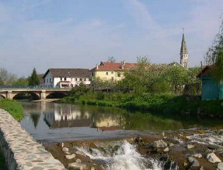
Nasce 60 m al di sotto della cima del Ballon d'Alsace, nel comune di Lepuix. Per tutto il suo corso il fiume scende in direzione sud. Inizialmente si tratta di un torrente di montagna, che via via raccoglie diversi piccoli affluenti. La valle della Savoureuse è di origine glaciale. Appena giunta nella piana di Belfort, prima di bagnare la città, a Valdoie riceve le acque della Rosemontoise e del Rhôme. Lascia poi il Territorio di Belfort per entrare nel dipartimento del Doubs, nel quale si getta nell’Allan poco prima di Sochaux.
Idrografia
La stazione idrometrica di Vieux-Charmont si trova poco a monte della confluenza con l’Allan.

Note
Altri progetti
 Wikimedia Commons contiene immagini o altri file su Savoureuse
| Controllo di autorità | VIAF (EN) 306273001 |
|---|
На других языках
[de] Savoureuse
Die Savoureuse ist ein rund 41 Kilometer langer rechter Nebenfluss des Allan im französischen Département Territoire de Belfort in der Region Bourgogne-Franche-Comté. Sie fließt durch die Stadt Belfort und entwässert den westlichen Teil des Départements über das Gewässersystem Allan, Doubs, Saône und Rhône zum Mittelmeer. Das Einzugsgebiet der Savoureuse nimmt eine Fläche von etwa 225 km² ein. Der Flussname geht auf den Patois-Ausdruck savour (Säge) zurück.[en] Savoureuse
The Savoureuse is the principal river running through the Territoire de Belfort. Its source is in the Ballon d'Alsace at 1190m altitude. From here, it runs through the city of Belfort to the town of Sochaux where it joins the Allan, a tributary to the Doubs. It is 41.2 km (25.6 mi) long.[1]- [it] Savoureuse
[ru] Саворёз
Саворёз (фр. Savoureuse) — река во Франции, в регионе Бургундия — Франш-Конте. Длина реки составляет около 40[источник не указан 2510 дней] км. Площадь бассейна насчитывает 141[1] км². Средний расход воды — 6,1 м³/с.[источник не указан 1501 день]Другой контент может иметь иную лицензию. Перед использованием материалов сайта WikiSort.org внимательно изучите правила лицензирования конкретных элементов наполнения сайта.
WikiSort.org - проект по пересортировке и дополнению контента Википедии