geo.wikisort.org - Fiume
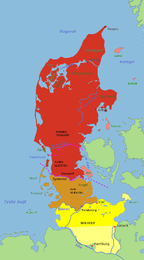
La Kongeå è un fiume della Danimarca che scorre nella penisola dello Jutland. Il fiume segna il confine tra la parte settentrionale e la parte meridionale dello Jutland, che in passato faceva parte del ducato di Schleswig. Il Kongeå ha una lunghezza di circa 50 km. Il fiume nasce a sud di Vamdrup e sfocia nel Wattenmeer presso la chiusa a nord di Ribe. Nel Medioevo, il fiume veniva chiamato Skodborg Å, prendendo il nome dal Castello Reale Skodborghus vicino a Vejen. Il Kongeå è stato il confine tra Danimarca e Germania dal 1864 a 1920, quando avvennero i Plebisciti nello Schleswig.
|
Questa voce o sezione sull'argomento fiumi non cita le fonti necessarie o quelle presenti sono insufficienti.
|
| Kongeå | |
|---|---|
| Stato | |
| Lunghezza | 50 km |
| Nasce | a sud di Vamdrup |
| Sfocia | nord di Ribe |
 | |
Altri progetti
 Wikimedia Commons contiene immagini o altri file su Kongeå
| Controllo di autorità | VIAF (EN) 237470130 · GND (DE) 4757918-3 |
|---|
На других языках
[de] Kongeå
Die Kongeå [.mw-parser-output .IPA a{text-decoration:none}ˈkɔŋəoːʔ] (deutsch Königsau) ist ein 65 km langes Fließgewässer, das von Osten nach Westen durch Jütland fließt.[en] Kongeå
The Kongeå (in German Königs Au) is a watercourse in Southern Jutland in Jutland, Denmark.[1] It rises southeast of Vejen and Vamdrup and after about 50 kilometres (31 mi) it flows through a sluice to tidal mudflats and sandbanks north of Ribe, and eventually into the North Sea. The eastern section is little more than a stream, while the western section is navigable by boat as far as the sluice. The Kongeå, however, passes no port or market town of any significance, and small boats use Ribe Å.- [it] Kongeå
Текст в блоке "Читать" взят с сайта "Википедия" и доступен по лицензии Creative Commons Attribution-ShareAlike; в отдельных случаях могут действовать дополнительные условия.
Другой контент может иметь иную лицензию. Перед использованием материалов сайта WikiSort.org внимательно изучите правила лицензирования конкретных элементов наполнения сайта.
Другой контент может иметь иную лицензию. Перед использованием материалов сайта WikiSort.org внимательно изучите правила лицензирования конкретных элементов наполнения сайта.
2019-2026
WikiSort.org - проект по пересортировке и дополнению контента Википедии
WikiSort.org - проект по пересортировке и дополнению контента Википедии