geo.wikisort.org - Río
El río Roanoke (en inglés: 'Roanoke River') es un río de la vertiente Atlántica de los Estados Unidos que corre por el sur de Virginia y el noreste de Carolina del Norte. Está formado por la confluencia de varios ramales en Virginia Occidental, fluyendo en dirección general sureste durante 660 km para desembocar en el estrecho de Albemarle, en la costa del océano Atlántico, en Carolina del Norte.
| Río Roanoke | ||
|---|---|---|
| Roanoke River | ||
 El valle del río Roanoke | ||
| Ubicación geográfica | ||
| Cuenca | Río Roanoke | |
| Nacimiento | Montañas Blue Ridge (montes Apalaches) | |
| Desembocadura | Albemarle Sound (océano Atlántico) | |
| Coordenadas | 37°14′15″N 80°12′49″O | |
| Ubicación administrativa | ||
| País |
| |
| División |
| |
| Cuerpo de agua | ||
| Afluentes | Río Dan | |
| Longitud | 660 km | |
| Superficie de cuenca | - km² | |
| Caudal medio | - m³/s | |
| Altitud |
Nacimiento: - m Desembocadura: 0 m | |
| Mapa de localización | ||
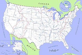 | ||
 | ||
Justo al norte de la frontera entre Virginia y Carolina del Norte, se une al río Dan, su principal tributario. Es navegable sólo para pequeñas embarcaciones desde su embocadura hasta Weldon.

| Control de autoridades |
|
|---|
 Datos: Q1584933
 Multimedia: Roanoke River
На других языках
[de] Roanoke River
Der Roanoke River ist ein 660 Kilometer[1] langer Fluss in den Vereinigten Staaten, der im Süden des Bundesstaates Virginia und im Nordosten North Carolina verläuft. Als einer der großen Flüsse der südöstlichen Vereinigten Staaten durchquert er ein überwiegend ländliches Gebiet zwischen dem östlichen Rand der Appalachen, des Piedmont-Plateaus und der Küstenregion. Dort mündet er schließlich in den Albemarle Sound. Der Roanoke hat eine bedeutsame Geschichte, an seinen Ufern entstanden die ersten Siedlungen der Kolonie Virginia und der Provinz Carolina. Teile des oberen Flusslaufes in Virginia zwischen der Stadt Roanoke und Clarksville werden auch als Staunton River bezeichnet. Im mittleren Abschnitt wird der Fluss durch eine Reihe von Stauseen eingedämmt.[en] Roanoke River
The Roanoke River (/ˈroʊ.əˌnoʊk/ ROH-ə-nohk) runs 410 miles (660 km) long[1] through southern Virginia and northeastern North Carolina in the United States.[2] A major river of the southeastern United States, it drains a largely rural area of the coastal plain from the eastern edge of the Appalachian Mountains southeast across the Piedmont to Albemarle Sound. An important river throughout the history of the United States, it was the site of early settlement in the Virginia Colony and the Carolina Colony. An 81-mile (130 km) section[3] of its lower course in Virginia between the Leesville Lake and Kerr Lake is known as the Staunton River, pronounced /ˈstæntən/, as is the Shenandoah Valley city of that name. It is impounded along much of its middle course to form a chain of reservoirs.- [es] Río Roanoke
[it] Roanoke (fiume)
Il fiume Roanoke è un fiume del sud-est della Virginia e del nord-est della Carolina del Nord, negli Stati Uniti d'America. Lungo 660 km (410 mi), è uno dei bacini idrici più importanti della zona del sud-est del paese, bagnando la zona compresa tra i Monti Appalachi e l'estuario Albemarle Sound, dove sfocia nell'Oceano Atlantico.[ru] Роанок (река)
Ро́анок[1] (англ. Roanoke River) — река на востоке США.Текст в блоке "Читать" взят с сайта "Википедия" и доступен по лицензии Creative Commons Attribution-ShareAlike; в отдельных случаях могут действовать дополнительные условия.
Другой контент может иметь иную лицензию. Перед использованием материалов сайта WikiSort.org внимательно изучите правила лицензирования конкретных элементов наполнения сайта.
Другой контент может иметь иную лицензию. Перед использованием материалов сайта WikiSort.org внимательно изучите правила лицензирования конкретных элементов наполнения сайта.
2019-2026
WikiSort.org - проект по пересортировке и дополнению контента Википедии
WikiSort.org - проект по пересортировке и дополнению контента Википедии