geo.wikisort.org - Río
El Owaka fluye hacia el sureste a través de The Catlins, un área situada en la parte meridional de la Isla Sur de Nueva Zelanda. Su longitud total es de 30 kilómetros, compartiendo estuario con el río Catlins. Ambos ríos desembocan en el océano Pacífico a la altura de Pounawea, a 28 kilómetros al sur de Balclutha. Su fuente se encuentra en el monte Rosebery, a doce kilómetros al sur de Clinton. La población de Owaka se encuentra cerca de la ribera sur del río.
| Control de autoridades |
|
|---|
 Datos: Q2042572
 Multimedia: Category:Ōwaka River
| Owaka | ||
|---|---|---|
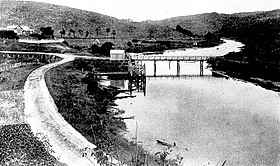 Nos falta una foto de este río. | ||
| Ubicación geográfica | ||
| Cuenca | n/d | |
| Nacimiento | n/d | |
| Desembocadura | Océano Pacífico | |
| Coordenadas | 46°26′38″S 169°40′41″E | |
| Ubicación administrativa | ||
| País |
| |
| División | Distrito Clutha | |
| Cuerpo de agua | ||
| Longitud | 30 km | |
| Superficie de cuenca | n/d km² | |
| Caudal medio | n/d m³/s | |
| Altitud |
Nacimiento: n/d m Desembocadura: 0 m | |
На других языках
[en] Ōwaka River
The Ōwaka River, until 2019 officially the Owaka River, flows southeastward through The Catlins, an area of the southern South Island of New Zealand.[1] Its total length is 30 kilometres (19 mi), and it shares the estuary of the Catlins River, flowing into the Pacific Ocean at Pounawea, 28 kilometres (17 mi) south of Balclutha. Its source is on the slopes of Mount Rosebery, 12 kilometres (7.5 mi) south of Clinton. The Ōwaka River is located within the Clutha District.- [es] Río Owaka
Текст в блоке "Читать" взят с сайта "Википедия" и доступен по лицензии Creative Commons Attribution-ShareAlike; в отдельных случаях могут действовать дополнительные условия.
Другой контент может иметь иную лицензию. Перед использованием материалов сайта WikiSort.org внимательно изучите правила лицензирования конкретных элементов наполнения сайта.
Другой контент может иметь иную лицензию. Перед использованием материалов сайта WikiSort.org внимательно изучите правила лицензирования конкретных элементов наполнения сайта.
2019-2026
WikiSort.org - проект по пересортировке и дополнению контента Википедии
WikiSort.org - проект по пересортировке и дополнению контента Википедии