geo.wikisort.org - Río
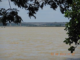
El río Baitarani es un río costero del este de la India que vierte sus aguas en el golfo de Bengala. Tiene una longitud de 365 km y drena una cuenca de 12.789 km², algo mayor que Gambia o Jamaica.
| Río Baitarani | ||
|---|---|---|
 | ||
| Ubicación geográfica | ||
| Cuenca | Río Baitarani | |
| Desembocadura | Golfo de Bengala | |
| Coordenadas | 20°45′N 86°48′E | |
| Ubicación administrativa | ||
| País |
| |
| División | Estados de Jharkhand y Orissa | |
| Cuerpo de agua | ||
| Longitud | 365 km | |
| Superficie de cuenca | 12.789 km² | |
| Caudal medio | - m³/s | |
| Altitud | 1 metro | |
| Mapa de localización | ||
 | ||
 | ||
El Baitarani proviene del estado de Jharkhand y luego fluye hacia el sur este por el estado de Orissa.
El río Baitarani, junto con los ríos Brahmani, y Mahanadi, forma en su desembocadura un gran delta.
| Control de autoridades |
|
|---|
 Datos: Q3773157
 Multimedia: Baitarani River
На других языках
[de] Baitarani
Der Baitarani ist einer der sechs großen Flüsse im ostindischen Bundesstaat Odisha.[en] Baitarani River
The Baitarani (also spelled Vaitarani) is one of six major rivers of Odisha, India. Venerated in popular epics and legends, the Baitarani River is a source of water for agricultural irrigation. Most of the potentially arable land in the area is not under cultivation. The coastal plain of Odisha has the name of "Hexadeltaic region" or the "Gift of Six Rivers". These deltas divide the coastal plain into three regions from north to south. The Baitarani, the Mahanadi and the Brahmani rivers form the Middle Coastal Plain, with evidence of past "back bays" and present lakes.[2]- [es] Río Baitarani
Текст в блоке "Читать" взят с сайта "Википедия" и доступен по лицензии Creative Commons Attribution-ShareAlike; в отдельных случаях могут действовать дополнительные условия.
Другой контент может иметь иную лицензию. Перед использованием материалов сайта WikiSort.org внимательно изучите правила лицензирования конкретных элементов наполнения сайта.
Другой контент может иметь иную лицензию. Перед использованием материалов сайта WikiSort.org внимательно изучите правила лицензирования конкретных элементов наполнения сайта.
2019-2026
WikiSort.org - проект по пересортировке и дополнению контента Википедии
WikiSort.org - проект по пересортировке и дополнению контента Википедии