geo.wikisort.org - River
The Xiuguluan River (Chinese: 秀姑巒溪; Hanyu Pinyin: Xiùgūluán Xī; Tongyong Pinyin: Siòuguluán Si; Wade–Giles: Hsiu4-ku1-luan2 Hsi1; Pe̍h-ōe-jī: Siù-ko͘-lôan-khoe) is the eighth-longest river in Taiwan with a total length of 104 km (65 mi). It is located in the southeastern part of the island. It flows through the Huadong Valley before emptying into the Pacific Ocean in Fengbin, Hualien.[1][2]
| Xiuguluan River | |
|---|---|
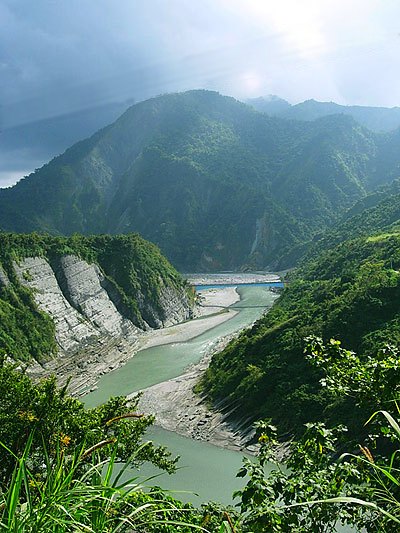 Xiuguluan River in Hualien | |
 | |
| Location | |
| Country | Taiwan |
| Physical characteristics | |
| Source | |
| • location | Mabolasi Mountain |
| • elevation | 3,000 m (9,800 ft) |
| Mouth | |
• location | Pacific Ocean |
• elevation | 0 m (0 ft) |
| Length | 104 km (65 mi) |
| Basin size | 1,790.46 km2 (691.30 sq mi) |
| Discharge | |
| • maximum | 17,600 m3/s (620,000 cu ft/s) |
| Basin features | |
| Tributaries | |
| • left | Lekuleku River Fengping River Hongye River Fuyuan River |
Overview
The river originates on the eastern side of Mabolasi Mountain (on the border with Taitung County) and flows through Xiuguluan Mountain. It is the largest river in eastern Taiwan. Over 30 species of fish have been found in the river.[3]
Rafting
The river is known for its many rapids and has become a prime destination for rafting,[3] especially on a 24 km (15 mi) section from Rueisuei Bridge to the Changhong Bridge.[4]
Tributaries
There are five major tributaries, listed here from mouth to source:[2]
- Fuyuan River – Hualien County – 28 km
- Hongye River – Hualien County – 16 km
- Fengping River – Hualien County – 19 km
- Lakulaku River – Hualien County – 54 km
See also
- List of rivers in Taiwan
References
- "Geography & demographics". The Republic of China Yearbook 2015. Executive Yuan. 2015. pp. 40–53. ISBN 978-986-04-6013-1.
- "Xiuguluan River basin". River System Introduction (in Chinese). The Ninth River Management Office, Water Resources Agency, Ministry of Economic Affairs. Retrieved 5 May 2016.
- "Xiuguluan River". East Coast National Scenic Area Administration. Retrieved 2010-07-18.
- "Ruisui Rafting Tourist Center". East Rift Valley National Scenic Area. Retrieved 2010-07-18.
| Wikimedia Commons has media related to Xiuguluan River. |
На других языках
- [en] Xiuguluan River
[it] Shiukuluan
Lo Siouguluan (caratteri cinesi: 秀姑巒溪; pinyin: Xiuguluan; POJ: Siù-ko͘-lôan-khoe) o Shiukuluan è un fiume di Taiwan, che scorre per 81 km lungo la contea di Hualien.Другой контент может иметь иную лицензию. Перед использованием материалов сайта WikiSort.org внимательно изучите правила лицензирования конкретных элементов наполнения сайта.
WikiSort.org - проект по пересортировке и дополнению контента Википедии