geo.wikisort.org - River
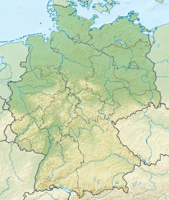
The Wuhle is a small right-bank tributary of the Spree. It originates in a ground moraine in Brandenburg near Ahrensfelde and flows through the Berlin boroughs of Marzahn-Hellersdorf and Treptow-Köpenick before joining the Spree.
This article does not cite any sources. (September 2020) |
This article may be expanded with text translated from the corresponding article in German. (May 2018) Click [show] for important translation instructions.
|
| Wuhle | |
|---|---|
 The Wuhle, as seen between Marzahn and Hellersdorf | |
  | |
| Location | |
| Country | Germany |
| State | Brandenburg |
| Physical characteristics | |
| Source | Forested area near Ahrensfelde |
| • coordinates | 52°35′46″N 13°34′13″E |
| • elevation | 61 metres (200 ft) above Normalhöhennull (NHN) |
| Mouth | Spree |
• coordinates | 52°27′16″N 13°33′54″E |
• elevation | 30 metres (98 ft) above NHN |
| Length | 16.5 kilometres (10.3 mi) |
| Basin size | 118 square kilometres (46 sq mi) |
| Discharge | |
| • location | Honsfelder Bridge (5.8 km upstream the mouth) |
| • average | 1.05 m3/s (37 cu ft/s) |
| Basin features | |
| Progression | Spree→ Havel→ Elbe→ North Sea |
| Tributaries | |
| • left | Hellersdorfer Graben |
| • right | Neue Wuhle |
| Waterbodies | Wuhleteich, Wuhlebecken |
It is the primary in- and outflow of the Wuhlebecken.
The Wuhle is depicted in the coat of arms of Marzahn-Hellersdorf.
See also
| Wikimedia Commons has media related to Wuhle. |
| Authority control |
|
|---|
На других языках
[de] Wuhle
Die Wuhle ist ein kleiner Fluss in Brandenburg und Berlin. Wie auch die Panke ist sie ein rechter Nebenfluss der Spree. Sie entspringt auf der Grundmoränenhochfläche des Barnim bei Ahrensfelde, nahe der Stadtgrenze von Berlin. In ihrem Lauf folgt sie weitgehend einer glazialen Rinne.- [en] Wuhle
Текст в блоке "Читать" взят с сайта "Википедия" и доступен по лицензии Creative Commons Attribution-ShareAlike; в отдельных случаях могут действовать дополнительные условия.
Другой контент может иметь иную лицензию. Перед использованием материалов сайта WikiSort.org внимательно изучите правила лицензирования конкретных элементов наполнения сайта.
Другой контент может иметь иную лицензию. Перед использованием материалов сайта WikiSort.org внимательно изучите правила лицензирования конкретных элементов наполнения сайта.
2019-2026
WikiSort.org - проект по пересортировке и дополнению контента Википедии
WikiSort.org - проект по пересортировке и дополнению контента Википедии