geo.wikisort.org - River
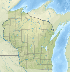
Whittlesey Creek is a creek that flows through Bayfield County, Wisconsin.[1] The source of the creek is northeast of Moquah and flows into Lake Superior north of Ashland Junction. As of 2010, 329 acres (1.33 km2) of land in the watershed belong to the Whittlesey Creek National Wildlife Refuge.[2] The creek is named after Asaph Whittlesey, who was the first settler of Ashland and a member of the Wisconsin State Assembly.[3]
| Whittlesey Creek | |
|---|---|
  | |
| Location | |
| Country | United States |
| State | Wisconsin |
| Physical characteristics | |
| Source | |
| • location | northeast of Moquah |
| • coordinates | 46.6152193°N 91.041855°W |
| Mouth | Lake Superior |
• location | north of Ashland Junction |
• coordinates | 46.5988313°N 90.9493545°W |
• elevation | 600 ft (180 m) |
| Basin features | |
| Tributaries | |
| • left | North Fork Whittlesey Creek |
See also
References
- "Feature Detail Report for: Whittlesey Creek". USGNIS. U.S. Department of the Interior. Retrieved 27 November 2020.
- "Annual Report of Lands Under Control of the U.S. Fish and Wildlife Service" (PDF). U.S. Fish & Wildlife Service. United States Department of the Interior. p. 29. Retrieved 27 November 2020.
- "State of Wisconsin Legislative Reference Bureau" (PDF). Archived from the original (PDF) on 2015-04-04. Retrieved 27 November 2020.
Текст в блоке "Читать" взят с сайта "Википедия" и доступен по лицензии Creative Commons Attribution-ShareAlike; в отдельных случаях могут действовать дополнительные условия.
Другой контент может иметь иную лицензию. Перед использованием материалов сайта WikiSort.org внимательно изучите правила лицензирования конкретных элементов наполнения сайта.
Другой контент может иметь иную лицензию. Перед использованием материалов сайта WikiSort.org внимательно изучите правила лицензирования конкретных элементов наполнения сайта.
2019-2026
WikiSort.org - проект по пересортировке и дополнению контента Википедии
WikiSort.org - проект по пересортировке и дополнению контента Википедии